
 England
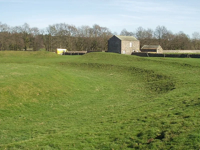
King Arthur's Round Table is a Neolithic henge in the village of Eamont Bridge in the English county of Cumbria, around one mile south east of Penrith [1]. It is 400 metres from Mayburgh Henge [1]. The henge is around 90 metres in diameter [1]. The enclosed area is about 50 metres across; the ditch has a maximum width of 16 metres; the berm 7 metres; and the bank 13 metres [1]. Around 1664 William Dugdale sketched the remains, showing the two opposing entrances, and also showing that there were two standing stones, one each side of the northwest entrance [1]. These stones had disappeared when William Stukeley saw the monument in 1725 [1]. Excavations were undertaken in 1937 by R. G. Collingwood and continued in 1939 by Gerhard Bersu [1]. The excavations showed that the ditch had been cleared out and reshaped and the entrance through it made narrower in modern times [1].
Text: Wikipedia – 'King Arthur's Round Table' (revision of 2026-07-20), CC BY-SA 4.0 · sentences selected and shortened by an AI system · source →King Arthur's Round Table
Also known as: King Arthur’s Round Table (Cumbria), King Arthur's Round Table henge, Table ronde du roi Arthur, Круглый стол короля Артура, 亞瑟圓桌
| Type | Henge |
|---|---|
| Period | 3000 - 1500 BC |
| Country | England |
| Coordinates | 54.6484° N, 2.7403° W |