
 England
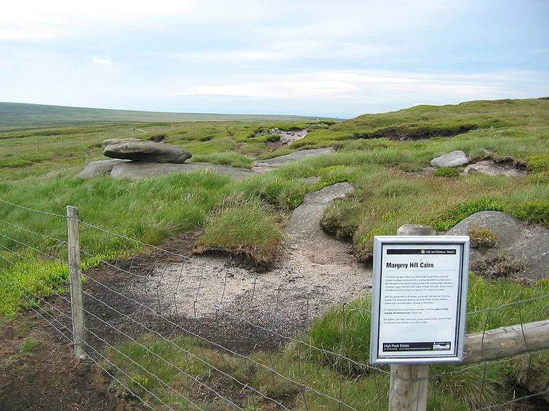
Margery Hill is a 546-metre hill on the Howden Moors in South Yorkshire, England [1]. It lies towards the northern boundary of the Peak District National Park, between Langsett Reservoir to the northeast and Howden Reservoir to the southwest [1]. The area is managed by the National Trust as part of their High Peak Estate [1]. Peat near the summit cairn has been dated to a uniform age of about 3,500 years old, indicating that it was constructed rather than natural; it is believed to have been part of a Bronze Age burial mound [1]. The area has been designated a Scheduled Ancient Monument by English Heritage [1]. Margery Hill is the highest marked point within the boundaries of the City of Sheffield [1].
Text: Wikipedia – 'Margery Hill' (revision of 2026-08-15), CC BY-SA 4.0 · sentences selected and shortened by an AI system · source →Margery Hill
| Type | Cairn |
|---|---|
| Period | 3000 - 1500 BC |
| Country | England |
| Coordinates | 53.4576° N, 1.7167° W |