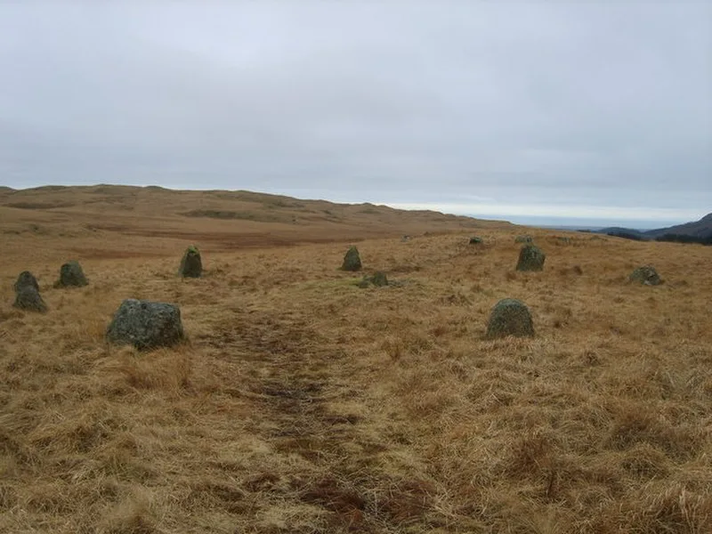
Burnmoor Stone Circles

Burnmoor Stone Circles
Michael Graham · CC BY-SA 2.0

The Burnmoor Stone Circles are a group of five Bronze Age stone circles in Cumbria, England[1]. Located about 1.6 km (1 mi) north of Boot village on the slopes of Boat How, the site covers roughly a square mile and is managed by the National Trust[1]. The largest circle, Brat's Hill, features approximately 42 stones forming an irregular circle roughly 30 meters in diameter[1]. The two nearby pairs of circles are known as White Moss and Low Longrigg[1].

TypeStone circle
Period3000 - 1500 BC
CountryEngland
Coordinates54.4093° N, 3.2743° W

Related resources

More sites in England

Hardknott Roman Fort · Swinside · Ravenglass Roman Bath House · Glannoventa · Ravenglass · Castle Crag · Giant's Grave, Cumbria · Kinniside Stone Circle · Langdale Axe Industry · Grey Croft Stone Circle · Castlerigg Stone Circle · Papcastle · Heaning Wood Bone Cave · Ambleside Roman Fort · Birkrigg Stone Circle · Caer Mote · Blennerhasset and Torpenhow · Seaton, Cumbria · Maryport · Carrock Fell · Alauna, Maryport · High Street, Lake District · Beckfoot · Cardurnock

All sites in England

Was this page useful?

Keep exploring

Every site on this page sits on the globe, and the people who research them are on the Discord.

3D Globe · Sites by country · Story Archive · Research Library · Weekly Journal · Search