
 England
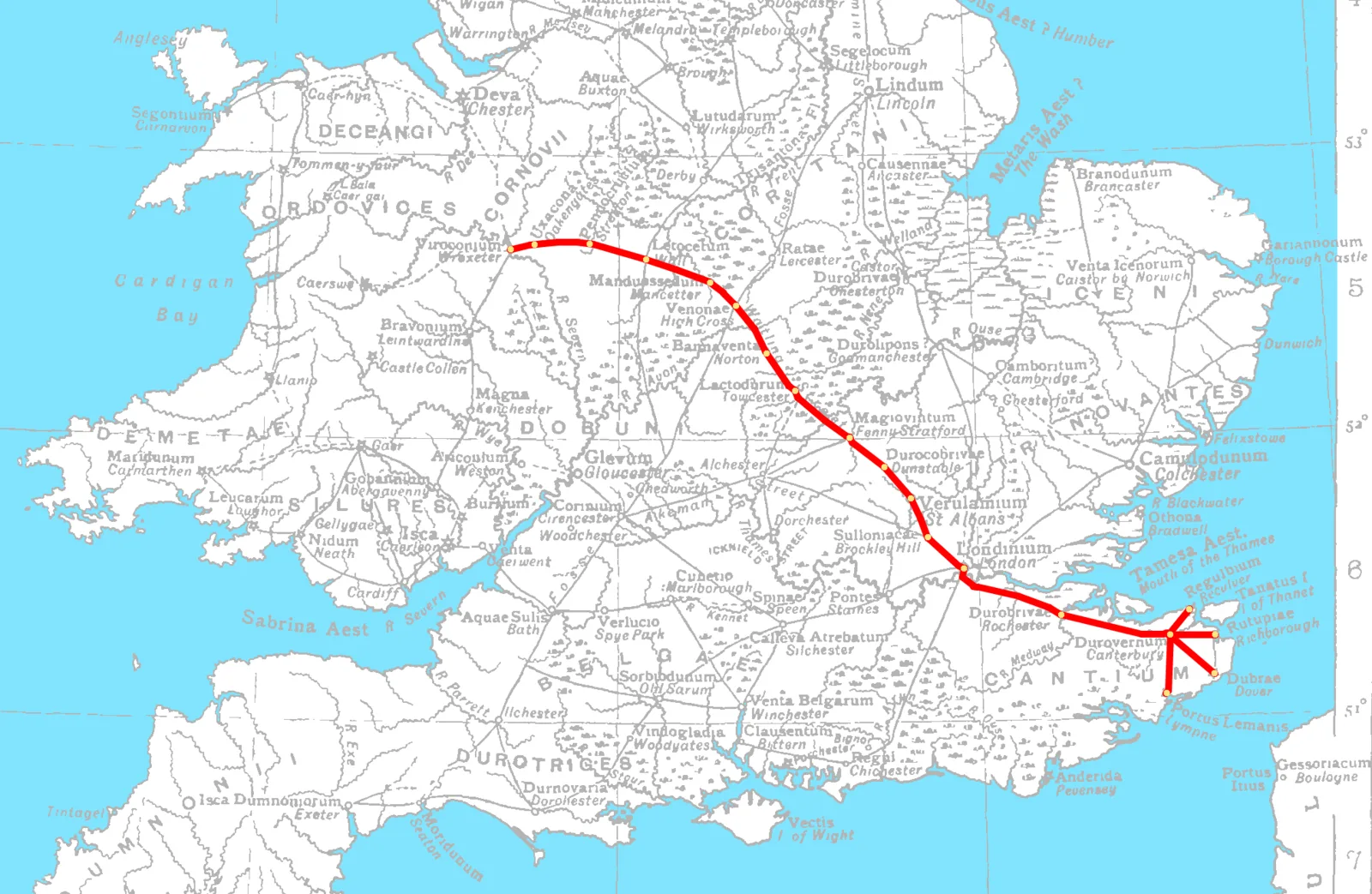
Watling Street is a historic route in England running from Dover and London in the southeast, via St Albans to Wroxeter [1] [2] [3] [4]. The road crosses the River Thames at London and was used in Classical Antiquity, Late Antiquity, and throughout the Middle Ages [1]. It was originally used by ancient Britons before being paved as one of the main Roman roads in Britannia [1]. The line of the road was numbered among the major highways of medieval England [1].
Watling Street
Also known as: Iter a Deva Londinium, Jalur Watling, Stryd Watling, Уотлинг стрит, Уотлинг-стрит, דרך ואטלינג, خیابان واتلینگ, ウォトリング街道, ワトリング・ストリート, ワトリング街道, 华特林古道, 惠特灵大道
| Type | Road/avenue/trackway |
|---|---|
| Period | 1 - 500 AD |
| Country | England |
| Coordinates | 51.5388° N, 0.1376° W |