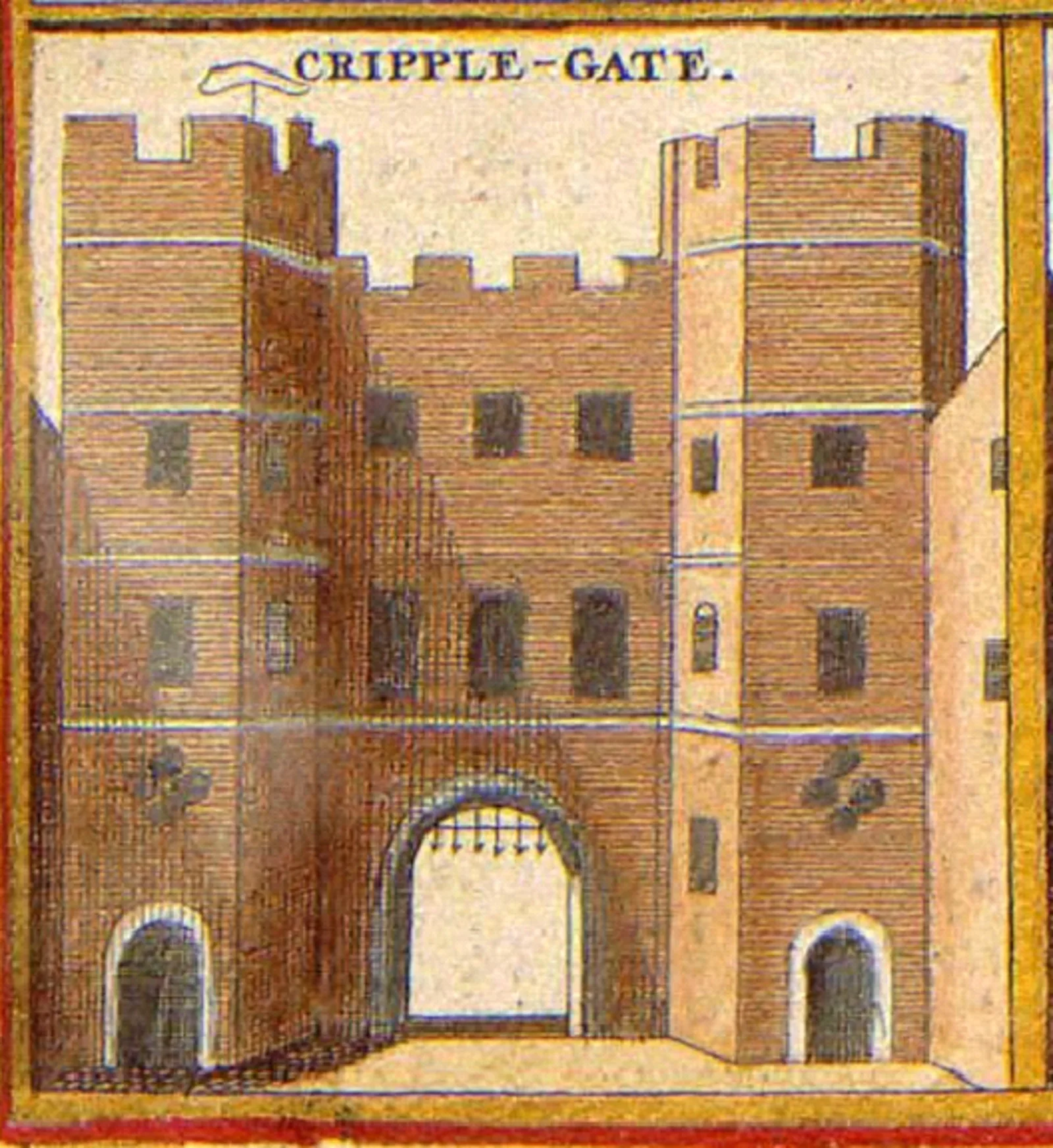
Cripplegate

Cripplegate
Anonymous cartographer/etcher[1]; From University of Toronto Wenceslaus Hollar Digital Collection. Scanned by University of Toronto. High-resolution version extracted using custom tool by User:Dr_Sach... · Public domain

Also known as: Porta Membris Captorum

Cripplegate was a gate in the London Wall which once enclosed the City of London [1]. The Cripplegate gate lent its name to the Cripplegate ward of the City [1]. Cripplegate was rebuilt during the 1490s and was unhinged and fortified with a portcullis after Charles II became king in 1660 [1]. It was eventually demolished in 1760; much of Cripplegate was gone by the 19th century and only small fragments of it survive today [1].

Text: Wikipedia – 'Cripplegate' (revision of 2026-06-06), CC BY-SA 4.0 · sentences selected and shortened by an AI system · source →
TypeGate/archway/bridge
Period1 - 500 AD
CountryEngland
Coordinates51.5182° N, 0.0931° W

More sites in England

Fortifications of London · Amphitheatre, London · Aldersgate · Moorgate · Devil's Highway - Roman Britain · London Mithraeum · Newgate · Ludgate · Bishopsgate · Billingsgate Roman House and Baths · London Wall · Aldgate · Watling Street · Richmond Park · Loughton Camp · Keston Roman Villa · Crofton Roman Villa · Ambresbury Banks · Foxholes, Hertford · Pilgrims' Way · Harrow Way · Grim's Ditch, Harrow · Lullingstone Roman Villa · Welwyn Roman Baths

All sites in England →

Was this page useful?

Keep exploring

Every site on this page sits on the globe, and the people who research them are on the Discord.

3D Globe · Sites by country · Story Archive · Research Library · Weekly Journal · Search