
 England
Brandon Camp is an archaeological site, about 1 mile south of Leintwardine, in Herefordshire [1]. The visible defences consist of a single bank forming a roughly triangular enclosure on the western side of Brandon Hill [1]. The maximum dimensions are about 250 metres west to east and 260 metres north to south, enclosing about 3.5 hectares [1]. Aerial photographs taken in 1959 and 1965 showed cropmarks inside the defences, in particular a rectangular area 14.5 by 32 metres just inside the eastern entrance, thought to be a Roman granary [1]. Aerial photographs of 1965 and 1976 showed that the original Iron Age fort probably occupied most of the hilltop; this suggested that the visible defences date from the Roman period and that a Roman fort was built on a captured British fort [1]. The features seen were investigated by excavation in the early 1980s by Sheppard Frere and J. K. St Joseph [1]. The presence of the granary was confirmed [1]. Immediately to the west were three widely separated canabae, two-roomed huts thought to be accommodation for officers [1].
Text: Wikipedia – 'Brandon Camp' (revision of 2026-07-21), CC BY-SA 4.0 · sentences selected and shortened by an AI system · source →Brandon Camp
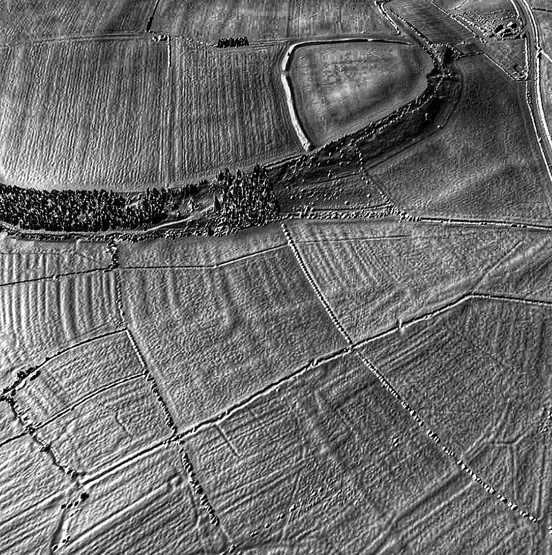
Also known as: Brandon Camp large univallate hillfort and ring ditch 350m north east of Warwick House.
| Type | Fortress/citadel |
|---|---|
| Period | 1500 - 500 BC |
| Country | England |
| Coordinates | 52.3463° N, 2.8817° W |