
 England
An Iron Age hillfort near the hamlet of Hazelwood in Devon, occupying a roughly oval area of approximately 2.4 hectares on a hilltop 185 m above sea level, commanding the River Avon valley. The defenses consist of a rampart with an external ditch and counterscarp bank encircling the site. In the medieval period, a ringwork and bailey castle was built within the earlier earthworks, reusing the prehistoric fortification. On the highest point, a level platform of about 4.5 by 3.5 m marks the site of a beacon recorded on a 1752 plan. The monument is a Scheduled Ancient Monument under the 1979 Act.
Blackdown Rings
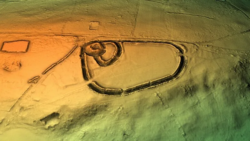
Also known as: Blackdown Camp, Blackdown Rings prehistoric hillfort and medieval castle, Loddiswell Blackdown Rings, The Rings, Loddiswell
| Type | Earthwork |
|---|---|
| Period | 4500 - 3000 BC |
| Country | England |
| Coordinates | 50.3545° N, 3.8003° W |