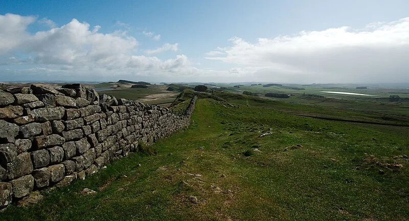
Hadrian's Wall

Hadrian's Wall
marsupium photography · CC BY-SA 2.0

Built in AD 122 during Emperor Hadrian's reign, Hadrian's Wall is a former Roman defensive fortification in Britannia[1]. Stretching 73 miles from Wallsend on the River Tyne to Bowness-on-Solway, it was a stone wall with large ditches both front and back, crossing northern England[1]. Soldiers were garrisoned along the wall in large forts, smaller milecastles, and intervening turrets[1]. Beyond its military function, its gates likely served as customs posts for trade control[1].

TypeWall
Period1 - 500 AD
CountryEngland
Coordinates55.0173° N, 2.2826° W

More sites in England

Turret - Hadrian's Wall · Stanegate · Knag Burn Gateway · Housesteads Roman Fort · The Goatstones · Carrawburgh · Coventina · Vindolanda · Limestone Corner · Cilurnum · Chesters Bridge · Hadrian's Wall Path · Military Way - Hadrian's Wall · Planetrees - Hadrian's Wall Section · Aesica · Lees Hall Roman Camp · Habitancum · Dere Street · Magnis, Carvoran · Coria, Corbridge · Corbridge Lion · Bremenium · Whitley Castle · Devil's Causeway

All sites in England

Was this page useful?

Keep exploring

Every site on this page sits on the globe, and the people who research them are on the Discord.

3D Globe · Sites by country · Story Archive · Research Library · Weekly Journal · Search