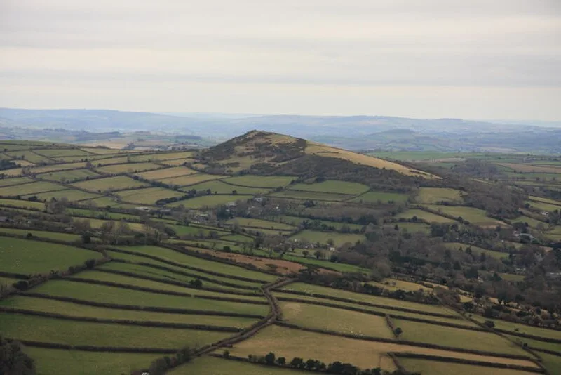
Brent Hill

Brent Hill
Guy Wareham · CC BY-SA 2.0

Brent Hill is an Iron Age univallate hillfort near South Brent on Dartmoor, Devon, occupying a prominent summit at approximately 311 m above sea level. The fort survives as an irregularly shaped enclosure following the naturally steep, rocky hillside, enhanced by a partial rampart and ditch. An extension of the rampart on the south-western side strengthens weaker natural defences, while a second outwork protects the south-east. The summit also served as a documented beacon site, named 'Brent Beacon' on Ogilby's 1675 map.

TypeFortress/citadel
Period1500 - 500 BC
CountryEngland
Coordinates50.4407° N, 3.8277° W

Related resources

More sites in England

Yellowberries Copse · Hembury Castle, Buckfast · Blackdown Rings · Holne Chase Castle · Stalldown Barrow · Stanborough · Yarrowbury · Halwell Camp · Holbury, Holbeton · Hound Tor · Drizzlecombe · Hundatorra · Upper Plym Valley · Grimspound · Denbury Hill · Yellowmead Stone Circle · Wasteberry Camp · Brisworthy Stone Circle · Ringmoor Stone Row and Cairn Circle · Hunter's Tor, Lustleigh Cleave · Bolt Tail · Capton · Grey Wethers · Dewerstone

All sites in England

Was this page useful?

Keep exploring

Every site on this page sits on the globe, and the people who research them are on the Discord.

3D Globe · Sites by country · Story Archive · Research Library · Weekly Journal · Search