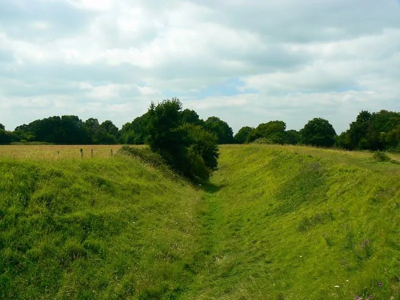
Ringsbury Camp

Ringsbury Camp
Brian Robert Marshall · CC BY-SA 2.0

An Iron Age multivallate hillfort dating to approximately 50 BC in the parish of Purton, Wiltshire. The scheduled monument encloses 3.4 hectares within double banks: the inner bank rises 5 metres high surrounded by a 3-metre ditch, while the outer bank stands 2 metres high. The banks are built from non-local limestone rubble, suggesting transported material. Excavations revealed settlement evidence including roundhouses, raised granaries, roads, pits, and hearths. Neolithic flint tools and an Iron Age coin (now in Purton Museum) have also been found at the site.

TypeFortress/citadel
Period500 BC - 1 AD
CountryEngland
Coordinates51.5800° N, 1.8932° W

Related resources

More sites in England

Bincknoll Castle · Ermin Way · Winterbourne Bassett Stone Circle · Fir Clump Stone Circle · Windmill Hill, Avebury · Barbury Castle · Hodson Stone Circle · Avebury · Beckhampton Avenue · Corinium Dobunnorum · The Longstones · South Street Barrow · Day House Lane Stone Circle · Kennet Avenue · Falkner's Circle · Overton Down · Silbury Hill · West Kennet Long Barrow · The Sanctuary · Overton Hill · Morgan's Hill Enclosure · The Devil's Den · Tan Hill, Wiltshire · Liddington Castle

All sites in England

Keep exploring

Every site on this page sits on the globe, and the people who research them are on the Discord.

3D Globe · Sites by country · Story Archive · Research Library · Weekly Journal · Search