
 England
Banbury Hillfort, or Banbury Hill Camp, is an Iron Age hillfort, about 1.25 miles south of Sturminster Newton and 1 mile north-west of the village of Okeford Fitzpaine in Dorset [1]. The fort is on a low hill: a single bank encloses a roughly circular area of about 1.2 hectares [1]. The site has been affected in the past by ploughing [1]. Where best preserved, the rampart is 15 metres wide and 0.5 metres above the interior, with an external ditch, visible in places, of width 8 metres and depth 1.5 metres [1]. There is an original entrance on the west side, protected by an external bank 15 metres wide and 1 metre high, with traces of an external ditch [1]. This bank, branching out from the north west part of the rampart, runs south-west and then curves towards the fort, so that there is a passage into the fort from the south, at one point down to about 2 metres wide [1]. There are no traces of remains in the interior [1].
Text: Wikipedia – 'Banbury Hill' (revision of 2026-07-21), CC BY-SA 4.0 · sentences selected and shortened by an AI system · source →Banbury Hill
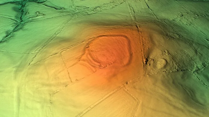
Also known as: Banbury Hill Camp, Banbury Hillfort, Hillfort on Banbury Hill
| Type | Fortress/citadel |
|---|---|
| Period | 1500 - 500 BC |
| Country | England |
| Coordinates | 50.9065° N, 2.3002° W |