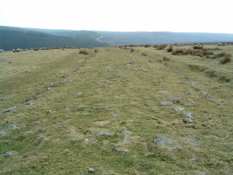
Wade's Causeway

Wade's Causeway
Paul Allison · CC BY-SA 2.0

Wade's Causeway is a sinuous, linear earthwork in the North York Moors, North Yorkshire, England, potentially spanning up to 40 km (25 mi) across the moors[1]. The visible course on Wheeldale Moor extends just over 1.6 km (1 mi) and consists of a stone-surfaced trackway with flanking ditches[1]. Its origins, age, purpose and full extent remain subjects of ongoing research and debate, with suggestions ranging from Roman road to Neolithic trackway[1][2].

TypeRoad/avenue/trackway
Period4500 - 3000 BC
CountryEngland
Coordinates54.3707° N, 0.7591° W

Related resources

More sites in England

Blue Man-i'-th'-Moss · Cawthorne Roman Camp · Blakey Topping Standing Stones · Costa Beck · Goldsborough, Scarborough · Kirkdale Cave · Derventio Brigantum · Beadlam Roman Villa · Duggleby Howe · Ruthergate · Ruther Cross · Star Carr · Eston Nab · Pocklington Iron Age Burial Ground · Willy Howe · Roulston Scar, Sutton Bank · Rudston Roman Villa · Rudston Monolith · Eboracum · Roman Column, York · Roman Bath, York · York City Walls · Brantingham Roman Villa · Petuaria

All sites in England

Was this page useful?

Keep exploring

Every site on this page sits on the globe, and the people who research them are on the Discord.

3D Globe · Sites by country · Story Archive · Research Library · Weekly Journal · Search