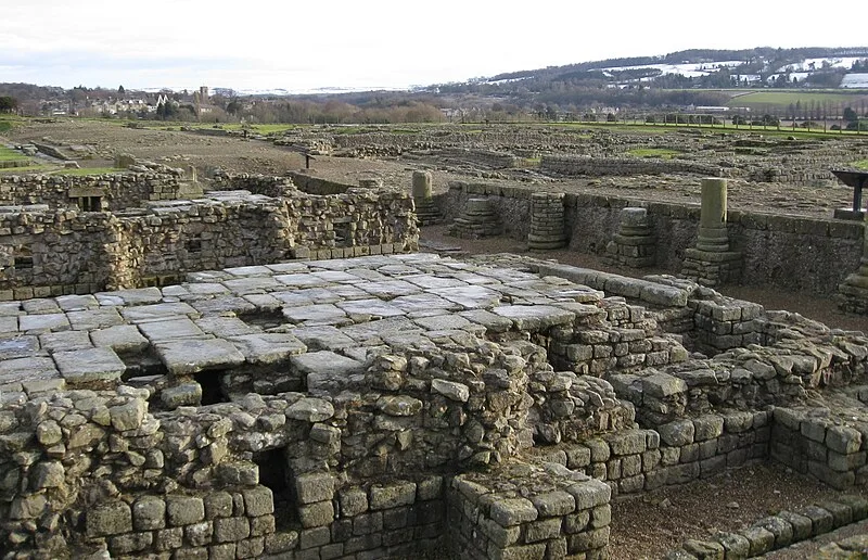
Coria, Corbridge

Coria, Corbridge
Glen Bowman from Newcastle, England · CC BY 2.0

Coria was a Roman fort and town 2.5 miles (4.0 km) south of Hadrian's Wall in the province of Britannia [1]. It stood at the junction where a major north-south Roman road crossed the River Tyne and met the Stanegate road, the first frontier line running east-west to Luguvalium [1]. The site sits on the edge of modern Corbridge village in Northumberland [1].

TypeFortress/citadel
Period1 - 500 AD
CountryEngland
Coordinates54.9785° N, 2.0332° W

More sites in England

Corbridge Lion · Devil's Causeway · Hunnum · Dere Street · Planetrees - Hadrian's Wall Section · Hadrian's Wall Path · Chesters Bridge · Cilurnum · Limestone Corner · Shaftoe Crags Settlement · Coventina · Carrawburgh · The Poind and his Man · Rudchester Mithraeum · Vindobala · Vindomora · Huckhoe Settlement · Slate Hill Settlement · Crawley Edge Cairns · Habitancum · Stanegate · The Goatstones · Hadrian's Wall · Turret - Hadrian's Wall

All sites in England

Was this page useful?

Keep exploring

Every site on this page sits on the globe, and the people who research them are on the Discord.

3D Globe · Sites by country · Story Archive · Research Library · Weekly Journal · Search