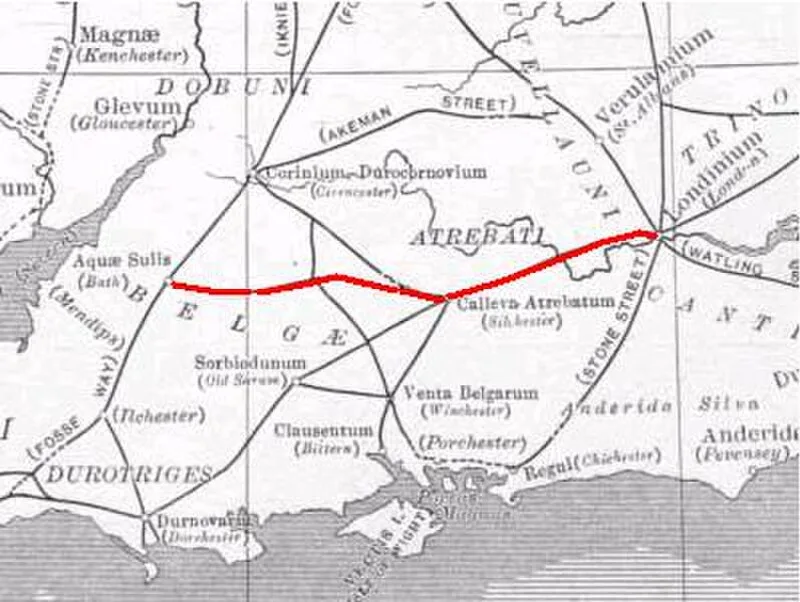
Roman Road from Silchester to Bath

Roman Road from Silchester to Bath
Neddyseagoon at English Wikipedia · CC BY-SA 3.0

Roman road (1st-5th c. AD) linking Calleva Atrebatum (Silchester) with Aquae Sulis (Bath) via Spinae (Speen), Cunetio and Verlucio. This route served as a vital east-west corridor for military logistics and civilian travel across southern Britain [1].

TypeRoad/avenue/trackway
Period1 - 500 AD
CountryEngland
Coordinates51.3591° N, 1.0319° W

Related resources

More sites in England

Bullsdown Camp · Calleva Atrebatum · Port Way · The Frith · Preston Candover Long Barrow · Grimsbury Castle · King John's Hill · Caesar's Camp, Rushmoor and Waverley · Perborough Castle · Caesar's Camp, Bracknell Forest · Medmenham · Blewburton Hill · Ladle Hill · Blewbury · Badshot Lea Long Barrow · Wittenham Clumps · Micheldever Wood · Bussock Camp · Beacon Hill, Burghclere, Hampshire · Norsebury Ring · Tidbury Ring · West Wycombe · Scutchamer Knob · Desborough Castle

All sites in England

Was this page useful?

Keep exploring

Every site on this page sits on the globe, and the people who research them are on the Discord.

3D Globe · Sites by country · Story Archive · Research Library · Weekly Journal · Search