Wimble Toot

Wimble Toot
Simon Burchell · CC BY-SA 4.0

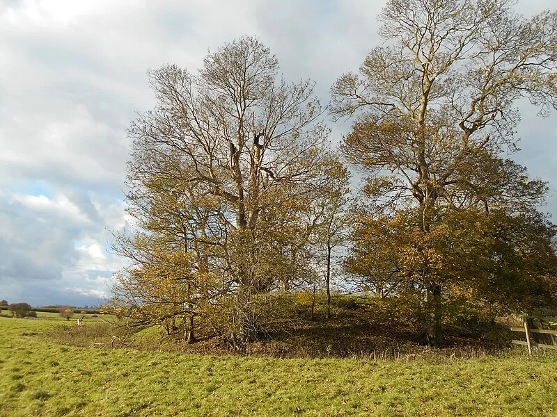
Scheduled monument near Babcary, Somerset, standing 2.74m high with a well-preserved ditch around its eastern side. Its origin is debated: traditionally classified as a Bronze Age bowl barrow (2600-700 BC), some scholars argue it was a Norman motte castle built c. 1067-1069, while archaeologist Norman Quinnell assessed it as a barrow due to the absence of a bailey, connecting roads, or medieval settlement evidence. The mound sits atop a ridge overlooking a brook flowing into the River Cary near the Roman Fosse Way.

TypeEarthwork
Period3000 - 1500 BC
CountryEngland
Coordinates51.0498° N, 2.6291° W

Related resources

More sites in England

New Ditch · Ponter's Ball Dyke · Cadbury Castle, Somerset · Compton Dundon · Dundon Hill Hillfort · Sigwells · Ham Hill, Somerset · Glastonbury Lake Village · Ham Hill Hillfort · King's Castle, Wells · Creech Hill · Maesbury Castle · Small Down Knoll · Meare Lake Village · Priddy Nine Barrows and Ashen Hill Barrow Cemeteries · Priddy Circles · Lopen Roman Mosaic · Blacker's Hill · Sweet Track · Westbury Camp · Dinies Camp · Dungeon Hill · Charterhouse Camp · Gough's Cave

All sites in England

Was this page useful?

Keep exploring

Every site on this page sits on the globe, and the people who research them are on the Discord.

3D Globe · Sites by country · Story Archive · Research Library · Weekly Journal · Search