Caesar's Camp, Rushmoor and Waverley

Caesar's Camp, Rushmoor and Waverley
data.gov.uk · OGL 3

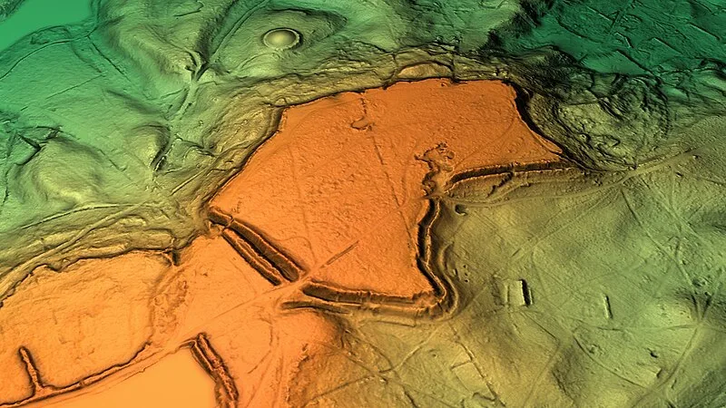
Multivallate Iron Age hillfort straddling the Surrey-Hampshire border, standing 177 metres above sea level roughly 3 km north of Farnham. The fort developed through three Iron Age phases: initially a univallate enclosure, then expanded with multivallate defences and a timber palisade, and finally rebuilt with a bank replacing the palisade. After abandonment, it was reused in the medieval period when a park pale was incorporated into the Iron Age defences as part of the Bishop of Winchester's Farnham estate, later associated with Farnham Castle.

TypeFortress/citadel
Period1500 - 500 BC
CountryEngland
Coordinates51.2431° N, 0.8041° W

Related resources

More sites in England

Badshot Lea Long Barrow · Caesar's Camp, Bracknell Forest · King John's Hill · Sunningdale Barrow · Bullsdown Camp · Roman Road from Silchester to Bath · Hascombe Hill · Torberry Hill · Beacon Hill, West Sussex · Devil's Jumps, Treyford · Calleva Atrebatum · Taplow · Medmenham · Port Way · The Frith · Farley Green, Surrey · Goosehill Camp · Preston Candover Long Barrow · Court Hill, Sussex · Bow Hill, Sussex · Devil's Humps, Stoughton · The Trundle · Burnham Beeches · Bignor Roman Villa

All sites in England

Was this page useful?

Keep exploring

Every site on this page sits on the globe, and the people who research them are on the Discord.

3D Globe · Sites by country · Story Archive · Research Library · Weekly Journal · Search