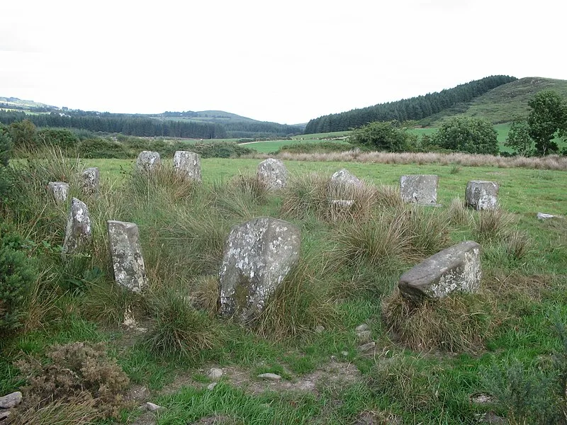
Carrigagulla

Carrigagulla
Ceoil (talk) (Uploads) · Public domain

Carrigagulla is a megalithic complex 2.9 km northeast of Ballinagree in County Cork, Ireland, set within an amphitheatre of foothills leading to the monument-rich Boggeragh Mountains. The centrepiece is Carrigagulla A, a fine axial stone circle 8.2 metres in diameter consisting of 16 standing stones (originally likely 17) ranging from 90 cm to just over 30 cm in height, encircling a central boulder. The complex also includes two stone rows -- the northeast row of five stones (four now displaced as gateposts) and a southwest row of three stones (one fallen) -- plus an ogham stone discovered during peat cutting, now housed in Cork Public Museum since 1940. The axial stone circle typology is characteristic of the Cork-Kerry megalithic tradition of the Bronze Age.

TypeStone circle
Period4500 - 3000 BC
CountryIreland
Coordinates52.0007° N, 8.9164° W

Related resources

More sites in Ireland

Knocknakilla · Glantane East · Beenalaght · Castlenalacht Stone Row · Templebryan Stone Circle · Bohonagh Stone Circle · Drombeg Stone Circle · Kealkill Stone Circle · Labbacallee Wedge Tomb · Grange Stone Circle · Uragh Stone Circle · Ardgroom · Poulnabrone Dolmen · Eightercua Stone Row · Turoe Stone · Coom Wedge Tomb · Riasc Monastic Settlement · Knockroe Passage Tomb · Meehambee Dolmen · Kilmogue Portal Tomb · Castlestrange Stone · Carnfree · Carrowkeel Megalithic Cemetery · Brownshill Dolmen

All sites in Ireland

Keep exploring

Every site on this page sits on the globe, and the people who research them are on the Discord.

3D Globe · Sites by country · Story Archive · Research Library · Weekly Journal · Search