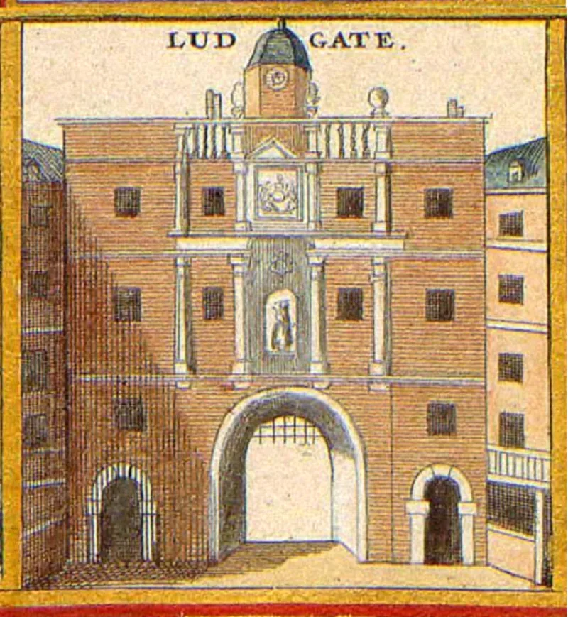
Ludgate

Ludgate
Anonymous cartographer/etcher;[1]; from University of Toronto Wenceslaus Hollar Digital Collection. Scanned by University of Toronto. High-resolution version extracted using custom tool by User:Dr_Sac... · Public domain

Ludgate was the westernmost gate in London's Roman city wall [1]. Originally constructed during the Roman period, it was rebuilt multiple times over the centuries, surviving into the Georgian era before being demolished on 30 July 1760 [1]. The demolition materials were sold for £148, and the gate's name survives in Ludgate Hill, Ludgate Circus and Ludgate Square [1].

TypeGate/archway/bridge
Period1 - 500 AD
CountryEngland
Coordinates51.5141° N, 0.1023° W

Related resources

More sites in England

Newgate · Aldersgate · Fortifications of London · Cripplegate · Amphitheatre, London · London Mithraeum · Devil's Highway - Roman Britain · Moorgate · Billingsgate Roman House and Baths · Bishopsgate · London Wall · Aldgate · Watling Street · Richmond Park · Keston Roman Villa · Loughton Camp · Crofton Roman Villa · Ambresbury Banks · Grim's Ditch, Harrow · Foxholes, Hertford · Pilgrims' Way · Harrow Way · Welwyn Roman Baths · Lullingstone Roman Villa

All sites in England

Was this page useful?

Keep exploring

Every site on this page sits on the globe, and the people who research them are on the Discord.

3D Globe · Sites by country · Story Archive · Research Library · Weekly Journal · Search