
 England
The Devil's Arrows are three aligned standing stones located outside Boroughbridge in North Yorkshire, England, near to where the A168 road crosses the River Ure [1]. The outer stones are 360 and 200 feet away from the central stone and form an almost straight line, running NNW–SSE [1]. Erected during the Stone Age and distinctively grooved by millennia of rainfall, the tallest stone is 22.5 feet in height, making this the second tallest menhir in the United Kingdom after the 25 feet tall Rudston Monolith in the East Riding of Yorkshire [1]. In 2026, scientists at Curtin University and the University of York used isotopic fingerprinting to show that the stones originated at Brimham Rocks, about 11 miles to the west [1]. The study also found that the Battle Cross at Aldborough has the same geological fingerprint as the surviving Arrows, supporting its identification as a repurposed fourth stone from the original monument [1]. The stones are part of a prehistoric complex concentrated around the River Ure [1]. The name is mentioned by the antiquary John Aubrey, who visited and drew the stones in 1687 [1].
Text: Wikipedia – 'Devil's Arrows' (revision of 2026-09-10), CC BY-SA 4.0 · sentences selected and shortened by an AI system · source →Devil's Arrows
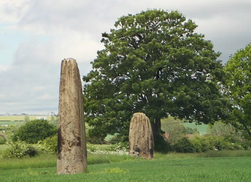
Also known as: Frecce del Diavolo, Stone alignment west of Boroughbridge known as the Devil's Arrows, including three standing stones and the setting for a fourth, Стрелы Дьявола, Стріли Диявола
| Type | Megalithic stones |
|---|---|
| Period | 3000 - 1500 BC |
| Country | England |
| Coordinates | 54.0931° N, 1.4036° W |