Cade's Road

Cade's Road
my work · CC BY-SA 3.0

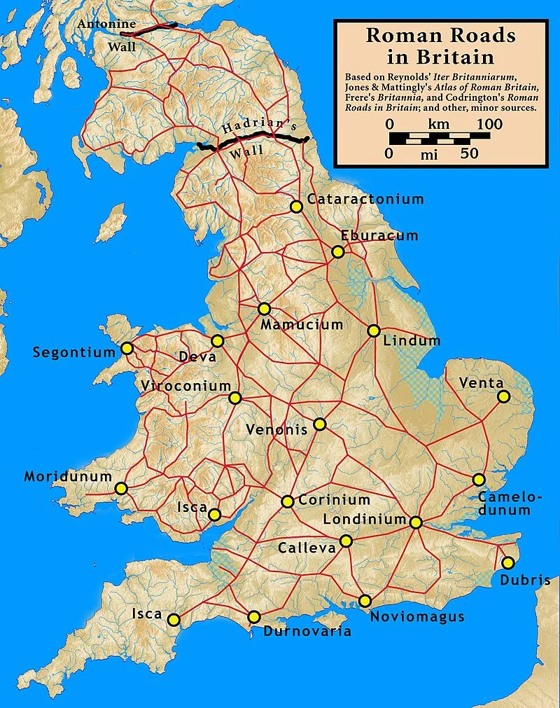
(1st–5th c. AD) Cade's Road is a Roman road in northeast England, named after John Cade of Durham, an 18th-century antiquarian who in 1785 proposed its existence and possible course from the Humber Estuary northwards to the River Tyne, spanning approximately 160 km (100 mi) [1]. The road's Roman name is unknown. Although evidence exists for such a road on some parts of the proposed route, there is still some doubt regarding its exact course [1].

TypeRoad/avenue/trackway
Period1 - 500 AD
CountryEngland
Coordinates54.8561° N, 1.5719° W

Related resources

More sites in England

Concangis · Washing Wells Roman Fort · Pons Aelius · Hastings Hill · Segedunum · Condercum · Longovicium · Arbeia · Vinovia · Vindomora · Vindobala · Rudchester Mithraeum · Piercebridge Roman Bridge · Piercebridge Roman Fort · Stanwick Iron Age Fortifications · Slate Hill Settlement · Huckhoe Settlement · The Poind and his Man · Crawley Edge Cairns · Shaftoe Crags Settlement · Hunnum · Devil's Causeway · Corbridge Lion · Coria, Corbridge

All sites in England

Was this page useful?

Keep exploring

Every site on this page sits on the globe, and the people who research them are on the Discord.

3D Globe · Sites by country · Story Archive · Research Library · Weekly Journal · Search