
 England
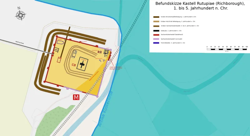
Richborough Castle (Roman Rutupiae) near Sandwich, Kent, was the probable landing point for the Roman invasion of Britain in AD 43 under Emperor Claudius. The site evolved from a military bridgehead into a thriving civilian town of about 21 hectares. Around AD 85, a monumental quadrifrons triumphal arch nearly 25 metres tall, clad in Italian granite, was erected as the symbolic gateway to Britannia along Watling Street. In 277-285 AD, the settlement was converted into a Saxon Shore fort to defend against Saxon raids. Substantial fort walls still stand several metres high today, along with remains of an amphitheatre and a late 4th-century hexagonal baptismal font.
Richborough Castle
| Type | Fortress/citadel |
|---|---|
| Period | 1 - 500 AD |
| Country | England |
| Coordinates | 51.2941° N, 1.3319° E |