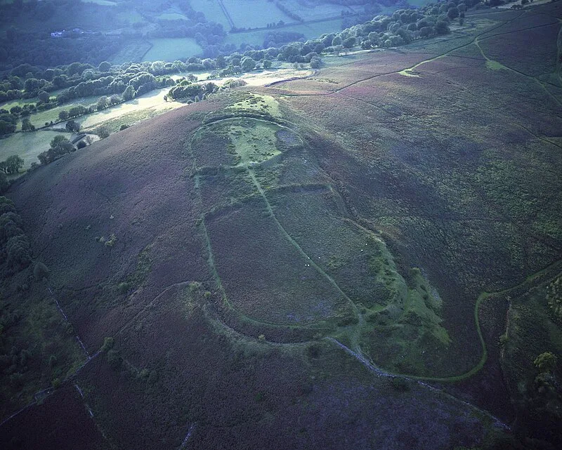
Gaer, Black Mountains

Gaer, Black Mountains
Jasperfforde · CC BY-SA 3.0

Gaer is a hill in the Black Mountains of the Brecon Beacons National Park in Monmouthshire, Wales [1]. It lies at the southern end of a long ridge between the valley of the Grwyne Fawr and the Vale of Ewyas, approximately one mile north of Bryn Arw and three miles northeast of Sugarloaf [1]. Its summit at 427 metres above sea level sits within an Iron Age hillfort known as Twyn y Gaer [1].

TypeFortress/citadel
Period1500 - 500 BC
CountryWales
Coordinates51.8917° N, 3.0280° W

More sites in Wales

Crug Hywel · Castell Dinas · Allt yr Esgair · Twmbarlwm · Gray Hill, Monmouthshire · Gaer Hillfort, Trellech · Harold's Stones, Trellech · The Larches, Monmouthshire · Slwch Tump · Burfa Castle · Pen-y-crug · Gilwern Hill, Powys · Llwynda-Ddu Camp · Mynydd Illtud · Caerau Hillfort · Dinas Powys Hillfort · Tinkinswood · St Lythans Burial Chamber · Maen Llia · Mynydd Maendy · Llyn Fawr · The Bulwarks, Porthkerry · Foel Chwern · Roundton Hill

All sites in Wales

Was this page useful?

Keep exploring

Every site on this page sits on the globe, and the people who research them are on the Discord.

3D Globe · Sites by country · Story Archive · Research Library · Weekly Journal · Search