
 Israel
Omrit, or Khirbat ‘Umayrī, is the site of an ancient Roman temple [1]. It stands where the western slopes of the Golan Heights meet the Upper Jordan Valley [1]. The site was destroyed in the Galilee earthquake of 363; a small chapel was later built on its ruins in the Byzantine period [1]. Omrit is situated atop a foothill of Mount Hermon, overlooking Hula Lake [1]. The site is located approximately 2.5 miles (c. 4 km) southwest of Banias, adjacent to a Roman road connecting Scythopolis and Damascus [1]. After a brushfire cleared the area in 1998, archaeological excavations began, being led by Professor Andrew J. Overman of Macalester College [1]. The region was well trodden by Roman influence, and thus far excavations have yielded three phases of temple construction approximated at mid 1st century BCE, 20 BCE and 1st century CE [1].
Text: Wikipedia – 'Omrit' (revision of 2026-09-19), CC BY-SA 4.0 · sentences selected and shortened by an AI system · source →Horvat Omrit
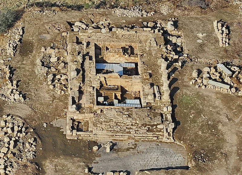
Also known as: Hurvat Omrit, Omrit, חורבת עומרית
| Type | Temple complex |
|---|---|
| Period | 500 BC - 1 AD |
| Country | Israel |
| Coordinates | 33.2186° N, 35.6632° E |