
 England
Bindon Hill is an extensive Iron Age earthwork, enclosing a coastal hill area on the Jurassic Coast near Lulworth Cove in Dorset [1]. It is about 19 kilometres west of Swanage, about 6 kilometres south west of Wareham, and about 17 kilometres southeast of Dorchester [1]. The main rampart and external ditch run for over 2 km along an east-west ridge parallel to the coast, which lies about 750 m to the south [1]. The ridge rises to 168 m and the cliffs are 30–120 m high [1]. At the western end, an incomplete series of ramparts curves back to the cliffs of Lulworth Cove [1]. At the eastern end, the main rampart reaches the cliffs on the north side of Mupe Bay [1]. The total enclosed area is about 110 ha [1]. The enormous enclosed area, lack of evidence of settlement in the interior, and the impossibility of effectively defending such a large perimeter, all suggest it was primarily an enclosed pasture for domesticated animals, not a strategic tribal hill fort [1].
Text: Wikipedia – 'Bindon Hill' (revision of 2026-09-03), CC BY-SA 4.0 · sentences selected and shortened by an AI system · source →Bindon Hill
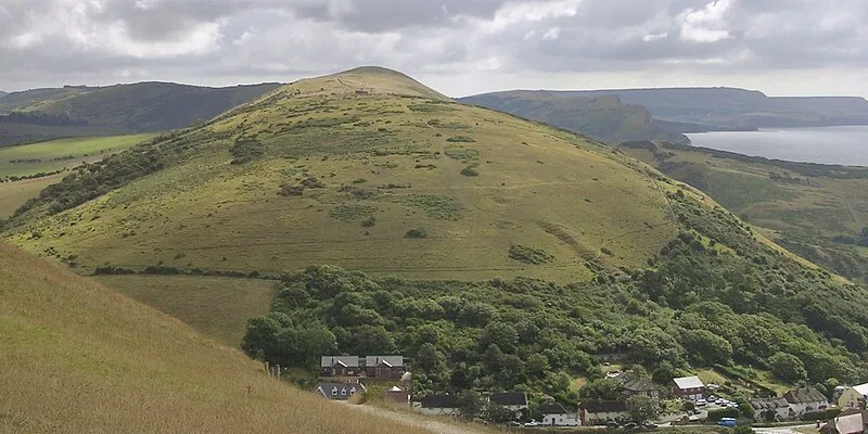
Also known as: Bindon Hill camp, ビンドン・ヒル, ビンドン丘
| Type | Earthwork |
|---|---|
| Period | 4500 - 3000 BC |
| Country | England |
| Coordinates | 50.6223° N, 2.2346° W |