Harrow Way

Harrow Way
Adam37 · CC BY-SA 3.0

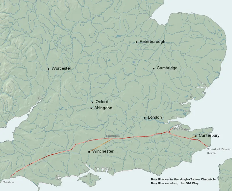
The Harrow Way, also called the Old Way, is an ancient trackway in southern England dated by archaeological finds to 600–450 BC, though likely in existence since the Stone Age [1]. This route stretched from Seaton in Devon to Dover in Kent [1]. In the 19th century, the eastern section was renamed the Pilgrims' Way, a route supposedly from Winchester to Canterbury, but this was actually an invention of Albert Way of the Ordnance Survey with no supporting evidence [1].

TypeRoad/avenue/trackway
Period1500 - 500 BC
CountryEngland
Coordinates51.2835° N, 0.0667° E

Related resources

More sites in England

Pilgrims' Way · Keston Roman Villa · Crofton Roman Villa · London to Lewes Way · Lullingstone Roman Villa · Oldbury Camp · Oldbury Rock Shelters · Ashdown Forest · London Wall · Billingsgate Roman House and Baths · Aldgate · Ebbsfleet Valley · Bishopsgate · London Mithraeum · Devil's Highway - Roman Britain · Amphitheatre, London · Moorgate · Fortifications of London · Cripplegate · Newgate · Aldersgate · Ludgate · Chestnuts Long Barrow · Addington Long Barrow

All sites in England

Was this page useful?

Keep exploring

Every site on this page sits on the globe, and the people who research them are on the Discord.

3D Globe · Sites by country · Story Archive · Research Library · Weekly Journal · Search