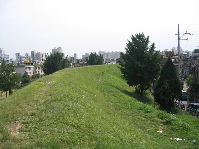
Earthen Fortification, Pungnap-dong

Earthen Fortification, Pungnap-dong
en:User:Straitgate · CC BY-SA 3.0

The Earthen Fortification at Pungnap-dong is a prehistoric earthwork in Seoul, South Korea, dating to approximately 500 BC–1 AD[1]. Located at the edge of the Han River in present-day Songpa-gu district, this flat earthen wall forms a long oval shape extending north-south and slightly leaning eastward[1]. The massive structure encompasses a circumference of approximately 3.5 kilometers (2.2 miles), making it one of the larger known earthworks from the Korean Three Kingdoms period[1]. The site occupies a strategic position along the Han River floodplain, likely serving defensive and administrative functions for ancient settlements in the region[1].

TypeEarthwork
Period500 BC - 1 AD
CountrySouth Korea
Coordinates37.5304° N, 127.1161° E

Related resources

More sites in South Korea

Mongchontoseong Earthen Fortification · Amsa-dong · Yongin Wangsanli Jiseongmyo · Songguk-ri · Gochang, Hwasun and Ganghwa Dolmen Sites · Daepyeong · Banwolseong · Gyeongju Historic Areas · The Tumuli Park Belt · Mount Namsan Belt · The Wolseong Belt · The Hwangnyongsa Belt · The Sanseong Belt · Igeum-dong · Bangudae Petroglyphs · Gaya Tumuli · Shell Mound in Dongsam-dong, Busan

All sites in South Korea

Keep exploring

Every site on this page sits on the globe, and the people who research them are on the Discord.

3D Globe · Sites by country · Story Archive · Research Library · Weekly Journal · Search