
 England
Bury Camp is the site of an Iron Age multivallate hillfort in north-west Wiltshire, England [1]. It occupies a triangular promontory of Colerne Down, in the north of Colerne parish, at the southern edge of the Cotswold Hills between two spurs of a river valley [1]. The enclosed area of approximately 9.2ha is surrounded by a ditch 4m wide and up to 1m deep, and an outer rampart up to 1.5m high on the east and northwestern sides and up to 2m high on the southwestern side, across the neck of the promontory [1]. The building of the hillfort can be dated to about 350 BC, but various Neolithic and Mesolithic flint tools were found, indicating a much earlier use [1]. In 1960, 175 shards of pottery were recovered; all except one were plain coarse ware without a trace of decoration [1]. Among organic remains, only two fragments of human bones were found, whereas between 400 and 500 animal bone fragments were found [1].
Text: Wikipedia – 'Bury Camp' (revision of 2026-07-18), CC BY-SA 4.0 · sentences selected and shortened by an AI system · source →Bury Camp
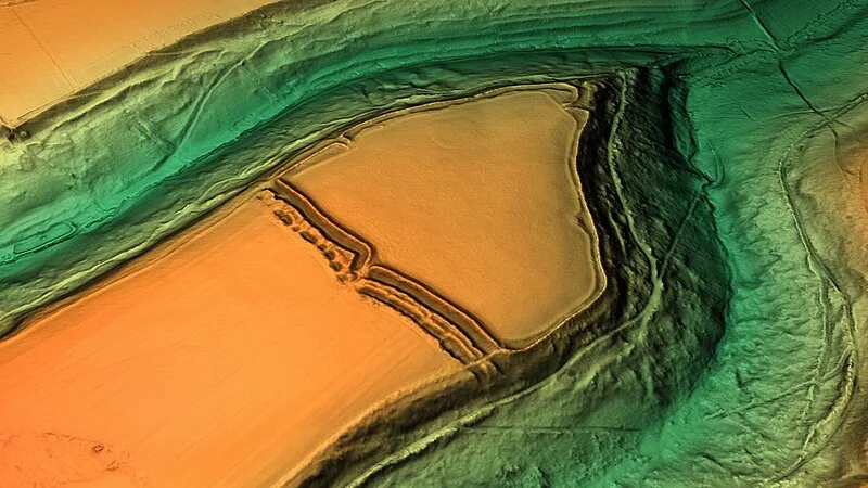
Also known as: Bury Ditches, Bury Wood Camp, Bury Wood Camp hillfort and earthwork enclosure 750m north of Raffinwood House
| Type | Fortress/citadel |
|---|---|
| Period | 500 BC - 1 AD |
| Country | England |
| Coordinates | 51.4648° N, 2.2633° W |