
 Azerbaijan
Bülövqaya is a Chalcolithic archaeological settlement near the village of Göynük in the Babek District of the Nakhchivan Autonomous Republic, Azerbaijan [1]. The site lies on the left bank of the Sarısu River at an elevation of about 1,430 to 1,452 m and covers approximately 1.14 ha [1]. Radiocarbon dates place the principal occupation of the site in the early to mid-fifth millennium BC [1]. Excavated material includes plain and painted pottery, obsidian and flint tools, bone artefacts, architectural remains, hearths, storage pits and pottery kilns [1]. Excavation identified two construction levels distinguished by soil colour and structure [1]. An analysis of 74 obsidian specimens found that material from the Zangezur Mountains predominated, with a smaller component attributed to Meydan Dağ in eastern Anatolia [1]. The architectural remains indicate groups of light rectangular structures arranged around working areas [1].
Text: Wikipedia – 'Bülövqaya' (revision of 2026-09-14), CC BY-SA 4.0 · sentences selected and shortened by an AI system · source →Bülövqaya
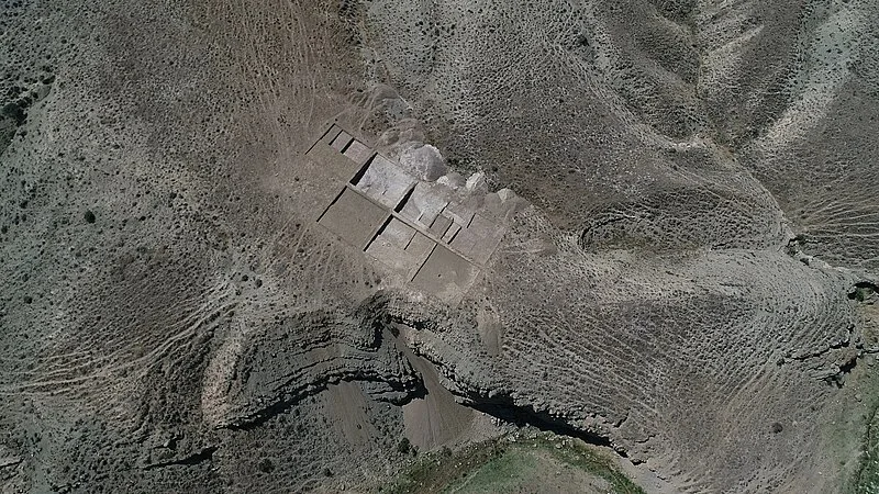
Also known as: Bülövkaya, Bülövqaya yaşayış yeri, Бюловкая
| Type | Settlement |
|---|---|
| Period | < 4500 BC |
| Country | Azerbaijan |
| Coordinates | 39.2834° N, 45.6382° E |