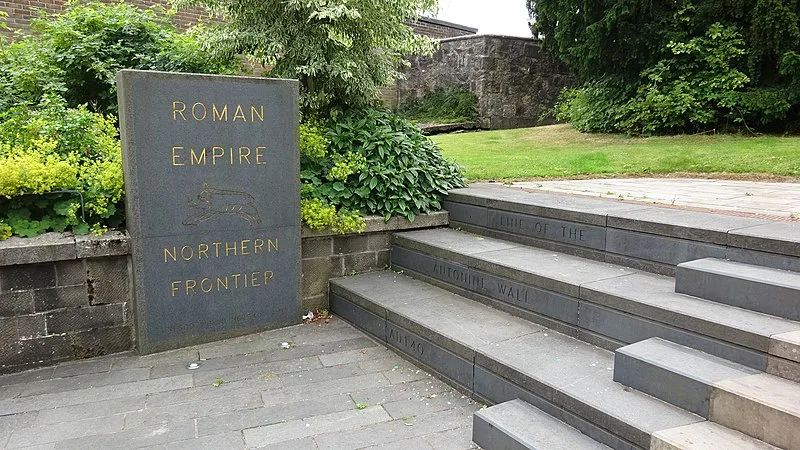
Antonine Wall

Antonine Wall
Rosser1954 · CC BY-SA 4.0

Built in approximately 142 AD, the Antonine Wall was a turf fortification on stone foundations constructed by the Romans across Scotland's Central Belt, spanning 63 km (39 miles) between the Firth of Clyde and the Firth of Forth [1]. It served as the northernmost frontier of the Roman Empire during its garrisoning period, intended to replace Hadrian's Wall to the south [1]. The barrier stood about 3 metres high and 5 metres wide, with a deep ditch on the northern side and likely a wooden palisade atop the turf [1]. As the second of two great walls built in second-century Britain, its remains are far less visible than Hadrian's Wall because the turf and wood construction has largely eroded away [1].

TypeWall
Period1 - 500 AD
CountryScotland
Coordinates55.9671° N, 4.0669° W

Related resources

More sites in Scotland

Tappoch Broch · Cairnpapple Hill · Ballochmyle Cup and Ring marks · Clava Cairns of Aviemore · Machrie Moor Stone Circles · Stairhaven · Ballymeanoch, Kilmartin Glen · Carving depicting Animals, Kilmartin Glen · Glebe Cairn, Kilmartin Glen · Kilmartin Glen · Cup and Ring marks, Kilmartin Glen · Nether Largie Standing Stones, Kilmartin Glen · Nether Largie Mid Cairn, Kilmartin Glen · Nether Largie South Cairn, Kilmartin Glen · Nether Largie North Cairn, Kilmartin Glen · Ri Cruin Cairn, Kilmartin Glen · The Linear Cemetery, Kilmartin Glen · Bruach An Druimein, Kimartin Glen · Temple Wood, Kilmartin Glen · Corrimony Chambered Cairn · Tirefour Castle · Balnuaran of Clava · Caterthuns · Edin's Hall Broch

All sites in Scotland

Was this page useful?

Keep exploring

Every site on this page sits on the globe, and the people who research them are on the Discord.

3D Globe · Sites by country · Story Archive · Research Library · Weekly Journal · Search