
 England
Mulfra Quoit is a Neolithic dolmen in the county of Cornwall in England [1]. It stands on Mulfra Hill to the north of the hamlet of Mulfra [1]. The Quoit is located west of Penzance between Porthmeor and New Mill on the top of Mulfra Hill [1]. The quoit has three 1.7m-high support stones, arranged in a U-shape 3.0m long and 1.7m wide, and open on one side [1]. The capstone, which has slipped down, measures 3.2m by 3.0m, and is almost square; it has a weight of 5 tonnes [1]. In 1769 the antiquarian, William Borlase published a plan and a drawing of the quoit and described a 60 cm-high stone embankment, which encircled the dolmen with a diameter of 12m, of which, nothing can be seen today [1]. In 1872 his descendant William Copeland Borlase examined an accumulation of stone in the centre of the dolmen, and undertook excavations which only yielded charred wood [1].
Text: Wikipedia – 'Mulfra Quoit' (revision of 2026-07-18), CC BY-SA 4.0 · sentences selected and shortened by an AI system · source →Mulfra Quoit
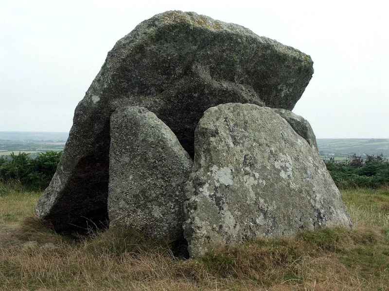
Also known as: Koyt Molvra, Portal dolmen known as Mulfra Quoit
| Type | Dolmen |
|---|---|
| Period | 4500 - 3000 BC |
| Country | England |
| Coordinates | 50.1634° N, 5.5697° W |