
 England
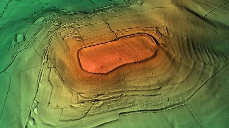
Dinedor Camp is an Iron Age univallate hillfort on a spur of Dinedor Hill, about 3 km south of Hereford, overlooking the confluence of the Wye and Lugg rivers. The sub-rectangular enclosure measures approximately 337 m long by 160 m wide, enclosing around 9.5 acres. Its rampart averages 3 m high, increasing to nearly 7 m at the northeast, with stone revetments on both faces and a quarry ditch. Excavations revealed permanent, dense occupation immediately behind the rampart, with Iron Age pottery and evidence dating the latest phase to the 2nd century BC. The site is a scheduled monument and was transferred to Dinedor Parish Council as a community asset in 2016.
Dinedor Camp
| Type | Fortress/citadel |
|---|---|
| Period | 1500 - 500 BC |
| Country | England |
| Coordinates | 52.0236° N, 2.6963° W |