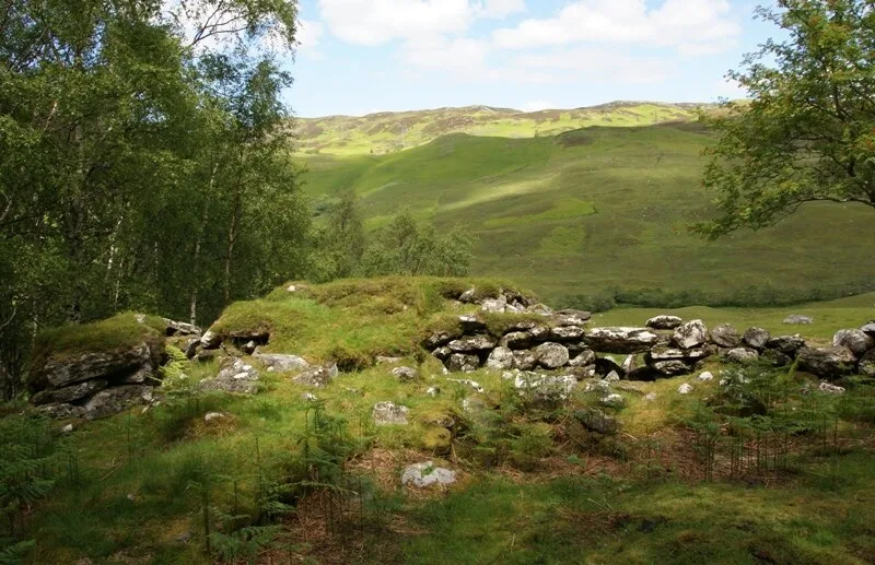
Dun Grugaig

Dun Grugaig
Otter · CC BY-SA 3.0

Also known as: Dun Grugaig,dun,Gleann Beag, Dun Grugaig (Glenelg)

Dun Grugaig is a D-shaped dun, or "semi-broch", located about 7 kilometres southeast of the village of Glenelg, Highland [1]. Dun Grugaig stands on the north bank of the Abhainn a’Ghlaine Bhig, in the upper reaches of Gleann Beag [1]. It is in the same valley as the two Glenelg brochs of Dun Telve and Dun Troddan [1]. Dun Grugaig is a D-shaped fortification of a type commonly regarded as a prototype broch or "semi-broch" [1]. The first modern survey was conducted by Henry Dryden in 1871 [1].

Text: Wikipedia – 'Dun Grugaig' (revision of 2026-07-21), CC BY-SA 4.0 · sentences selected and shortened by an AI system · source →
TypeFortification
Period1500 - 500 BC
CountryScotland
Coordinates57.1837° N, 5.5567° W

More sites in Scotland

Dun Troddan · Dun Telve · Caisteal Grugaig · Dun Ringill · Tirefour Castle · Rubha an Dùnain Passage Grave · Corrimony Chambered Cairn · Dun Ardtreck · Dun Beag Broch · Clachtoll Broch · Bruach An Druimein, Kimartin Glen · Glebe Cairn, Kilmartin Glen · Kilmartin Glen · Cup and Ring marks, Kilmartin Glen · Nether Largie North Cairn, Kilmartin Glen · Nether Largie Mid Cairn, Kilmartin Glen · The Linear Cemetery, Kilmartin Glen · Nether Largie South Cairn, Kilmartin Glen · Temple Wood, Kilmartin Glen · Nether Largie Standing Stones, Kilmartin Glen · Ri Cruin Cairn, Kilmartin Glen · Carving depicting Animals, Kilmartin Glen · Ballymeanoch, Kilmartin Glen · Dun Hallin

All sites in Scotland →

Was this page useful?

Keep exploring

Every site on this page sits on the globe, and the people who research them are on the Discord.

3D Globe · Sites by country · Story Archive · Research Library · Weekly Journal · Search