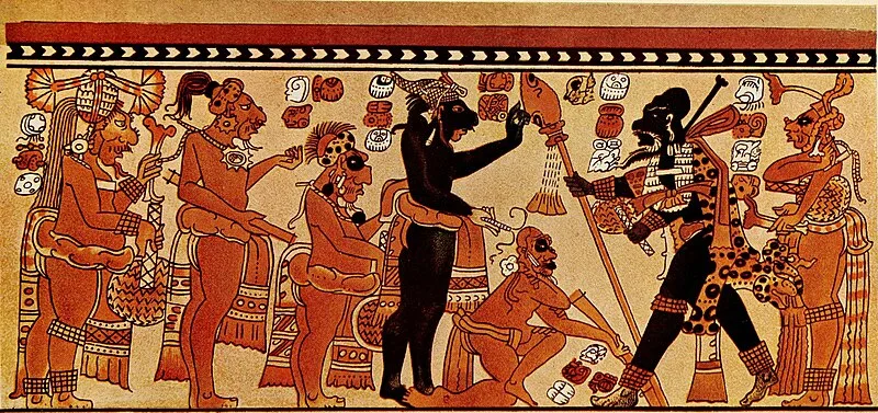
Chama

Chama
Internet Archive Book Images · No restrictions

(8th c. AD) Chama is a small Late-Classic Maya highland settlement in the Chixoy River valley of Alta Verapaz, Guatemala, approximately 50 km northwest of San Pedro Carchá [1]. The site was likely established through lowland colonization during the early 8th century and developed a distinctive, short-lived Classical ceramic style [1]. Early 20th-century excavations led by Robert J. Burkitt of the Pennsylvania University Museum revealed its peripheral status within the broader Maya lowland kingdoms [1].

TypeCity/town/settlement
Period500 - 1000 AD
CountryGuatemala
Coordinates15.7428° N, 90.3659° W

More sites in Guatemala

Cancuén · Tres Islas · Ucanal · Acrópolis Aguateca · Dos Pilas · Punta de Chimino · Tamarindito · Arroyo de Piedra · Sitio Arqueológico Altar de Los Sacrificios · Machaquila · La Amelia · El Ceibal · Chitinamit · Chutixtiox · Mixco Viejo · Qʼumarkaj · Kʼatepan · Kaminal Juyu Parque Arqueológico · Sitio Arqueológico El Chal · Sitio Arqueológico Iximche · Wajxaklajun · Parque Arqueológico Zaculeu · El Porvenir · Ixtutz

All sites in Guatemala

Was this page useful?

Keep exploring

Every site on this page sits on the globe, and the people who research them are on the Discord.

3D Globe · Sites by country · Story Archive · Research Library · Weekly Journal · Search