

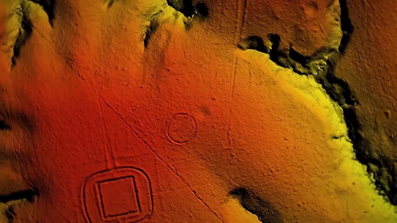
Martti Pärssinen and a University of Helsinki team flew LiDAR over 4,000 km of Amazon forest in Acre and Amazonas, scanning 180,000 sq km. They estimate 24,000–30,000 earthworks hidden below — enclosure complexes of up to 8 structures linked by roads, plus geometric geoglyphs with ditches 5m deep, likely ceremonial gathering hubs.
LiDAR reveals 24,000–30,000 ancient earthworks hidden beneath Amazon canopy
Key facts
- Research team led by Martti Pärssinen of the University of Helsinki flew LiDAR over 4,000 km of dense Amazonian forest in the Brazilian states of Acre and Amazonas
- Scanned cultural area covers approximately 180,000 square kilometers in the southwestern Amazon
- Researchers estimate 24,000 to 30,000 total earthworks are scattered across the scanned region
- LiDAR revealed enclosures clustered into complexes of up to eight structures connected by roads, along with previously undetected quadrilateral and multilateral embankments
- Earlier geoglyph discoveries in Acre from the late 1970s included massive geometric shapes (squares, circles, hexagons) with ditches carved 5 meters deep and earthen walls stretching the length of several football fields
- Sites are believed to have functioned as ceremonial gathering points for ritual, trade, dance, and sport
Keep exploring
Every site on this page sits on the globe, and the people who research them are on the Discord.
3D Globe · Sites by country · Story Archive · Research Library · Weekly Journal · Search
AI-generated text · images from the original sources · always verify with the sources.