 ANCIENT NERDS
Water Erosion Evidence in the Osiris Shaft
The paper argues that water erosion is an unsupported explanation for weathering features on the Osiris Shaft walls, because no geological studies have actually documented such features within the shaft itself, and alternative processes like salt crystallization and thermal cycling can produce similar damage in arid conditions without requiring the prolonged rainfall or wetter paleoclimate that the water erosion hypothesis invokes.
Beneath the Khafre Causeway on the Giza Plateau, approximately 25 to 30 meters below the desert surface, three vertical shafts descend into Eocene limestone that has now been saturated with groundwater for millennia. Researchers descending the Osiris Shaft encounter conditions that challenge conventional assumptions about desert geomorphology: the lowest chamber sits permanently flooded, forming an underground lake with crystal-clear water that seeps actively through the limestone walls. Yet this is only the present state of a much deeper temporal puzzle. On the shaft walls between the surface entrance and the first chamber level, erosion features riddle the stone—deep vertical grooves, dissolution pitting, fissures, and undulating surfaces—patterns consistent with chemical weathering documented on adjacent Sphinx enclosure walls. These marks raise a question that straightforward geological explanation has not yet resolved: what processes, over what timescale, and under what climatic conditions could produce such pervasive water damage in a landscape now classified as hyperarid? [1]
The Osiris Shaft Structure and Stratigraphy
The Osiris Shaft descends approximately 35 meters (115 feet) below the Giza Plateau surface. It is situated beneath the Khafre Causeway roughly halfway between the Great Sphinx and Khafre’s funerary temple. The structure consists of three vertical shafts—A, B, and C—that lead to three distinct underground levels. When Zahi Hawass’s team first reached the lowest chamber during the 1999 excavation, they encountered a flooded subterranean lake. They required two months of continuous pumping before they could even investigate the space. The water was described as crystal-clear, with audible dripping from rock walls indicating active groundwater movement. [2] [3]
The shaft penetrates the full thickness of the Mokattam Formation, a Middle Eocene nummulitic marine limestone sequence underlying the Giza Plateau. Within these walls, the characteristic alternating pattern of the Mokattam Formation is clearly visible. Harder nummulite-rich limestone strata are interspersed with softer marly layers that exhibit different degrees of weathering susceptibility. Researchers from the Khafre Enigma project documented that builders selected particularly dense limestone layers for initial carving before excavating larger chambers along these geological boundaries. The shaft’s angled passages were designed to facilitate water infiltration through the porous limestone, creating deliberate hydraulic pathways into the deeper structure. [4]
The lowest level (Level 3) intersects the regional water table, producing the permanent flooding that has characterized the shaft since its discovery. Water continues seeping through the limestone walls today, with active dripping audible during site visits and exploration. This infiltration creates ongoing conditions for chemical weathering of the shaft walls through carbonic acid dissolution. Geophysical surveys confirm the Giza Plateau contains an active aquifer system with groundwater levels that respond to modern irrigation and urbanization practices. [1] [5]

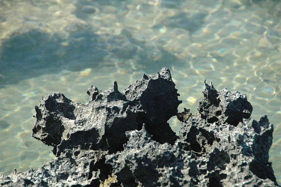
Karstified aragonitic limestone (Pain Pond, San Salvador Island, Bahamas) 4. Photo: James St. John / Wikimedia Commons. visual evidence of the chemical weathering mechanism described, making the carbonic acid dissolution process tangible. Source
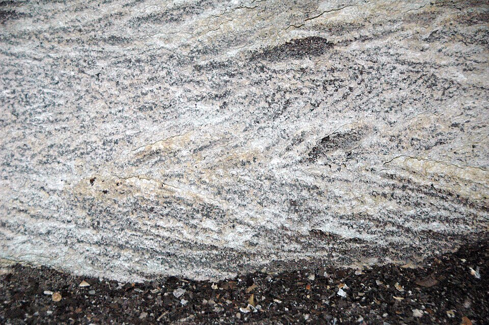
Pink Grotto - herringbone cross-stratified calcarenite limestone (San Salvador Island, Bahamas) 2. Photo: James St. John / Wikimedia Commons. Visual reference for the geological formation that hosts the aquifer system and controls water infiltration…. Source
Artifacts recovered from Level 2—pottery, bones, and two granite sarcophagi in niches—date to approximately 500 BCE, indicating secondary use during the Late Period. However, the original construction date remains debated. Some sources attribute at least one shaft section to the Fifth-Sixth Dynasty when, according to those sources, rainfall was more abundant. This attribution traces back to a single modern content creator rather than peer-reviewed archaeological analysis. What the evidence does confirm is straightforward: a three-level subterranean complex intentionally designed to intersect the water table, carved through the Mokattam Formation’s alternating geological strata, and containing permanent groundwater in its deepest chamber. [1] [3]
The Giza Plateau Hydrogeological System
The Giza Plateau rests on limestone formations of the Eocene Mokattam Group, specifically the El-Asl Formation and El-Ghazalat Member, which exhibit varying resistance to weathering due to lithological heterogeneity. Geophysical surveys using electrical resistivity, seismic refraction, and ground-penetrating radar have mapped a three-layer subsurface model with the aquifer layer at relatively shallow depths. The limestone exhibits high permeability allowing water seepage through joints and fractures. Interconnected structural trends running NW, ENE, and NE orientations facilitate vertical aquifer connectivity and groundwater upwelling from deeper formations. Historical regional groundwater flow in Greater Cairo and Giza showed remarkable changes between 1962 and 1982, demonstrating the system’s sensitivity to external pressures. [6]
The Osiris Shaft, located beneath Khafre’s causeway on the Giza Plateau, represents a deliberate intersection of ancient architecture and hydrogeology. The structure extends approximately 30 to 35 meters below the plateau surface. It consists of three vertical shafts (A, B, C) leading to three distinct levels, with the lowest chamber completely flooded by active groundwater at approximately 25 meters depth. The shaft cuts through three distinct limestone strata layers with varying resistance to weathering, a characteristic typical of Late Period shaft construction. This design was intentional: the Osiris Shaft was constructed to intersect the water table, in deliberate contrast to typical Egyptian temple construction practices that sought to avoid moisture exposure. The structure functioned historically as a water source, with local people using it for drinking and swimming before modern pumping efforts. [7]
Active groundwater with audible dripping water continues to seep through the shaft walls today, demonstrating ongoing hydrogeological processes. Groundwater levels at Giza fluctuate in response to Nile flooding, irrigation activities, and rainfall patterns, creating conditions for variable water action on subterranean structures. However, these levels have risen significantly in recent decades due to water leakage from irrigation canals and urbanization, threatening the structural stability of monuments. Research documented in 2019 confirmed that rising groundwater levels have increased water presence in subterranean structures including vertical shafts. This may be accelerating weathering of shaft walls through increased moisture exposure and salt crystallization cycles. The Giza Plateau limestone aquifer system exhibits interconnected structural trends that facilitate vertical aquifer connectivity, potentially affecting the Osiris Shaft through groundwater upwelling. This modern rise demonstrates that the hydrogeological system remains dynamically active, responding to anthropogenic pressures in ways that pose direct threats to the archaeological record. [6]
The Giza region has experienced periods significantly wetter than present, with the African Humid Period occurring from approximately 14,600 years ago until 6,000-5,000 years ago, followed by approximately the last 5,000 years of hyperarid conditions. This climate history creates a fundamental interpretive challenge. Significant documented water erosion features exist on the Sphinx enclosure walls at Giza, including deep vertical grooves carved into limestone. Some researchers attribute these features to water action during periods wetter than the past 5,000 years of hyperarid conditions. A Geomorphological Study of the Giza Necropolis identified features suggesting flowing water action within the Sphinx enclosure, with vertical fissures and faults resembling rainfall erosion marks indicating concentrated runoff drainage. [8]
Water erosion on Giza limestone involves chemical weathering processes where slightly acidic rainwater dissolves carbonate rock, with differential erosion occurring along alternating hard and soft strata. But here’s where the interpretation divides: deep vertical erosion features on the limestone walls of the Sphinx enclosure and the Osiris Shaft area have differing attributions. Some researchers argue these features require water action incompatible with the past 5,000 years of aridity. Others attribute them to wind or salt crystallization weathering. The Osiris Shaft’s construction incorporated deliberate design features to manage water infiltration into porous limestone, including angled passages that allow water to seep into the substrate. This raises questions about whether the ancient builders anticipated or embraced the hydrogeological conditions they encountered. The evidence doesn’t resolve whether these erosion features formed during the African Humid Period thousands of years before the pyramids were built, or whether ongoing groundwater processes continue to shape these structures in ways not fully documented by the historical record. [9]
Paleoclimate Evidence and Water Erosion Features at Giza
The Giza plateau limestone is sufficiently porous to allow significant water seepage through subsurface features, including shafts and chambers. The water table at Giza Plateau lies approximately 150 feet (approximately 45 meters) below the surface. The Osiris Shaft, a multi-level subterranean structure located beneath Khafre’s causeway, descends approximately 25-30 meters (about 100 feet) below the Giza Plateau surface with its lowest level entirely water-filled where it intersects the local water table. The shaft penetrates three distinct limestone strata of the Mokattam Formation (Members I, II, and III), with VR documentation explicitly noting “all three layers of limestone”. The Giza limestone sequence exhibits alternating hard and soft strata, with harder Member I reef limestone more resistant than softer Member II and III strata. [9]
The Osiris Shaft features an angled L-shaped dual-shaft architecture deliberately designed to facilitate water seepage into the porous limestone substrate. This architectural design aligns with 27th Dynasty shaft construction practices and represents intentional engagement with the geological conditions created by wetter climatic periods. The shaft experienced repeated flooding events that deposited sediment layers and gravel throughout its chambers, sometimes filling spaces to near-ceiling heights. The lower chambers contain active groundwater that continuously drips from rock walls, creating permanent water-filled conditions at depth. The shaft was historically used as a drinking water source on the Giza Plateau, with water levels that fluctuated and were accessed by the local population for drinking and swimming. Salt crystallization from evaporating groundwater has contributed to weathering of limestone surfaces within the shaft system [10].
Rising groundwater tables currently threaten the structural stability of the Giza pyramids complex due to urban irrigation and canal leakage, indicating ongoing and active hydrogeological processes beneath the plateau. Regional hydrogeological studies document significant changes in groundwater flow patterns in the Greater Cairo/Giza region between 1962 and 1982, indicating an active and dynamic aquifer system. The Sphinx enclosure exhibits erosion patterns indicating prolonged exposure to water that cannot be attributed to the current arid climate or human activity over the past 5,000 years. Chemical weathering of limestone by slightly acidic rainwater produces dissolution features including pitting and sinkholes, representing a primary erosion mechanism in semi-arid environments when combined with concentrated runoff patterns. High relative humidity in the surroundings of the Sphinx is documented as a key factor in surface deterioration of the limestone rock. [11] [12] [13] [14]
The Sphinx enclosure exhibits evidence of water being focused along joints and fractures forming dissolution features consistent with karstic processes including grikes and clints. The evidence for water erosion during the African Humid Period on the Sphinx enclosure walls remains contested. Some researchers maintain that wind and sand abrasion alone cannot account for the observed weathering patterns. [15] [16]
Connecting the Dots
The Osiris Shaft was designed with an angled, L-shaped configuration that facilitated water seepage into the porous limestone. During the Fifth and Sixth Dynasties, when the shaft was carved, Egypt’s climate was transitioning from the African Humid Period—a time when the Sahara contained grasslands, lakes, and rivers, and North Africa experienced markedly wetter conditions. The archaeological evidence and the paleoclimate record overlap here. The shaft’s water management features were not anomalous design choices but responses to environmental conditions that still included periodic rainfall and surface runoff. What makes this significant is that the shaft’s deepest chamber remains permanently flooded with groundwater, a condition that excavators discovered required two months of pumping to excavate. The construction timeline and the hydrological reality together suggest the shaft was positioned to access an aquifer that responded to both the residual wetness of the African Humid Period and the emerging arid conditions of dynastic Egypt. [9] [17]
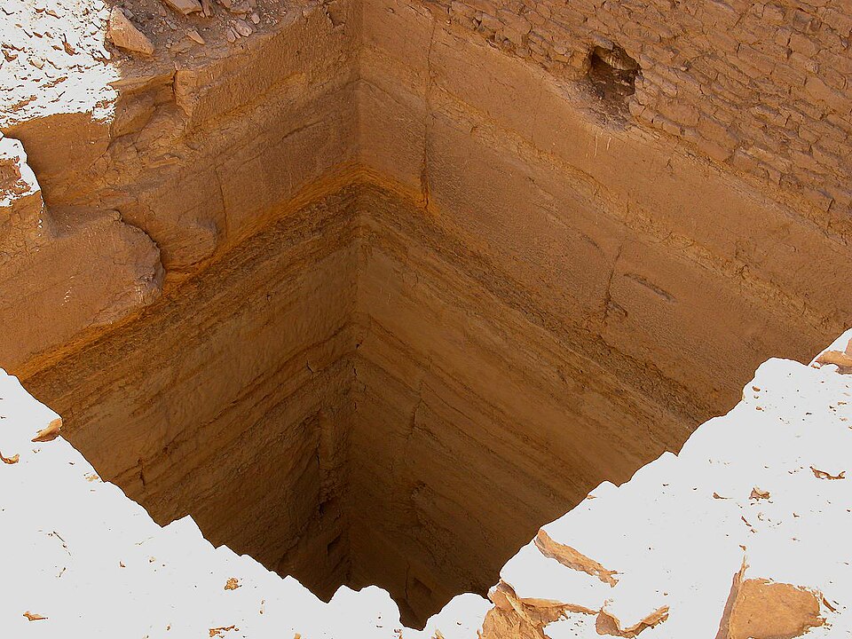
Flickr - archer10 (Dennis) - Egypt-12B-024. Photo: Dennis G. Jarvis / Wikimedia Commons. The paragraph situates the shaft in the Fifth Dynasty construction period—visual evidence of period-appropriate shaft…. Source
The geological evidence explains why the shaft walls show differential weathering patterns. The shaft penetrates alternating layers of hard and soft limestone within the Mokattam Formation. Geophysical imaging has documented a shallow aquifer system beneath the Giza Plateau with resistivity values of 40-80 Ωm indicating saturated limestone bedrock. Clay minerals including smectite—comprising roughly 10 percent by weight in comparable Helwan limestone—cause hydric swelling when moisture levels fluctuate. The Mokattam Formation is interbedded with marls and swelling clays dominated by montmorillonite, which accelerate weathering in softer strata while denser layers resist erosion. Ancient masons in the shaft strategically selected locations where particularly dense limestone layers could be penetrated first before carving chambers, demonstrating lithological knowledge that the current weathering patterns now reflect. The soft limestone layer in the Giza geological sequence aligns with areas of accelerated degradation in the shaft walls, confirming that the heterogeneous composition of the plateau directly controls where erosion occurs. [18]
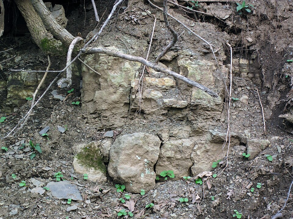
Nineveh Limestone (Greene Formation, Lower Permian; Clark Hill section, Monroe County, Ohio, USA) 2. Photo: James St. John / Wikimedia Commons. The shaft walls showing differential weathering are central to the argument; a clear geological example…. Source
The flooded chambers contain multiple sediment layers deposited by repeated flood events, matching evidence of flood events with sediment deposits documented throughout the Giza plateau’s underground chambers. Contemporary field observations in the Osiris Shaft recorded multiple rooms flooded almost to their ceilings with water carrying rubble, sediment, and gravel until chambers filled to their maximum capacity. These stratified deposits represent distinct flood episodes accumulated over time. The Sphinx enclosure exhibits analogous erosion patterns consistent with prolonged water exposure, including vertical and undulating fissures that differ from the horizontal flaking seen in wind and sand abrasion on nearby Old Kingdom structures. The Sphinx enclosure basin would have collected runoff from large areas of the plateau due to its location and elevation, creating conditions for water accumulation and erosion—paralleling the Osiris Shaft’s position beneath the Khafre Causeway. The same geological formations that produced differential weathering at the Sphinx control the shaft’s susceptibility to water damage. [16]
The current flooding is partially attributed to modern causes. Groundwater levels beneath the Giza Plateau have risen due to water leakage from irrigation canals and mass urbanization, with pumps capable of extracting 26,000 cubic meters daily installed beneath the Sphinx. Historical regional groundwater flow in Greater Cairo and Giza showed remarkable changes between 1962 and 1982. Yet electrical resistivity imaging confirms a pre-existing shallow aquifer. Hawass’s excavation team documented crystal-clear water in the bottom chamber. [6]
The Other Side
The mainstream archaeological and geological consensus takes a sharply different view of both the water erosion evidence and its paleoclimatic implications. Crucially, no peer-reviewed geological or geomorphological study specifically documents water erosion features within the Osiris Shaft walls between the surface entrance and first chamber level. While water erosion on the Sphinx enclosure has been extensively debated, the shaft walls themselves remain unstudied in this regard. The Wikipedia article on the Sphinx water erosion hypothesis explicitly classifies the dating conclusions derived from weathering patterns as a “fringe claim” in mainstream archaeology, placing them outside accepted scholarly consensus. [19]
The weathering mechanisms themselves offer compelling alternative explanations. Salt crystallization, or haloclasty, is a documented weathering process in Egyptian limestone that can produce erosion-like features, dissolution pitting, and surface degradation without requiring significant water infiltration or prolonged moisture exposure. Thermoclastite processes—freeze-thaw and thermal cycling effects—also operate effectively in arid and semi-arid environments like modern Egypt. These mechanisms require neither the prolonged rainfall that proponents invoke nor the wetter paleoclimatic conditions of the African Humid Period. [20] [21] [22]
Modern hydrogeological research complicates the paleoclimate inference further. Contemporary groundwater fluctuations at Giza respond to Nile flooding cycles and extensive agricultural irrigation, creating cyclical saturation and drying that amplifies salt weathering regardless of any paleoclimate signal. The same differential decay patterns visible on the Osiris Shaft walls appear in monuments throughout the Mokattam Formation limestone, consistent with intrinsic geological heterogeneity rather than spatially variable water exposure. The shaft’s current flooding reflects present groundwater conditions, not necessarily ancient climate. Without systematic documentation of the Osiris Shaft walls themselves comparable to the extensive literature on Sphinx weathering, the water erosion hypothesis remains unsupported by the specific evidence it claims to explain. [15] [23]
What We Actually Know
The Osiris Shaft is a three-level subterranean complex cut into Giza Plateau limestone beneath the Khafre Causeway, reaching approximately 25–30 meters below the plateau surface through three distinct vertical shafts. The shaft descends through Mokattam Formation limestone exhibiting petrographic variation, including micrite-sparite limestone with alternating hard and soft strata that display differential weathering susceptibility. There is a hard gray upper bed on which the pyramids are founded and a friable lower layer beneath. Petrographic studies confirm carbonate content varies across these layers, with chambers and shafts appearing to follow lithological boundaries during excavation. [7] [24]
The lowest level of the shaft intersects a saturated limestone aquifer system with documented groundwater intersecting the structure at its base, forming flooded chambers with active water seepage through limestone walls. The Giza Plateau aquifer, with water table levels historically influenced by Nile flooding and drought cycles, has risen in modern times, threatening monument stability due to irrigation canal leakage and urbanization. [9] [25]
During the African Humid Period, wetter conditions prevailed across North Africa beginning approximately 14,600 years ago and ending around 5,000–6,000 years ago, transforming the Sahara into extensive grasslands, lakes, and rivers. Local stratigraphic evidence from Holocene floodplain Unit IV in core F3-08 provides Giza-specific proxy data indicating wetter conditions during the latter part of the Middle Holocene at the site itself. Clay minerals within the limestone, particularly smectite, contribute to weathering through hydric swelling and volumetric changes when moisture fluctuates, a mechanism documented in adjacent Helwan limestone. Salt crystallization weathering is also a significant documented mechanism affecting Egyptian limestone monuments. [26] [27]
Multiple sediment layers documented within Osiris Shaft chambers indicate repeated flooding events with sediment accumulation, with chambers reported flooded to ceiling height and water carrying rubble, sediment, and gravel repeatedly. Water erosion features including deep vertical grooves, dissolution pitting, and undulating surfaces are well-documented on Giza Plateau limestone, particularly on the Sphinx enclosure walls, demonstrating chemical weathering from slightly acidic water affecting the bedrock. Karst weathering processes including rock dissolution and crust formation are documented on Great Pyramid limestone blocks. [28] [16] [19]
The critical gap: no published geological or geomorphological studies document water erosion features within Osiris Shaft walls between the surface entrance and the first chamber level. All documented erosion evidence pertains specifically to the Sphinx enclosure, an exposed surface monument. [4]
References
[1] The Osiris Shaft — https://www.guardians.net/hawass/osiris1.htm (accessed 2026-05-13)
[2] Unexplained Underground Structures from Lost Ancient Civilizations [71:38-73:42] — Universe Inside You (YouTube) — https://youtu.be/qGQ_FKu25UU?t=4298 (accessed 2026-05-13)
[3] [PDF] Contextualizing the Osiris Shaft at Rosetau (Giza) in Archaeological … — https://scholarworks.umt.edu/context/etd/article/12783/viewcontent/Whiting_Nic_thesis.pdf (accessed 2026-05-13) [Academic]
[4] The Discovery of the Osiris Shaft at Giza - Giza Archives Project — https://www.yumpu.com/en/document/view/11852378/the-discovery-of-the-osiris-shaft-at-giza-giza-archives-project (accessed 2026-05-13)
[5] Wandering the Road with Seriah - UFOs, Aliens, Pyramids, SciFi, and More! [29:54-31:41] — Brothers of the Serpent (YouTube) — https://youtu.be/4PlqJcMww-k?t=1794 (accessed 2026-05-13)
[6] [PDF] Assessment of Groundwater Movement at Giza Pyramids Plateau … — https://www.aensiweb.com/old/jasr/jasr/2013/4711-4722.pdf (accessed 2026-05-13)
[7] The First-Ever 360° VR Tour Inside the Osiris Shaft (Forbidden Giza Tunnel) [12:45-14:31] — Anyextee (YouTube) — https://youtu.be/aCtK2ULJA6Y?t=765 (accessed 2026-05-13)
[8] Geological Evidence at Giza: The Sphinx Erosion Mystery [9:46-11:41] — Curious Being (YouTube) — https://youtu.be/0pVFMlX7dS8?t=586 (accessed 2026-05-13)
[9] The First-Ever 360° VR Tour Inside the Osiris Shaft (Forbidden Giza Tunnel) [11:26-13:12] — Anyextee (YouTube) — https://youtu.be/aCtK2ULJA6Y?t=686 (accessed 2026-05-13)
[10] The Age of the Pyramids with Randall Carlson [3:39-5:54] — Brothers of the Serpent (YouTube) — https://youtu.be/wDdK4lrshAQ?t=219 (accessed 2026-05-13)
[11] [PDF] Limestone weathering on historical monuments in Cairo, Egypt — https://www.stone.rwth-aachen.de/limestone_cairo.pdf (accessed 2026-05-13)
[12] [PDF] The mechanisms of the differential erosion of limestones — https://www.ubss.org.uk/resources/proceedings/vol15/UBSS_Proc_15_2_143-148.pdf (accessed 2026-05-13)
[13] Weathering Processes and Mechanisms Caused by Capillary … — https://www.mdpi.com/2075-163X/11/1/18 (accessed 2026-05-13)
[14] Limestone weathering: its engineering significance and a proposed classification scheme — https://doi.org/10.1144/gsl.qjeg.1988.021.01.02 (accessed 2026-05-13) [Academic]
[15] Sphinx water erosion hypothesis - Wikipedia — https://en.wikipedia.org/wiki/Sphinx_water_erosion_hypothesis (accessed 2026-05-13) [Reputable]
[16] Robert M. Schoch: Research Highlights The Great Sphinx — https://www.robertschoch.com/sphinx.html (accessed 2026-05-13)
[17] Primordial Egypt - On the Trail of the Ancients [48:55-50:40] — Brothers of the Serpent (YouTube) — https://youtu.be/l2hEgB6A9LQ?t=2935 (accessed 2026-05-13)
[18] From Satellites to Secrets: The Khafre Data with Marc Young [23:28-25:10] — Brothers of the Serpent (YouTube) — https://youtu.be/1ZYW8Ho1d-k?t=1408 (accessed 2026-05-13)
[19] The Sphinx Controversy: Another Look at the Geological Evidence — https://www.hallofmaat.com/sphinx/the-sphinx-controversy-another-look-at-the-geological-evidence-2/ (accessed 2026-05-13)
[20] Photomicrograph of the samples from Helwan quarry used in this … — https://www.researchgate.net/figure/Photomicrograph-of-the-samples-from-Helwan-quarry-used-in-this-experiment_fig3_276305273 (accessed 2026-05-13)
[21] Haloclasty - Wikipedia — https://en.wikipedia.org/wiki/Haloclasty (accessed 2026-05-13) [Reputable]
[22] What Is Haloclasty? - World Atlas — https://www.worldatlas.com/articles/what-is-haloclasty.html (accessed 2026-05-13)
[23] Pyramids’ Black & White Casings: The SHOCKING True Purpose [18:17-20:08] — Curious Being (YouTube) — https://youtu.be/3MWTcFVrktY?t=1097 (accessed 2026-05-13)
[24] cross section of the Giza plateau, the Mokattam Formation and… — https://www.researchgate.net/figure/cross-section-of-the-Giza-plateau-the-Mokattam-Formation-and-the-quarries_fig4_341623252 (accessed 2026-05-13)
[25] The Osiris Shaft and the Khafre Causeway (Giza Plateau) — https://www.academia.edu/146002350/The_Osiris_Shaft_and_the_Khafre_Causeway_Giza_Plateau_Archaeological_Context_Second_Level_Sarcophagi_and_Limited_Tomographic_Correlation (accessed 2026-05-13) [Academic]
[26] The Impact of Hydric Swelling on the Mechanical Behavior of Egyptian Helwan Limestone — https://pp.bme.hu/ci/article/download/15360/8742 (accessed 2026-05-13)
[27] Mokattam Formation - Grokipedia — https://grokipedia.com/page/mokattam_formation (accessed 2026-05-13)
[28] Videos - How the great pyramids were built using water — https://www.secretofthepyramids.com/circumstantial-evidence (accessed 2026-05-13)
Keep exploring
Every site on this page sits on the globe, and the people who research them are on the Discord.
3D Globe · Sites by country · Story Archive · Research Library · Weekly Journal · Search