

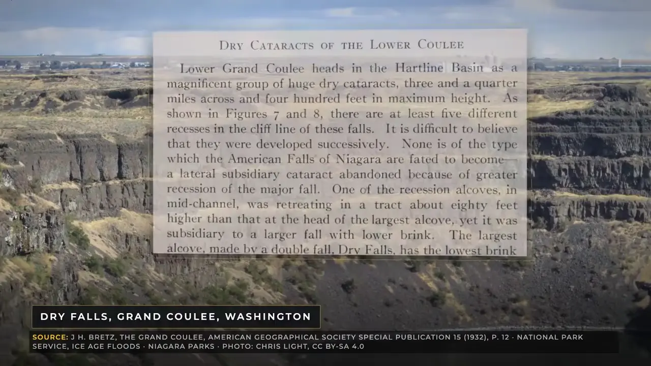
The Channeled Scablands of eastern Washington preserve Dry Falls, a former cataract about 3 miles (roughly 5 km) wide and 400 feet high. The video cites discharge estimates above 300 million cubic feet per second for the Missoula floods and argues that peak water stood 400 feet above the rim, leaving no visible waterfall; below the cataract, it says flow reached 800 feet deep. It describes Niagara's horseshoe as a “recessional cataract” shaped by repeated erosion and links that form to the Scablands cataracts. It dates the canyon cutting to brief glacial–interglacial transitions, with a window of no more than about 3,000 years and the actual cutting taking weeks or less. 💧⛰️
Video cites 300M+ cfs Scablands floods and a 3-mile cataract
Key facts
- Dry Falls, the Scablands cataract described, was about 3 miles (roughly 5 km) wide and 400 feet high—not 5 miles wide.
- The video cites discharge estimates above 300 million cubic feet per second for the Missoula floods.
- The video argues that peak water stood about 400 feet above the cataract rim and reached about 800 feet deep below it.
- The video describes Niagara's horseshoe as a recessional cataract shaped by repeated erosion and links that form to the Scablands cataracts.
- The video dates the canyon cutting to brief glacial–interglacial transitions, with a total window of no more than about 3,000 years and the cutting itself taking weeks or less.
Sources
thetitan.network
Linked in video description
Channeled Scablandsen.wikipedia.org
The buttes range in height from 30 to 230 m (98 to 755 ft), while the rock basins range from 10 m (33 ft) in width up to the 11 km (7 mi) long and 30 m deep ...
Channeled Scabland morphologyresearchgate.net
The erosional mesoforms (scaled to flow depth) include longitudinal grooves, butte-and-basin scabland, potholes, inner channels and cataracts. These make up an ...
Dry Falls and the Channeled Scablandiugs-geoheritage.org
Dry Falls, the main feature in a series of huge cataracts known as the “great cataract group”, sits at the heart of Washington's Channeled Scabland, a vast ...
How did the Channeled Scablands Form?fws.gov
It is three miles wide and 400 feet high—ten times the size of Niagara Falls—with plunge pools at its base suggesting the erosive power of an ...
Washington's Channeled Scablandfile.dnr.wa.gov
by JH BRETZ · Cited by 8 — Like the Niagara proto- type of a retreating cataract, they migrated upstream by under- cutting from the points of inception and thus left recessional gorges or ...
Was this story useful?
Keep exploring
Every site on this page sits on the globe, and the people who research them are on the Discord.
3D Globe · Sites by country · Story Archive · Research Library · Weekly Journal · Search
AI-generated text · images from the original sources · always verify with the sources.