

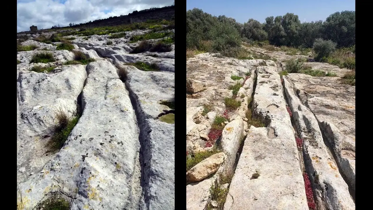
Carts are the leading explanation over sledges: a loaded wheel cuts a steep, narrow channel, unlike a sledge's wide, shallow groove. Across 2,628 tracks, the survey found no systematic alignment with Neolithic temple entrances or ramps; the associated quarries are Classical-period ashlar workings. Tracks converge on Roman farm complexes at Tell Qoris, run through streets at Mdina and Rabat (ancient Melite), and cut into warehouse threshold slabs at Yul Qorti, Marsa. The railway gauge claim? H. S. Groucutt's 2022 mean centre-to-centre spacing was ~139 cm, but the gauge-relevant inner-edge spacing was only ~111 cm, with individual tracks varying ~110–160 cm — incompatible with a fixed standard gauge. 🛞📜
Ruts mostly link to Roman-era sites, not temples; the standard-gauge railway claim fails
Site mentioned
📍 Cart Ruts🌍 Show on the globe
Key facts
- Carts are the leading explanation over sledges: a loaded wheel concentrates pressure and cuts a steep, narrow channel, whereas a dragged sledge leaves a wider, shallower groove.
- The survey covered 2,628 tracks and found no systematic alignment with Neolithic temple entrances or construction ramps. The quarries associated with the tracks are Classical-period ashlar quarries for squared building blocks.
- Tracks converge on Roman-period agricultural complexes at Tell Qoris and survive in streets beside Roman houses at Mdina and Rabat, ancient Melite. Grooves also cut into threshold slabs of a Roman warehouse beside the harbour quay at Yul Qorti, Marsa.
- About one-third of Malta's Classical rock-cut tombs lie within 50 m of a track, consistent with the Classical tradition of tombs lining roads. This supports Roman use but does not establish when every groove was first cut.
- A 2022 study by H. S. Groucutt reported mean centre-to-centre rut spacing of about 139 cm. Measured between inner edges, as railway gauge is measured, the mean was about 111 cm; individual tracks varied roughly from 110 to 160 cm, making a fixed standard-gauge network implausible.
- At 112 locations a quarry cuts across an existing track, and at 17 a groove is worn into a quarry floor. Roman roads laid over ruts likewise show that the grooves came first, so the tracks were not all created simultaneously.
- Nicolas Grima's interpretation is that the road network expanded after Phoenician settlement and probably peaked under Roman rule, although he does not exclude some tracks predating the Phoenicians.
Sources
Was this story useful?
Keep exploring
Every site on this page sits on the globe, and the people who research them are on the Discord.
3D Globe · Sites by country · Story Archive · Research Library · Weekly Journal · Search
AI-generated text · images from the original sources · always verify with the sources.