

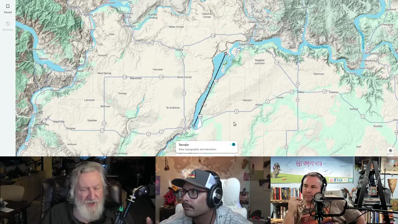
The Finger Lakes and Channeled Scablands/Grand Coulee have different origins and scales. Grand Coulee is about 50 miles long; the Scablands cover roughly 2,000 square miles, while individual Finger Lakes run about 4–35 miles. The Finger Lakes were carved by glaciers during the last Ice Age. The Scablands were repeatedly scoured by Missoula floods, mainly through Columbia River basalt; older granite appears at the dam. The Finger Lakes lie mainly in shale and other sedimentary rock. Grand Coulee is drier today than western New York, but rainfall does not determine how either landscape formed. Both were shaped by water, but they are different feature types with different processes and scales. The presenter's claim of an identical catastrophic flood origin is unsupported.
Presenter's claim that Finger Lakes and Scablands share a flood origin is unsupported
Key facts
- The Finger Lakes are glacial erosional basins from the last Ice Age, not catastrophic flood channels.
- The Channeled Scablands were repeatedly carved by Missoula outburst floods.
- Grand Coulee is approximately 50 miles (81 km) long, not 20–21 miles; individual Finger Lakes range from roughly 4 to 35 miles.
- The Scablands are largely cut into Columbia River basalt, although older granite is exposed at Grand Coulee Dam; the Finger Lakes are largely underlain by shale and other sedimentary bedrock.
- Modern rainfall is lower around Grand Coulee than in western New York, but it does not establish a common origin, and the Finger Lakes are not a post-flood environment.
- These are different landform types formed by different processes and at different scales.
Sources
Channeled Scablands - Wikipediaen.wikipedia.org
The Channeled Scablands are a relatively barren and soil-free region of interconnected relict and dry flood channels, coulees and cataracts
[PDF] Upper Grand Coulee: New views of a channeled scabland ...par.nsf.gov
The scabland saddle on the west shows how, before upper Grand. Coulee was excavated, Missoula floodwater utilizing the high-level “Coulee creek” vale overflowed ...
Channeled Scablands and the Palouse Falls - Inspired Journeysinspiredjourneys.live
... long as the Grand Coulee at 60 miles long. Scablands are where soil had been removed and the underlying rock is exposed or covered with its ...
[PDF] The Ice Age Floods Through the Western Channeled Scablandsweb.gps.caltech.edu
Floodwater was at least 700 feet above the present lake elevation and moving at an estimated 60-70 mph during the larger floods Deposition initially increased ...
[PDF] Lower Grand Coulee - Ice Age Floodshugefloods.com
The Lower Grand Coulee extends from Dry Falls to Soap Lake. It is perhaps the most striking of the coulees of the Missoula Flood-created ...
Geology of the rock foundation of Grand Coulee Dam ...pubs.geoscienceworld.org
The foundation and abutments of the dam, exposed by excavation of glacial and fluvial overburden, are composed of two types of granite. The ...
Grand Coulee National Natural Landmarknps.gov
This large geological feature is approximately 81 kilometers (50 miles) long and averages about 16 kilometers (1 mile) in width.
Resume of the regional geology of the Grand Coulee area, ...pubs.usgs.gov
by MH Staatz · 1976 · Cited by 3 — During glacial times the ice-dammed Columbia River overflowed its southern bank in many places, cutting through the loess and forming shallow valleys or coulees.
Was this story useful?
Keep exploring
Every site on this page sits on the globe, and the people who research them are on the Discord.
3D Globe · Sites by country · Story Archive · Research Library · Weekly Journal · Search
AI-generated text · images from the original sources · always verify with the sources.