

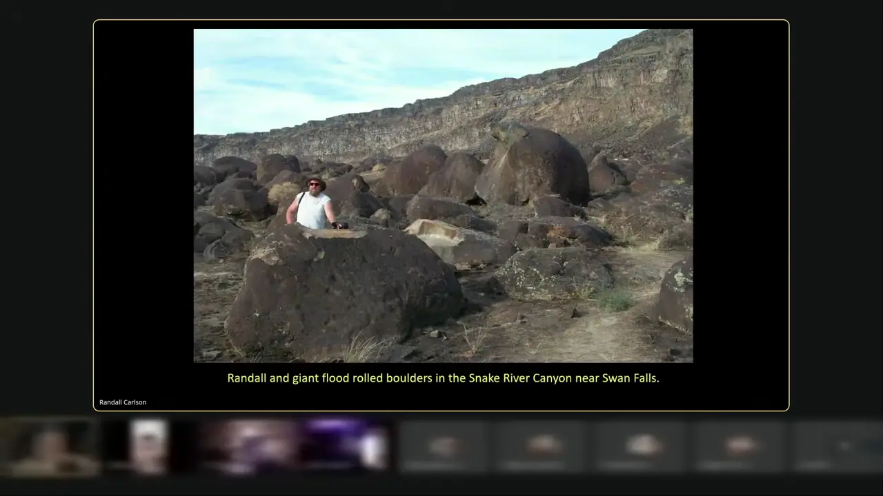
Megaflood deposits get compared across continents. Work on south Sinai wadis like Wadi Isla used boulder transport and runoff modelling to reconstruct a cataclysmic flood, which the presenter speculates at roughly 11,000-14,000 years ago. Imbricated, systematically stacked clasts indicate water rather than glacial transport. The Snake River and Hell's Canyon in Idaho were cut by an end-ice-age megaflood; the Swan Falls boulder bar runs 3-5 miles and is a couple hundred feet thick. Does one cause explain both? 🌊
Megaflood boulder deposits compared between south Sinai wadis and Snake River Canyon
Key facts
- Published work on extreme floods in wadis of south Sinai, including Wadi Isla, used boulder transport and rainfall-runoff modelling to reconstruct a cataclysmic flood event, with the presenter speculating a date of roughly 11,000-14,000 years for the Pleistocene-Holocene transition.
- Imbrication - a systematic stacking orientation of clasts - is described as diagnostic of water transport rather than glacial transport, and is illustrated in Sinai wadi outwash and at the mouth of the wadis.
- The video argues the same category of pluvial event could have produced the sheet floods needed to erode the Sphinx enclosure walls.
- The Snake River Canyon in southern Idaho, and Hell's Canyon, are described as being cut by a megaflood at the end of the last ice age; the Swan Falls boulder bar is 3-5 miles long and a couple hundred feet thick, composed of boulders ripped out of the canyon bedrock.
- The video asks whether the Sinai and Snake River flood events are unrelated, or whether they require a common cause able to affect both sides of the planet.
- A 1960 geomorphology textbook cited in the video states that the valley west of the Nile at Luxor containing the royal tombs appears water-eroded while the tombs themselves show no destructive water action, and concludes that significant water action probably ceased at least 4,000 years ago but sometime earlier.
Sources
Reconstructing an extreme flood from boulder transport ...researchgate.net
Kehew et al. (2010) reconstructed extreme flash floods in Wadi Isla, South Sinai, Egypt, using palaeohydrological indictors related to flood velocity and ...
Bringing Water to the Sinai? | Arts & Sciencesbu.edu
Because Wadi El-Arish has the largest watershed in the Sinai and collects over 60 percent of the peninsula's precipitation, it is being closely studied for its ...
Wādī 'Islah, South Sinai Governorate, Egyptmindat.org
Wadi - a valley or ravine , bounded by relatively steep banks, rainy season becomes a watercourse ; found primarily in North Africa and the Middle East Mindat. ...
Embark on a Journey to Sinai with Wadi Day Hikes in 2026sinaihikes.com
Join a guided day hike through Sinai Wadis and embark on a peaceful journey to Sinai's most picturesque landscapes and desert paths.
EGYPT: Lessons from the January floods in Sinaireliefweb.int
The January floods in North Sinai left 780 homes totally destroyed, 1,076 submerged, and much other damage. , or near, dried up watercourses ( ...
Was this story useful?
Keep exploring
Every site on this page sits on the globe, and the people who research them are on the Discord.
3D Globe · Sites by country · Story Archive · Research Library · Weekly Journal · Search
AI-generated text · images from the original sources · always verify with the sources.