

🌋 13,077 years ago, the Laacher See volcano in Germany's Eifel range erupted with VEI magnitude 6 force, ejecting over 6 cubic km of tephra with columns reaching the stratosphere. A 2021 study redated the eruption to 13,077 years BP. Initial blast flattened trees within 4 km radius; eruption lasted several weeks with 30+ crater collapses.
The Laacher See volcanic eruption occurred 13,077 years ago (11,077 BC), recently redated 126 years earlier than previously thought
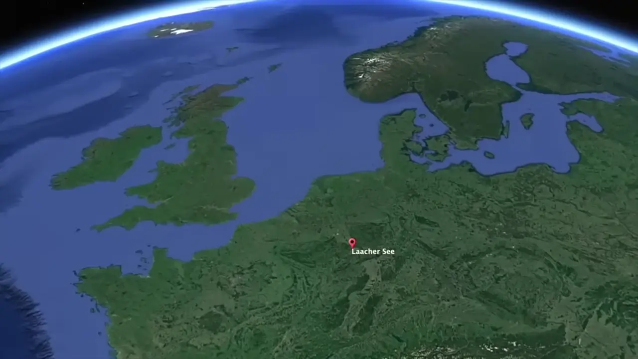
Site mentioned
📍 Laacher See
Key facts
- The Laacher See volcanic eruption occurred 13,077 years ago (11,077 BC), recently redated 126 years earlier than previously thought
- Located in Eiffel mountain range, western Germany, part of the West European Rift System seismotectonic belt
- Eruption ejected approximately 20 cubic kilometers of tephra with eruption column reaching 40 km in height
- Classified as magnitude 6 on the Volcanic Explosivity Index (VEI)
- Initial blast flattened trees within 4 km radius; eruption lasted several weeks with more than 30 crater collapses
- Pyroclastic flows covered valleys up to 10 km away; tephra deposits exceeded 50 m thickness near crater and remained 10 m thick at 5 km distance
- Ash fallout covered area larger than 300,000 square kilometers from Britain to Italy and southern Sweden to Poland, with evidence recorded in Greenland ice cores
- Tephra deposits dammed the Rhine River creating a 140 square kilometer lake that subsequently breached causing devastating downstream flooding
- Eruption caused several years of cold summers and up to two decades of environmental disruption
- Devastated the Federmesser culture (hunter-gatherer population) identified archaeologically by distinctive stone, bone, and antler tools including barbed points, scrapers, arrowheads, drills, chisels, spatulas, and portable art/jewelry
- Post-eruption site located 10 kilometers north of volcanic crater contains charred remains of roe and red deer with large lithic fragment assemblages
- Emergence of two new cultures (Bromme culture of southern Scandinavia and Perstunian culture of northeastern Europe) likely representing Federmesser survivors with reduced tool-making skills and lost bow-and-arrow technology
- Volcanic deposits preserve ancient environment: charred trees, tree imprints, leaf and needle prints (100+ plant species identified including birch, pine, willow, aspen), animal bones (bears, horses, red deer, elk, beavers, wolves, bats, ibex), perfectly preserved animal tracks from bears to woodland grouse, and raindrop imprints
Sources
Evolution and environmental impacts of the eruption of ...oceanrep.geomar.de
Laacher See Volcano (LSV), 40 km south of Bonn, explosively erupted ca. 6.3 km3 of chemically strongly zoned phonolite magma probably during ...
Laacher Seeen.wikipedia.org
The lake was formed by a Plinian eruption approximately 13,000 years BP with a Volcanic Explosivity Index (VEI) of 6, similar to the Pinatubo eruption of 1991.
Eruption of the Laacher See volcano redatedsciencedaily.com
Accordingly, the eruption of the Laacher See volcano occurred 13,077 years ago and thus 126 years earlier than previously assumed. This sheds ...
Impact Laacher See eruption on NE Germanypimdeklerk-palynology.eu
The eruption of the Laacher See volcano certainly caused temperatures to decrease, this decrease was too small and too short to greatly affect vegetation and ...
Devastating volcanic eruption did not cause the sudden- ...phys.org
The results suggest that the volcanic eruption must have taken place 130 years earlier than previously assumed.
Was this story useful?
Keep exploring
Every site on this page sits on the globe, and the people who research them are on the Discord.
3D Globe · Sites by country · Story Archive · Research Library · Weekly Journal · Search
AI-generated text · images from the original sources · always verify with the sources.