

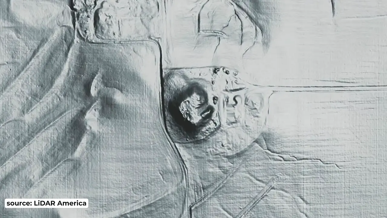
LiDAR from LiDAR America reveals a 50-ft earthen pyramid at Emerald Mound, St. Clair County, Illinois — about 300 by 300 ft at the base and just ~15 miles from Cahokia. Concealed by trees on private farm land, it vanishes in normal aerial photos. Listed on the National Register in 1971. 🏺🌳
LiDAR reveals 50-ft earthen pyramid at Emerald Mound, Illinois near Cahokia
Site mentioned
📍 Emerald Mound🌍 Show on the globe
Key facts
- LiDAR imagery made by LiDAR America shows an earthen pyramid at Emerald Mound in St. Clair County, Illinois, standing about 50 ft tall and covering roughly 300 by 300 ft (about two football fields).
- Emerald Mound lies about 15 miles from Cahokia and is considered one of the major cities of the Cahokia-centered Mississippian polity.
- The site is on private farm land, concealed beneath tall trees, so it is largely invisible in conventional aerial photography.
- An 1881 illustration of the mound calls it the 'Old Farm Mound'.
- Archaeologist Tim Pauket studied the site and estimates it spans 145 acres, with multiple temples, plazas and sweat lodges - more than a simple village site.
- LiDAR also shows a second earthen pyramid about 30 ft tall standing outside the main mound view.
- The site dates to about 1050-1350 AD, beginning with Cahokia's rise and outlasting Cahokia's abandonment in 1250.
- The video notes that some sources report the mound is oriented to the 18.6-degree lunar maximum, but says it has yet to see an archoastronomer confirm this.
- Despite being on private land, Emerald Mound was listed on the National Register of Historic Places in 1971.
- The LiDAR survey covered five virtually unknown earthen pyramid sites on private land across the United States.
Sources
LiDAR image of Emerald Acropolis with borrow area and ...researchgate.net
LiDAR image of Emerald Acropolis with borrow area and now-defunct spring designated. Courtesy of the Illinois State Archaeological Survey. Source publication.
Emerald Moundtrails.mdah.ms.gov
Emerald Mound covers roughly eight acres and is situated on the highest point in the surrounding landscape. It is the third-largest pre-Columbian earthwork ...
Searcharcgis.com
Emerald Mound Topographic Map. Tile layer Apr 21, 2021. Open in Map ... Cahokia, Illinois — 283-299 S 3rd St, Belleville, Illinois, 62220.
Emerald Mound and Village Siteen.wikipedia.org
Clair County, Illinois. The site includes five mounds, two of which have been destroyed by modern activity, and the remains of a village. Middle Mississippian ...
Emerald Mound - Southwest Regiondnrhistoric.illinois.gov
Site is closed to visitors ... Emerald Mound preserves the remains of a Native American earthwork, once part of a complex that included about 140 acres of small ...
Was this story useful?
Keep exploring
Every site on this page sits on the globe, and the people who research them are on the Discord.
3D Globe · Sites by country · Story Archive · Research Library · Weekly Journal · Search
AI-generated text · images from the original sources · always verify with the sources.