

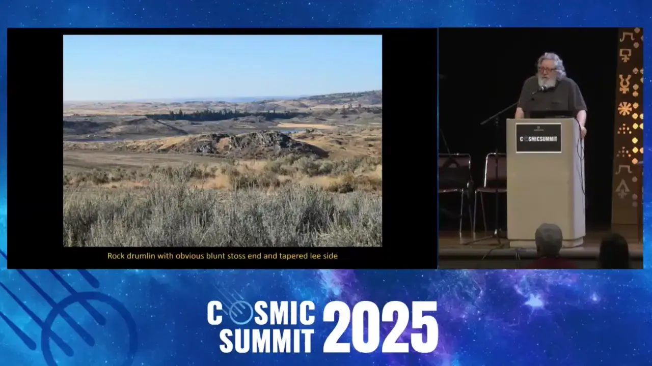
Those elongated hills called drumlins scattered across North America are frozen records of catastrophic floods that roared beneath ice sheets! Dr. John Shaw proposed they formed from subglacial pressurized floods, with researcher Jerome Lessemann documenting drumlin swarms in British Columbia. The drumlin's shape itself records ancient water flow — blunt end faces upstream, tapered end faces downstream. One flood event, the Livingston Lake, released roughly 84,000 cubic kilometers of water, with some flow coming from the north, not just glacial Lake Missoula to the east! 🏔️💧
Drumlins Reveal Catastrophic Subglacial Floods Across North America
Key facts
- Drumlins are streamlined hills formed by subglacial pressurized floods beneath ice sheets thousands of feet thick
- Their shape serves as a paleocurrent indicator: blunt end faces upstream, tapered end faces downstream
- Thousands of drumlins covering thousands of square miles provide simultaneous data points recording flow direction
- John Shaw was the researcher who first proposed that drumlins formed from subglacial pressurized floods
- Jerome Lessemann was Shaw's graduate student who documented drumlin swarms in British Columbia
- The Livingston Lake event showed a total discharge of approximately 84,000 cubic kilometers of water
- Research indicates some flood water originated from the north in British Columbia, not from glacial Lake Missoula to the east
Sources
[PDF] Drumlin formation by subglacial meltwater erosionfaculty.washington.edu
This erosional theory is related to an earlier theory in which drumlins are held to result from the infilling of subglacial cavities. The unifying factor for ...
(PDF) Drumlin formation by subglacial meltwater - ResearchGateresearchgate.net
It is concluded that some drumlins are composed of preexisting sediment or bedrock left upstanding in ridges as a result of the removal of surrounding materials ...
Drumlins and catastrophic subglacial floods - ScienceDirect.comsciencedirect.com
Drumlins are associated with landforms related to such floods, and landscapes produced by outburst floods in extraglacial areas contain drumlin-like landforms.
The meltwater hypothesis for subglacial bedforms - ScienceDirect.comsciencedirect.com
This paper presents an historical and in places informal account of the meltwater hypothesis, which invokes enormous outburst floods for the formation of ...
Drumlin formation by subglacial meltwater erosioncdnsciencepub.com
It is concluded that some drumlins are composed of preexisting sediment or bedrock left upstanding in ridges as a result of the removal of surrounding materials ...
Was this story useful?
Keep exploring
Every site on this page sits on the globe, and the people who research them are on the Discord.
3D Globe · Sites by country · Story Archive · Research Library · Weekly Journal · Search
AI-generated text · images from the original sources · always verify with the sources.