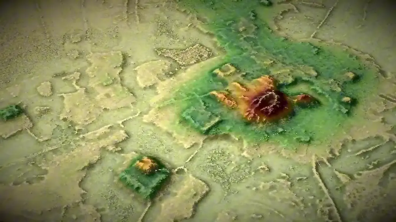
The Amazon rainforest covers about 5.5 million km², roughly 40% of South America. LiDAR surveys have uncovered extensive pre-Columbian, low-density settlement networks in Ecuador’s Upano Valley and Bolivia’s Amazon lowlands, including roads, raised platforms, mounds, reservoirs, agricultural features and geometric earthworks.
The video argues that some mapped settlements could have held more than one million people, comparable to Rome. That is the presenter’s interpretation; the published LiDAR research does not establish that population estimate. Orellana’s 1541 account of Amazonian settlements provides historical context, not proof of a million-person metropolis. 🏛️🌿
Sources
Huge network of ancient cities uncovered in the Amazon rainforestcnn.comArchaeologists working deep in the Amazon rainforest have discovered an extensive network of cities dating back 2500 years.
The hidden ancient mega-cities of the Amazon are finally revealing ...sciencefocus.comBy doing an airborne lidar scan, they discovered a network of connected settlements in the area, made up of larger cities and smaller towns with ...
Laser mapping reveals oldest Amazonian cities, built 2500 years agoscience.orgA dense network of interconnected cities, now hidden beneath the forest in Ecuador's Upano Valley, has been revealed by the laser mapping technology called ...
A Lost Civilization Under the Rainforest? LiDAR Is Rewriting ...m.economictimes.comNow, laser scanning shows large settlements, roads, and farming systems. These discoveries prove that complex societies thrived in the Amazon ...
Lost Cities of the Amazon Discovered From the Airsmithsonianmag.comMapping technology cut through the canopy to detect sprawling urban structures in Bolivia that suggest sophisticated cultures once existed.
Over 20000 precolonial earthworks in the Southwest ...nature.comby M Pärssinen · 2026 · Cited by 7 — Here we used canopy-penetrating LiDAR data over 4,430 km of flight. LiDAR reveals pre-Hispanic low-density urbanism in the Bolivian Amazon. ...
Odd shapes hidden in dense Amazon rainforest reveal ...science.orgNow, using a laser-based form of radar known as lidar, researchers suggest ancient Amazonians were widespread in territories previously ...
Lidar reveals pre-Hispanic low-density urbanism in the ...nature.comby H Prümers · 2022 · Cited by 244 — In the Amazon lowlands, lidar was first used for archaeological prospection in the Iténez/Guaporé region as part of the 2011 German–Bolivian ...
AI-generated text · images from the original sources · always verify with the sources.