 ANCIENT NERDS
Submerged Sites Between Geology and Pseudoarchaeology
The paper argues that prominent claims of ancient human construction at submerged sites like the Yonaguni Monument, Gulf of Khambhat, and Bimini Road lack credible evidence, with natural geological processes — bedding-plane jointing, tectonic fracturing, and coastal erosion — adequately explaining the geometric features, and no definitive human artifacts having been recovered through controlled excavation. It categorizes the debate into well-documented baselines, plausible-but-uncertain interpretations, and speculative fringe claims, concluding that pseudoarchaeological assertions about lost civilizations tied to these formations are not supported by the geological and archaeological record.
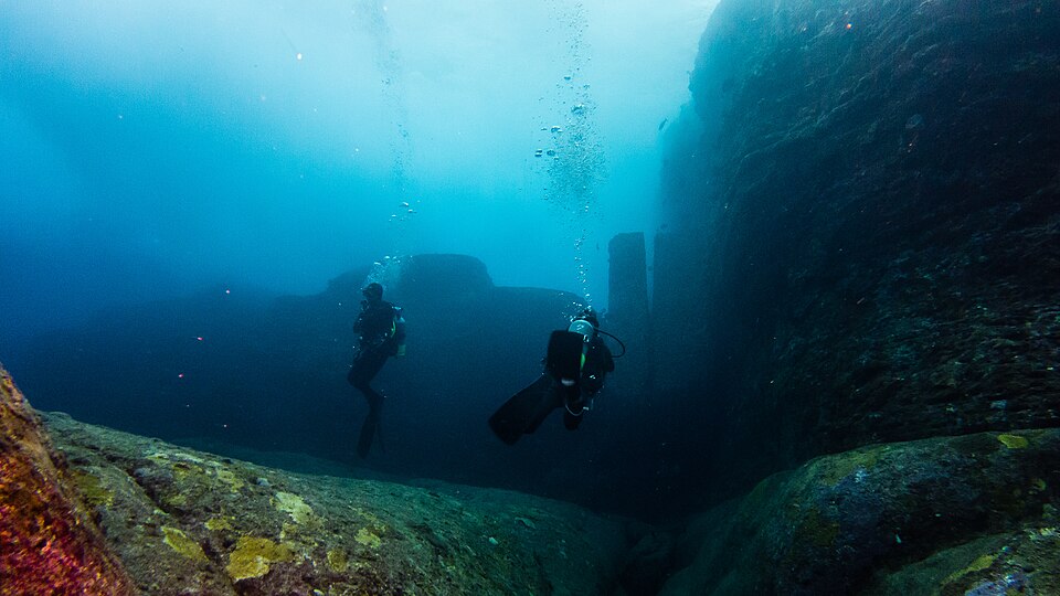
In 1986, a diving tour operator named Kihachiro Aratake was scouting hammerhead shark dive sites off the southern coast of Yonaguni Island when he descended past a series of step-like sandstone formations lying just beneath the surface. The structure measured roughly 100 meters long, 60 meters wide, and rose 25 meters from the seafloor. Within a few years, University of the Ryukyus marine geologist Masaaki Kimura began arguing that the formations were man-made, identifying stepped monoliths, terraces, a triumphal arch, temples, a stadium, roads, and water channels carved into the rock. Boston University geologist Robert M. Schoch examined the same formation and concluded that more than 95 percent of it was natural, with the apparent steps produced by bedding-plane jointing and tectonic fracturing in Lower Miocene sandstones deposited roughly 20 million years ago. Neither Japan’s Agency for Cultural Affairs nor the government of Okinawa Prefecture recognizes the site as cultural property, and no definitive human artifacts have ever been recovered from the seafloor. [1] [2] [3]
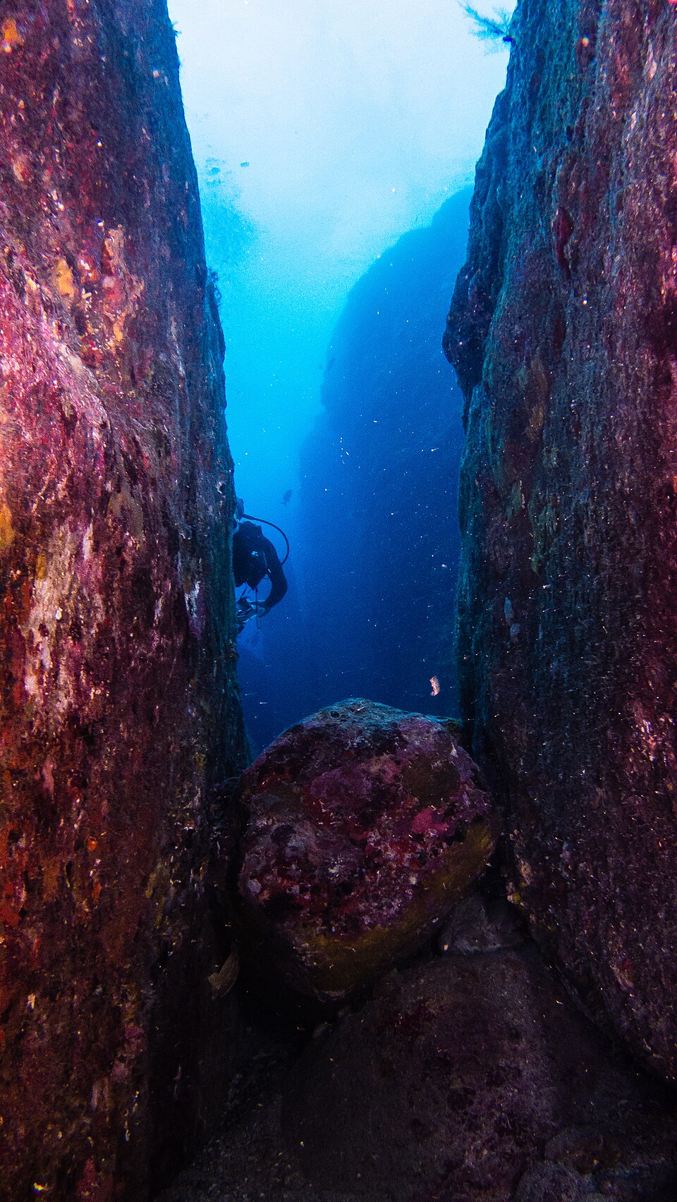
Illustration: Yonaguni Monument DSC02806. Photo: Vincent Lou from Shanghai, China / Wikimedia Commons. DSC02806. Source
Yonaguni Monument DSC02814. Photo: Vincent Lou from Shanghai, China / Wikimedia Commons. DSC02814. Source

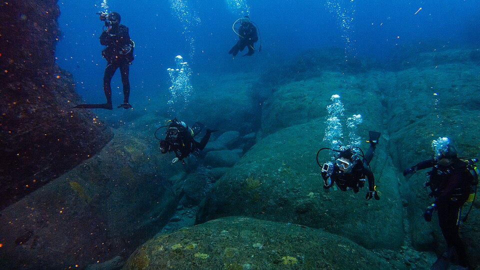
Yonaguni Monument DSC02807. Photo: Vincent Lou from Shanghai, China / Wikimedia Commons. DSC02807. Source

Sevier River Formation (Miocene; Joe Lott Creek Canyon, Tushar Mountains, Utah, USA) 52. Photo: James St. John / Wikimedia Commons. Source
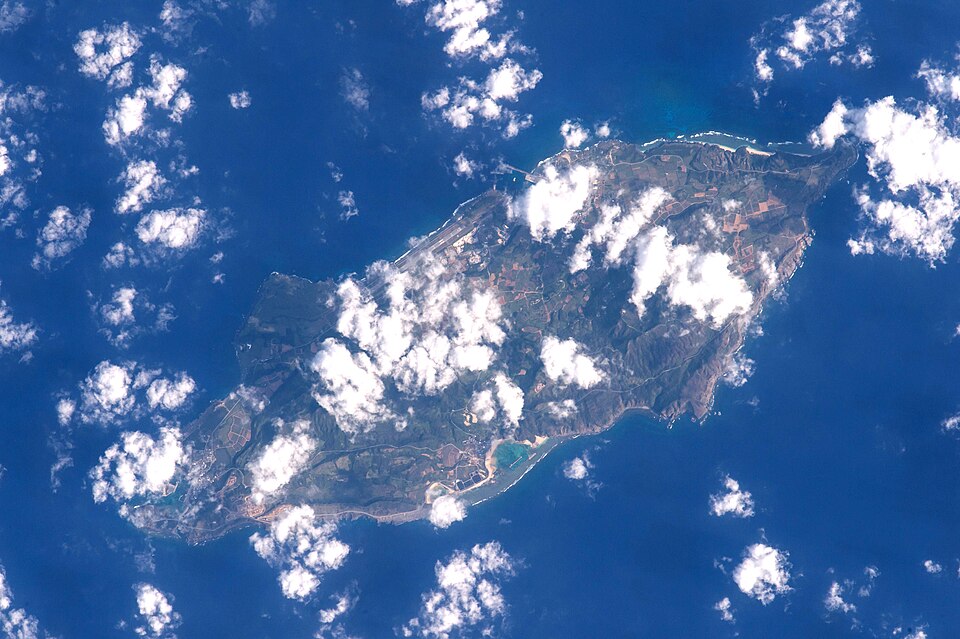
Illustration: Yonaguni Island ISS045. Photo: Image Science and Analysis Laboratory, NASA-Johnson Space Center. “The Gateway to Astronaut Photography of Earth.” / Wikimedia Commons. Yonaguni Island, located in Okinawa Prefecture, Japan. Source
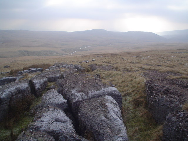
Illustration: Coarse sandstone beds dipping southwards - geograph.org.uk - 1096728. Photo: Nic Howes / Wikimedia Commons. Source
In December 2000, India’s National Institute of Ocean Technology ran side-scan sonar surveys across the Gulf of Khambhat and detected geometric patterns that investigators described as “unnatural features” for a marine environment. When dredging later pulled up a piece of wood radiocarbon dated to approximately 7500 BC, prominent archaeologists rejected the date as significant because the artifacts had been recovered by dredging rather than controlled excavation, and the wood’s stratigraphic relationship to the sonar patterns could not be established. [4]

Illustration: Harsh Vardhan unveiled the Remote-Controlled Polar vehicle “India’s capabilities on monsoon prediction substantially enhanced”, at the National Institute of Ocean Technology (NIOT), in Chennai. The Secretary. Photo: Ministry of Earth Sciences / Wikimedia Commons. Source
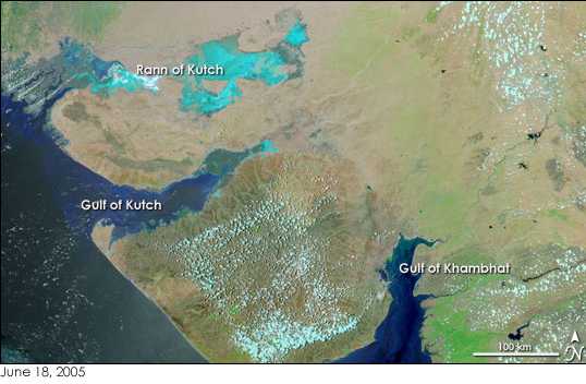
Gujarat Gulfs. Photo: Wikimedia Commons. Source
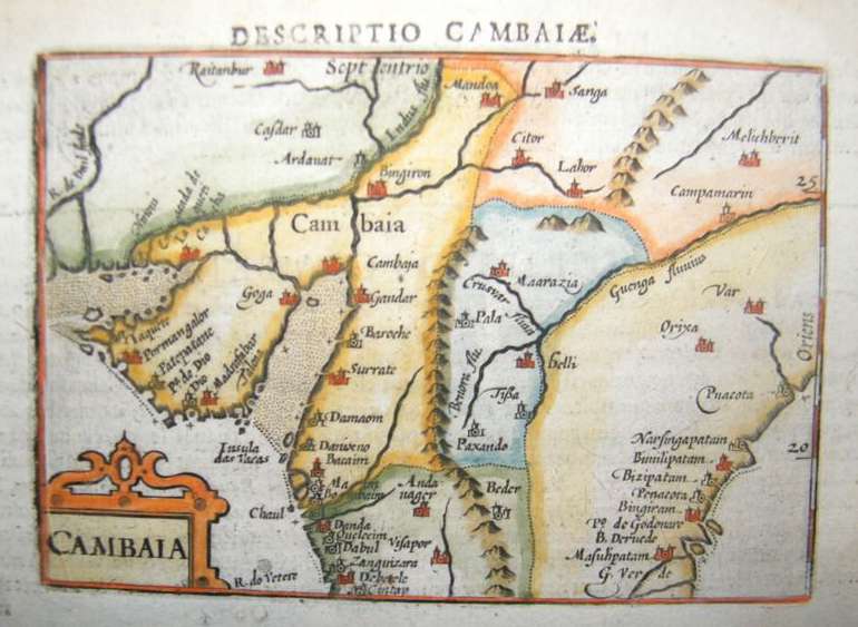
Map of Gulf of Cambay, A map by Petrus Bertius, Amsterdam, 1606. Photo: Petrus Bertius / Wikimedia Commons. A map of Gujarat by Petrus Bertius, Amsterdam. Source
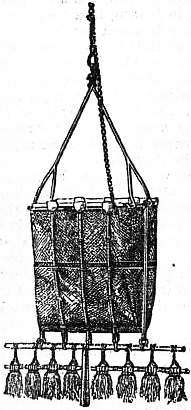
Illustration: Britannica Dredge and Dredging 15. Photo: Encyclopædia Britannica, Volume 8, Slice 7., available freely at Project Gutenberg / Wikimedia Commons. Deep-sea Dredge, with Tangle Bar. Source
Yonaguni: The Sandstone Steps Beneath Japan
Dive operator Kihachiro Aratake was hunting for hammerhead shark observation sites off the south coast of Yonaguni Island in 1986 when he reported a submerged structure that has since become Japan’s most contested piece of bedrock. The main rectangular formation, known as the Yonaguni Monument, measures roughly 100 m long by 60 m wide and rises about 25 m from the seabed, with its top terrace lying between 5 and 16 ft below the surface. The rock itself is unremarkable geologically: it is Lower Miocene Yaeyama Group sandstone and mudstone deposited approximately 20 million years ago, connected to the underlying bedrock rather than assembled from free-standing blocks. The 20-million-year figure is the geological age of the substrate — not any claimed construction date — and the same lithology outcrops on Yonaguni Island itself, well above the waterline. [5]
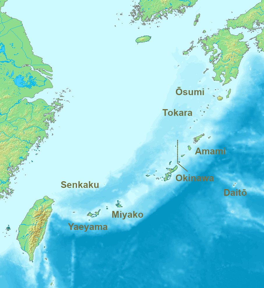
Illustration: Location Ryukyu Islands. Photo: Nanshu, Michiel1972 / Wikimedia Commons. Source
Masaaki Kimura, a marine geologist at the University of the Ryukyus, has spent more than 15 years measuring and mapping the formation, and he insists the site is a man-made complex of stepped monoliths. His catalog of features he interprets as artificial includes a stepped pyramid, a castle, a triumphal arch, five temples, a stadium, roads, canals, retaining walls, quarry marks, animal sculptures, and what he calls an ‘underwater sphinx’. Kimura’s chronology has shifted twice. He initially placed construction at or before 8,000 BCE — when the site would have stood above water — but at the 2007 Pacific Science Congress he revised the age to 2,000–3,000 years, invoking tectonic subsidence rather than post-glacial sea-level rise as the mechanism that submerged the structure. [6] [7]

Yonaguni Monument Arch. Photo: Melkov / Wikimedia Commons. The ‘triumphal arch’ is a specific named feature in Kimura’s catalog and a strong test…. Source
Robert M. Schoch of Boston University, who has dived the site personally, reaches a different conclusion. He estimates the formation is over 95% natural, produced by well-defined bedding planes and orthogonal jointing in sandstone that fracture along straight lines. But here’s the part that troubles Kimura’s reading: geometrically similar stepped and rectangular fracturing appears above sea level along Yonaguni’s own northeast coast, in surface outcrops untouched by any ancient engineers. Both sides actually agree on the underlying mechanism — the bedrock naturally produces step-like geometry through bedding-plane jointing and tectonic fracturing in the seismically active Ryukyu arc. The dispute is over whether humans did anything on top of that natural template. Schoch allows that prehistoric inhabitants may have ‘touched up’ portions and mimicked the natural step-like features in now-visible rock-cut tombs on the island, but he rejects the artificial-origin reading overall. One Japanese seismologist, Toru Ouchi of Kobe University, has sided with Kimura after his own dives, dissenting from the natural-formation consensus — a reminder that the dispute is active rather than closed. [8] [6] [9]
The ‘steps’ identified on the structure sit several feet apart vertically — far too widely spaced to function as walkable human stairs, which is structurally inconsistent with any practical monumental construction. Kimura himself acknowledges that pottery and wood do not survive on the seafloor, and despite nearly 40 years of diving and multiple scientific expeditions, no diagnostic cultural artifacts — no inscriptions, no mortar, no worked tools in situ, no ceramic, no worked columns — have ever been recovered from the submerged structure. Neither Japan’s Agency for Cultural Affairs nor the Okinawa prefectural government recognizes the Yonaguni Monument as cultural property, and neither agency has conducted research or preservation work at the site. [10]
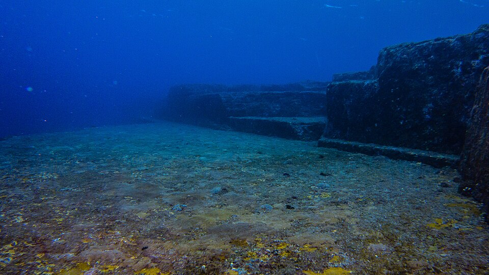
Yonaguni Monument DSC02829. Photo: Vincent Lou from Shanghai, China / Wikimedia Commons. DSC02829. Source
The combination of missing artifacts and dramatic visual geometry has made Yonaguni a fixture of pseudoarchaeological literature. Kimura himself hypothesizes the site may be a remnant of the mythical lost continent of Mu, and his structural identifications — castle, triumphal arch, stadium, temples — have been adopted without independent peer-reviewed corroboration by popularizers including Graham Hancock’s Netflix series Ancient Apocalypse. The Mu hypothesis has no accepted historical backing; it derives from 19th-century mistranslations and occult literature, not from geology or archaeology, and mainstream encyclopedic sources explicitly classify Kimura’s man-made-construction reading as pseudoarchaeological. Kimura cites only one historical event in support of submergence — the April 1771 Yaeyama tsunami, with a reported run-up over 131 ft — but that event is documented, not prehistoric, and provides no evidence for artificial construction. Forty years of diving, documentaries, and scientific expeditions have failed to recover a single diagnostic artifact from the submerged structure itself — and that absence is precisely what has allowed the Yonaguni story to anchor Japan’s version of the global pseudoarchaeological Atlantis circuit. [6]
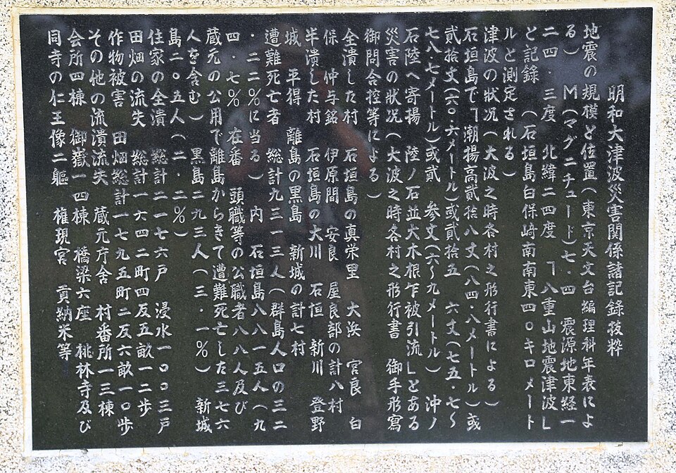
明和大津波災害記録の石碑. Photo: Yononakanokasa / Wikimedia Commons. Text inscription excerpted from the record of the Meiwa Tsunami. Source
Gulf of Khambhat: Sonar Anomalies and a Dredged Log
In December 2000, a side-scan sonar survey by India’s National Institute of Ocean Technology (NIOT) operating in the Gulf of Khambhat detected a series of geometric patterns on the seafloor approximately 20 km west of Hazira, at water depths of 20–40 m — patterns described in the original peer-reviewed publication as “very unusual in the marine domain”. The official institutional response was swift: on 19 May 2001, the Indian government announced the discovery as a “major archaeological discovery”. A follow-up NIOT campaign in November 2001 used dredging rather than controlled excavation to recover material from the seafloor. The dredge recovery yielded stone artefacts, potsherds, hearth pieces, animal bones, and human teeth embedded in fluvial sands and silts, along with a carbonised wooden log radiocarbon-dated to approximately 9500 years BP (~7500 BC). A marine magnetic survey at the same site detected no major metallic debris — a finding that further complicated the “lost city” interpretation. [11]
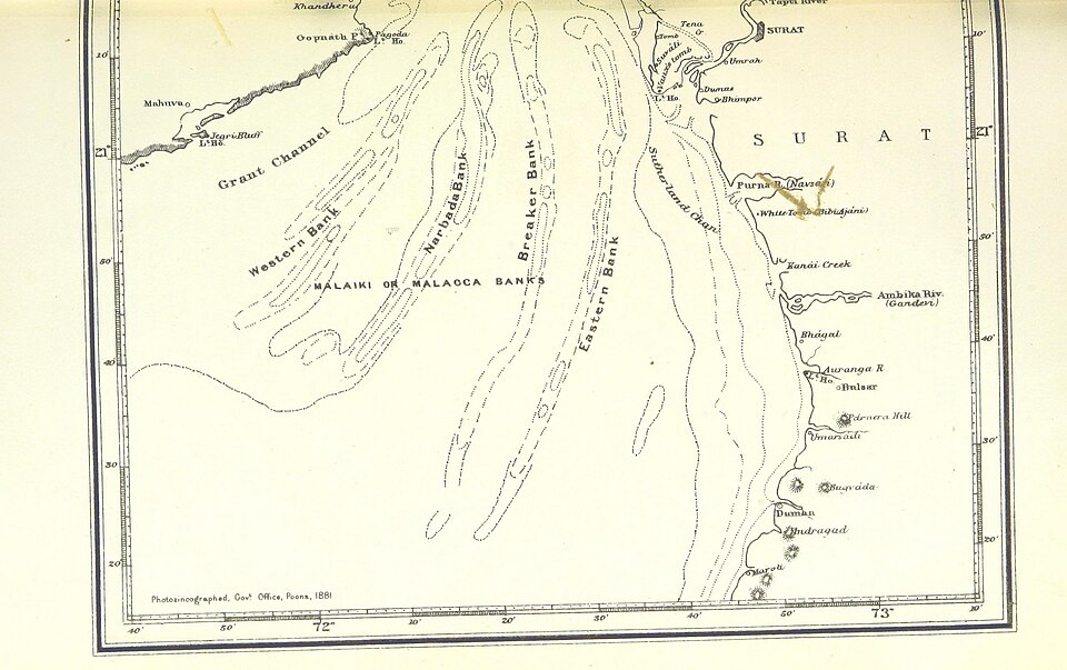
Illustration: Gulf of Cambay (South part) 1896. Photo: The British Library / Wikimedia Commons. Gulf of Cambay (South part) 1896. Source
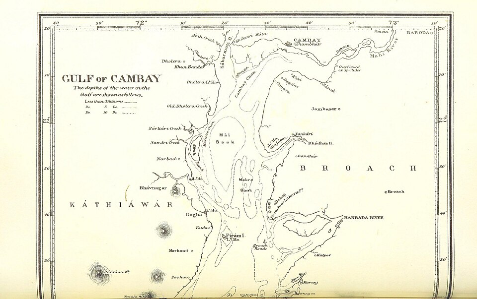
Gulf of Cambay (North part) 1896. Photo: The British Library / Wikimedia Commons. Gulf of Cambay (North part) 1896. Source
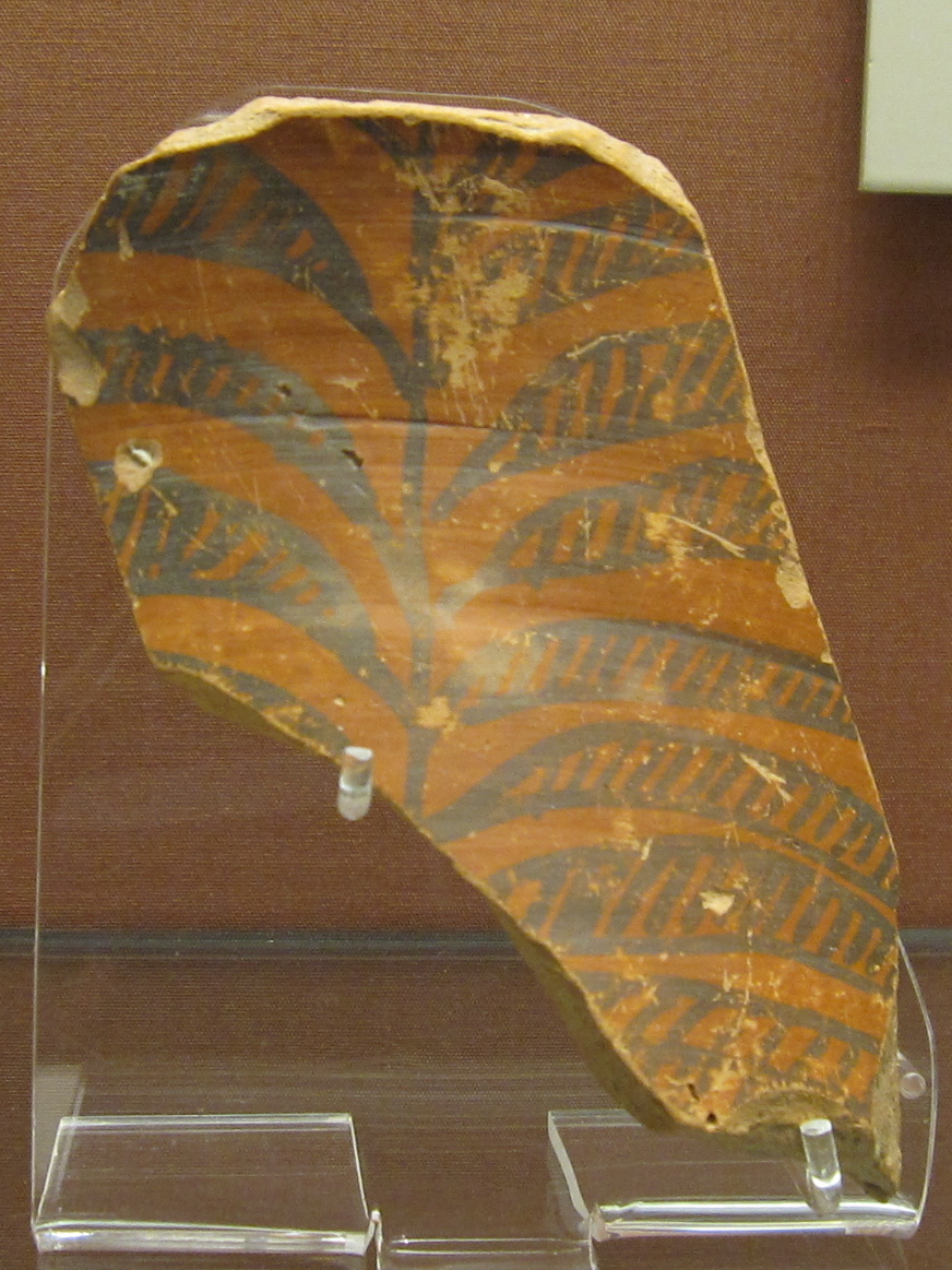
Illustration: British Museum Asia 24. Photo: Gryffindor / Wikimedia Commons. Source
The November 2001 NIOT campaign used dredging rather than controlled excavation — and that single methodological choice became the central objection. Mainstream archaeologists pointed out that the recovery method scraped the seafloor and brought up whatever lay in its path, with no way to establish the depth, layer, or structural relationship between any recovered object and the sonar anomalies. The 7500 BC wood date, although striking, could not be securely tied to the alleged structures: the piece of wood might have been transported by ancient river flow long before any putative settlement existed, or might have come from older sediments reworked onto the seafloor. The lithic material itself remains contested — thin-section petrography by Kathiroli (2003) in the journal Episodes found well-rounded goethite grains constituting approximately 25% of the analysed material, a texture consistent with natural water-transport sedimentary processes rather than deliberate knapping. No chaîne opératoire, use-wear, or residue analysis has been published to demonstrate the recovered stones are humanly modified tools. [12]
The Gulf of Khambhat is a funnel-shaped embayment with the highest tidal range in India (~11 m), feeding chronically turbid waters carrying heavy sediment loads from the Narmada, Tapi, Mahi, and Sabarmati rivers. In this freshwater-fed estuarine environment, the freshwater reservoir effect can produce age offsets of up to ~2,000 14C years within a single river — and the marine reservoir effect adds roughly 400 years. Any 14C date on waterlogged wood or shells from an estuarine context must be independently corroborated before it can be used to date human occupation. The harbour itself is a hostile environment: maximum depths are only ~30 m near the Arabian Sea mouth, narrowing to ~10 m in the north, with massive Holocene sediment input that buries and reworks surface materials. Sea-level reconstructions place features at 36 m depth at roughly 10–9 kyr BP — corresponding to the early Holocene marine transgression, not to a recent catastrophic submergence.
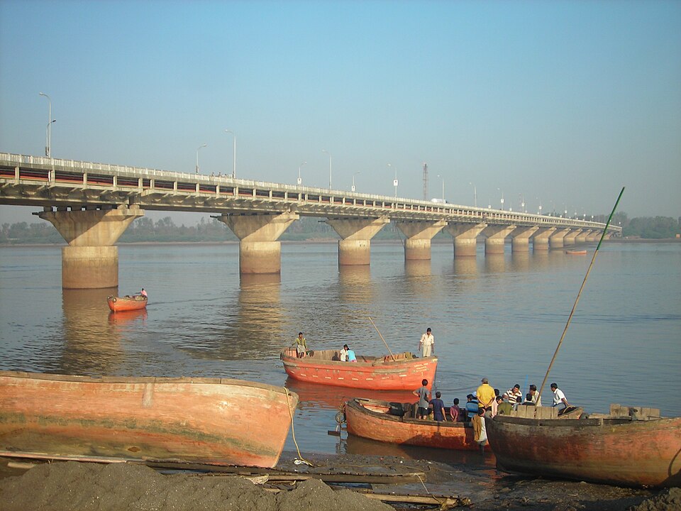
Illustration: ONGCbridge. Photo: Urva222 / Wikimedia Commons. ONGC Bridge, Over Tapi River. Source
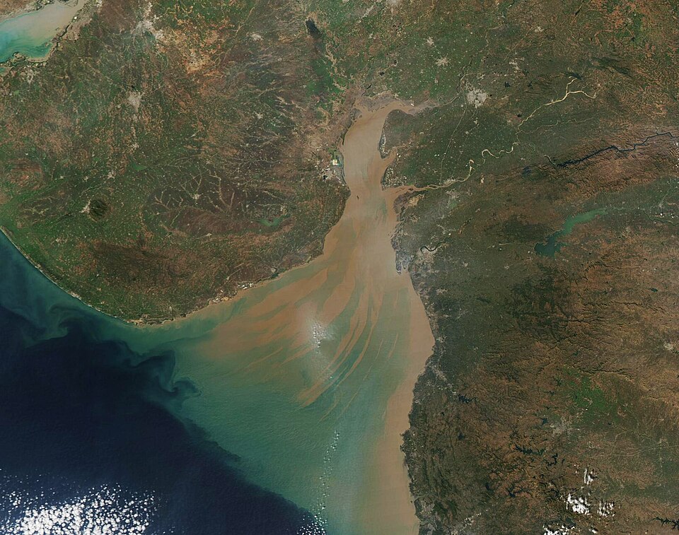
Streaks of Sediment in the Gulf of Khambhat (MODIS 2022-01-11). Photo: MODIS Land Rapid Response Team, NASA GSFC / Wikimedia Commons. Shows the northernmost river input to the gulf, the one that feeds the shallow 10…. Source
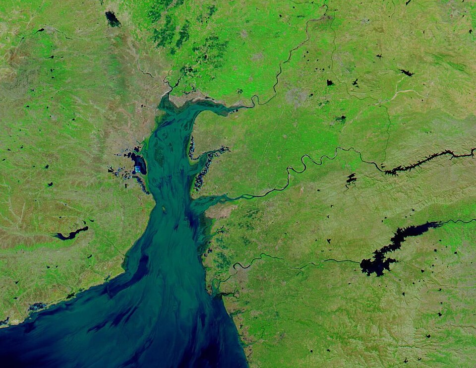
Gulf of Khambhat (MODIS). Photo: MODIS Land Rapid Response Team, NASA GSFC / Wikimedia Commons. Shows the northernmost river input to the gulf, the one that feeds the shallow 10…. Source
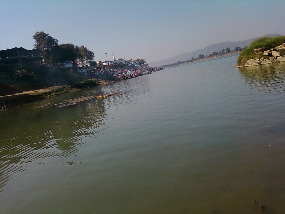
Illustration: Narmada river (M.P.) india. Photo: Abhirock123 / Wikimedia Commons. its a river of middle India.its a river which does not make estuary. Source
Harappan/Indus-tradition sites along the Gujarat coast — Lothal, Kuntasi, Padri, Nageshwar, Bet Dwarka, and Bagasra — date to the early to mid-3rd millennium BC, with stone anchors recovered from inter-tidal zones along the Gulf of Khambhat and Gulf of Kachchh. India’s CSIR-National Institute of Oceanography has run a formal Centre for Marine Archaeology since 1981, documenting numerous ancient ports, jetties, and shipwrecks as an accepted baseline of maritime cultural heritage. The Periplus of the Erythraean Sea and the Vishnu Purana both reference the Gulf of Khambhat’s tidal range — a region long known to seafarers, not a stranger to maritime history. Within the Gulf of Khambhat itself, two palaeochannels of former river courses were identified at 20–40 m water depth, approximately 20 km offshore — real drowned landscape features, independent of any “city” interpretation. Geologists have suggested that at least some of the geometric sonar patterns could be iron-oxide concretions or silty sandstone formations produced by mineral precipitation in ancient lakebeds. The presence of mud volcanoes, pockmarks, and hydrocarbon seeps in the gulf adds further plausible natural mechanisms for acoustic anomalies. [13] [14]
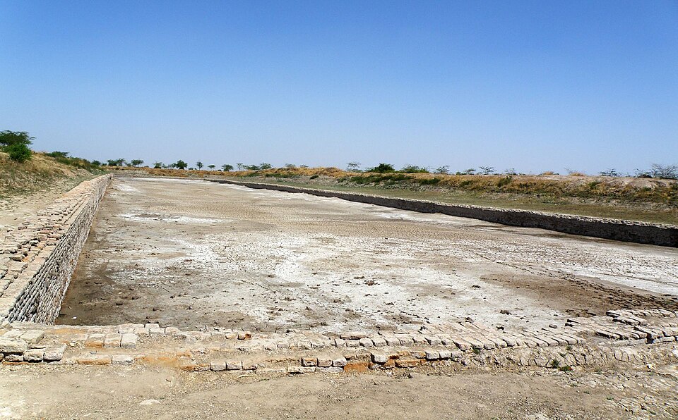
Lothal Dockyard. Photo: Raveesh Vyas / Wikimedia Commons. Source
More than two decades after the initial NIOT survey, the core problem remains unchanged: no controlled excavation has been conducted at the site, and the academic literature continues to treat the anthropogenic origin of the larger “city-like” structures as unproven. The “lost civilization” interpretation has been amplified in popular media, including a 2002 BBC report and Graham Hancock’s writings, but mainstream archaeological opinion cites sonar misinterpretation, carbon-dating errors, and contextual problems with dredged artefacts. The submerged landscape is real. The 7500 BC wood is real. Whether either connects to a pre-Harappan urban settlement remains undemonstrated. [15] [16] [4] [17]
Bimini Road: Beachrock or Ancient Pavement?
On September 2, 1968, divers J. Manson Valentine, Robert Angove, and Jacques Mayol descended into roughly 5.5 meters of water off the northwest coast of North Bimini and reported a 0.8-kilometer linear arrangement of rectangular limestone blocks oriented northeast-southwest, with a hook at its southwest end. Within months, the feature was being called a “road” and linked to Atlantis. Yet the rocks themselves are not masonry. They are beachrock — a natural sedimentary rock formed in the intertidal zone when carbonate-supersaturated seawater cements sand, shell hash, and coral fragments beneath the beach surface. Eugene Shinn, a USGS sedimentologist, demonstrated that beachrock was actively forming at Bimini in the modern ocean, with calcium-rich seawater cementing sand quickly enough to trap glass shards and bottle caps in the rock matrix. The blocks are rounded and cushion-like, not tool-cut; their high degree of erosion makes it “highly implausible that any original surface features, including any tool marks and inscriptions, would have survived”. This is the fundamental starting point: Bimini Road is made of natural beachrock, the kind of which forms routinely across the Bahamas and worldwide. [18]
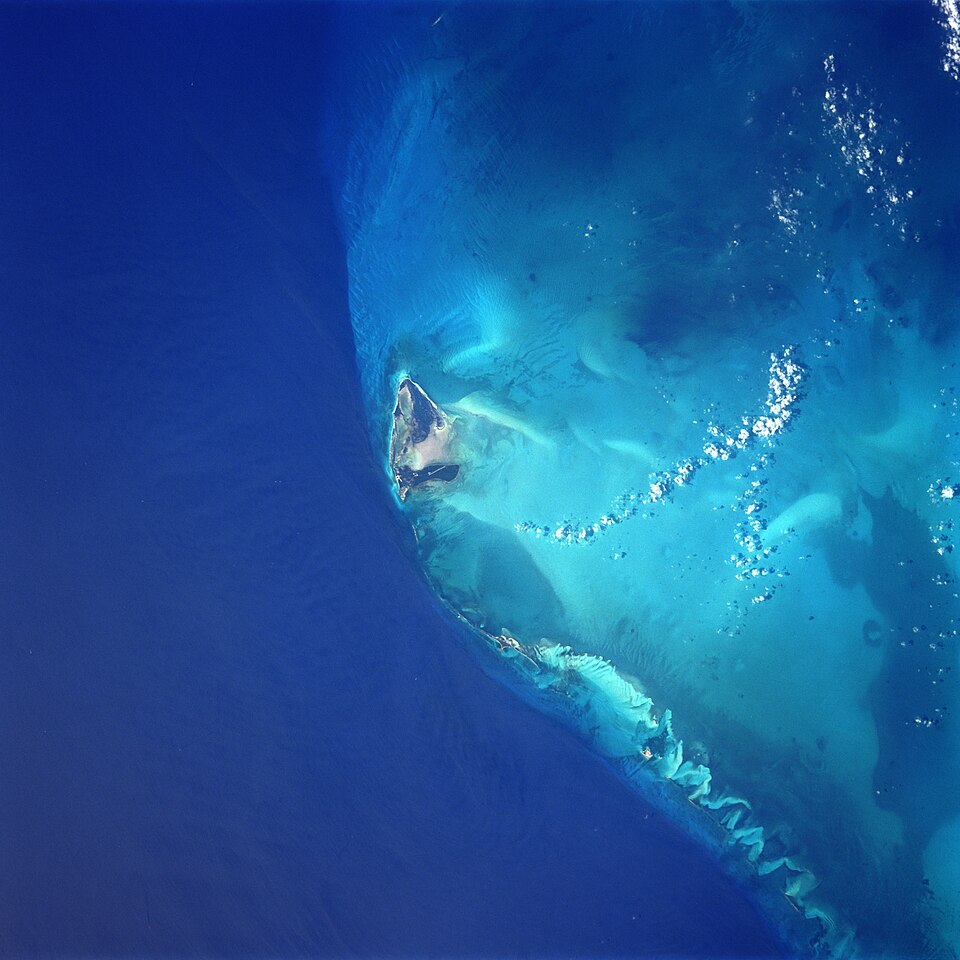
Illustration: Bimini island. Photo: Original picture by NASA / Wikimedia Commons. Source
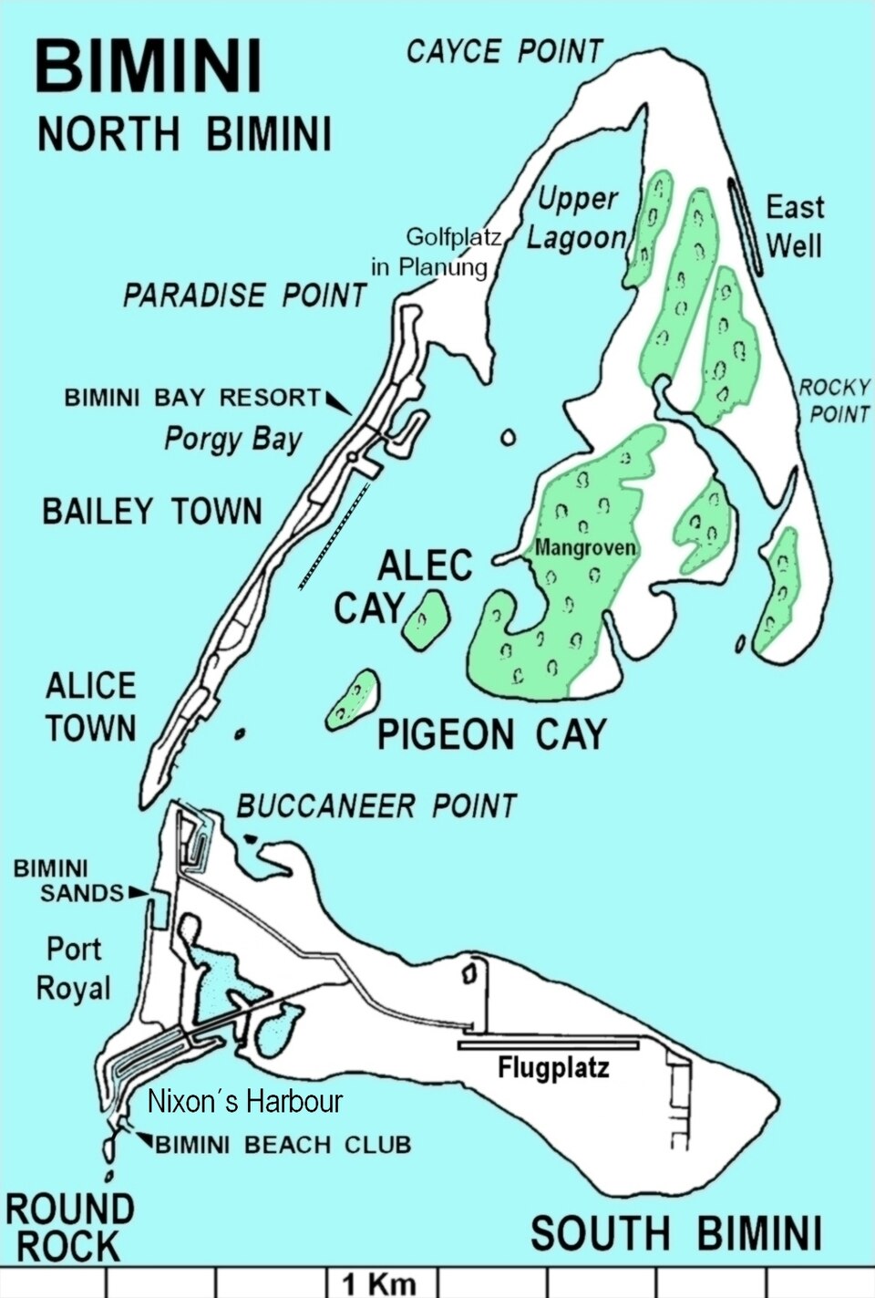
Illustration: Bimini-N S. Photo: Joachim Greiner / Wikimedia Commons. Karte von North Bimini. Source
The radiocarbon evidence reinforces the natural origin. A core collected by Shinn in 1977 and dated at the University of Miami in 1978 returned whole-rock ages of 2,780±70, 3,500±80, and 3,350±90 BP, with shells at 3,510±70 BP and carbonate cement at 2,770±80 and 2,840±70 BP — the shells older than the cement that binds them, internally consistent with sediments accumulating first and being cemented later. Davaud and Strasser concluded that the beachrock layer formed beneath the surface of North Bimini Island and was only exposed by coastal erosion approximately 1,900–2,000 years ago. Gifford and Ball’s 1980 direct examination produced eight specific observations weighing against an anthropogenic interpretation: the three linear features are unconnected at the southwest end; no second course of blocks exists anywhere; insufficient blocks remain to have formed a destroyed second course; bedrock closely underlies the entire area; no regular or symmetrical supports were observed beneath any block; no regular or repeated grooves interpretable as tool marks were present; and the seaward feature is not continuous enough to have served as a thoroughfare. A uranium-thorium date of 14,992±258 BP from underlying marine limestone, sometimes cited as evidence of great antiquity, is scientifically invalid for two independent reasons: the sample was partially recrystallized and therefore not a closed system, and at roughly 15,000 years ago sea level stood 95–100 meters below present, meaning the sampling locality was 90–95 meters above sea level when that carbonate supposedly accumulated. The geological verdict is not contested at the level of evidence — it is contested only in popular and fringe forums. [19]
The Atlantis identification faces a second, independent line of problems. Plato’s Timaeus and Critias place the destruction of Atlantis roughly 9,000 years before his own time (around 9,600 BCE) and locate it beyond the “Pillars of Hercules” in the Atlantic — the Strait of Gibraltar, not the Bahamas. The Cayce connection, meanwhile, is a documented psychic prediction: in 1938, the American mystic Edgar Cayce stated that “a portion of the temples may yet be discovered, under the slime of ages and sea water near Bimini… Expect it in ‘68 or ‘69” — thirty years before the discovery. This prediction is the sole historical basis for the Atlantis reading; the geological dates place the exposed beachrock surface at roughly 2,800 years ago, almost seven thousand years after Plato’s chronology demands. The geographic mismatch and chronological mismatch are both fatal on their own; together they leave the Cayce prophecy as the only thread holding the identification together. [20] [21] [22]
The peer-reviewed methodology for distinguishing natural from anthropogenic submerged features, articulated by Galili and colleagues in 2024, requires geological context, sea-level considerations, associated archaeological finds (including coastal survey), broader archaeological context, and direct visual assessment by an underwater archaeologist. When applied to Bimini Road, the criteria fail almost uniformly. There are no artifacts, no inscriptions, no pottery, no burials, no quarry marks, no settlement layers, and no wheel ruts — none of the diagnostic material culture expected from built architecture. The blocks rest directly on bedrock or loose sand rather than on excavated foundations, and the linear geometry follows a former intertidal spit rather than a constructed thoroughfare. The Galili framework explicitly warns that remote sensing alone is insufficient and that direct visual assessment is required — a warning that the original popularizers of the Atlantis interpretation, working from a 1968 diver’s report and a 1938 psychic prediction, never observed. [23] [24]
The deeper methodological pattern is more telling than any single test. The “New Atlantis” framework associated with Cayce, and later popularized by writers like Graham Hancock, has been characterized in academic critique as a form of historical creationism — selecting evidence that confirms the desired conclusion (a single 1938 prophecy, the linear shape of an eroding beachrock exposure, Plato’s literary description of a fictional island) while ignoring the geological dating, the field observations of trained geologists, the absence of any cultural material, and the basic geography of Plato’s own account. When a 1938 prophecy made three decades before any feature existed is cited as confirmation, while a 1978 radiocarbon study showing 2,800-year-old beachrock cement is dismissed, the asymmetry is the methodology. Bimini Road is a textbook case of how a feature with a documented natural origin — exposed by ordinary coastal erosion of an intertidal cementation surface — gets recruited into a lost-civilization narrative built on prior belief. The geological evidence resolves the question; the framework simply refuses to update. [25] [20] [26]
Doggerland: The Benchmark of Submerged-Landscape Science
The trawler Colinda’s recovery of a barbed antler harpoon from the Leman and Ower Banks in September 1931, embedded in a lump of moorlog roughly 36 metres below modern sea level, was the first tangible archaeological evidence of human occupation of what is now the southern North Sea bed. Skipper Pilgrim E. Lockwood’s catch was initially reported in 1932, and subsequent pollen analysis of the surrounding peat confirmed a freshwater, terrestrial depositional environment, demonstrating that the point had been lost on dry land rather than dropped at sea. That single artefact has since been joined by more than 200 radiocarbon-dated palaeozoological and archaeological fossil bone samples from the North Sea bed, with roughly two-thirds Pleistocene in age and one-third Holocene, providing a sustained baseline of organic material against which the drowned landscape’s chronology can be measured. When AMS techniques eventually re-dated the Colinda harpoon (OxA-1950) to 11,740 ± 150 BP, calibrating to roughly 13,800–13,400 cal BP, the find stopped being a curiosity and became a Late Glacial anchor for an entire submerged territory. [27] [28]
The scale of Doggerland research expanded dramatically in 2007 when the North Sea Palaeolandscapes Project, funded by the UK Aggregates Levy Sustainability Fund and led by Vincent Gaffney at the University of Bradford, used 3D seismic-reflection data originally acquired for oil and gas exploration to map approximately 23,000 km² of the British sector. That footprint grew further under the ERC-funded “Europe’s Lost Frontiers” project (grant 670518, 2015–2020), which integrated seismic survey, vibrocoring, marine magnetometry and sedaDNA analysis across the Southern River palaeo-channel system. Sediment core ELF019, recovered under that programme, documented the environmental transition from freshwater silts through terrestrial organic deposits to marine clay, with the freshwater-to-marine transition radiocarbon-dated to 10,243–10,199 cal BP, anchoring the drowning sequence to the Greenlandian stage of the Lower Holocene. A 2026 PNAS sedaDNA study led by the University of Warwick then detected temperate woodland taxa — oak, elm, hazel, and the warmth-preferring Tilia — in southern Doggerland more than 16,000 years ago, with lime appearing roughly 2,000 years earlier than on the British mainland, and with Pterocarya DNA suggesting the genus survived as a relic population well into the last glaciation. The same study reported that parts of the landscape persisted above water as late as ~7,000 years ago, substantially later than older sea-level models predicted. [29] [30]
The Storegga tsunami debate exemplifies how Doggerland research has moved beyond assertion into multi-proxy resolution. The submarine landslide off Norway around 8,150 BP / 8,200 cal BP released a total sediment volume of approximately 5,600 km³, of which about 1,700 km³ moved as an underwater failure, generating tsunami deposits recorded across more than 600 km of North Atlantic coastline with run-up heights of 25–30 m on parts of Shetland. Weninger et al. (2008, Documenta Praehistorica 35, 1–24) argued for a precise calendric date and framed the tsunami as the catastrophic final flooding of Doggerland, while Hill et al. (2017) modelled the wave overrunning the remaining islands. The 2020 Gaffney et al. multi-proxy characterisation of vibrocore ELF001A from the Outer Dowsing Deep provided the first direct physical evidence of Storegga deposits in the southern North Sea, but the authors concluded that the tsunami’s impact was “temporary and likely localized and mitigated by the dense woodland and topography of the area,” with clear physical remnants restricted to inland basins and incised river valleys. Walker et al. (2020, Antiquity 94, 1409–1425) reached a parallel conclusion from a neighbouring core: environmental DNA recorded bear, wild boar and ruminants on an oak–hazel meadowland the wave crossed, but no direct evidence of human occupation in the cored transect, undermining the catastrophist interpretation. The disagreement has since hardened into a methodological question — Griffiths & Wicks (2024) frame it as a taphonomic recovery-rate problem, arguing that the archaeological invisibility of the tsunami is partly an artefact of how little has actually been cored. [31] [32]
What distinguishes Doggerland from the other candidates in this comparison is the steady accumulation of peer-reviewed evidence rather than a single headline find. Brown Bank, roughly 85 km off the Dutch coast, has been surveyed with simultaneous high-resolution (0.5–1 m) and ultra-high-resolution (10–20 cm) seismic, vibrocoring and dredging to recover Mesolithic artefacts within their preserved landscape context. The Wessex Archaeology campaign for Vattenfall’s Norfolk Boreas offshore wind farm delivered what the team described as the most complete and extensive set of sediment cores ever extracted from the southern North Sea, covering approximately 85 km² of mapped peat deposits and providing a near-continuous environmental record of roughly 3,500 years. ZooMS analysis of more than 1,000 barbed and unbarbed osseous points from the Dutch sector has now distinguished birch-tar-hafted projectile tips from hide-perforators and recovered human-bone points alongside red-deer points, with direct 14C ages of 9.5–7.3 ka BP — a documented functional repertoire, even if no monumental architecture has emerged. Fringe and Atlantis-advocate sources do attempt to equate Doggerland with Plato’s lost island, citing Plato’s reported plain dimensions of ~370 × 550 stadia against a reconstructed Doggerland plateau of ~375 × 560 km and re-translating νῆσος as “peninsula” rather than “island,” but those claims circulate only outside peer-reviewed venues and run directly counter to the published chronologies. The submerged continental shelf is now formally framed by archaeologists and statutory agencies as one of Europe’s largest and best-preserved prehistoric landscapes, with offshore wind development creating both research opportunities and conservation threats, and with the UK’s 18,765 km² Dogger Bank MPA at the centre of ongoing EU Habitats Directive litigation. [33]
Doggerland is the only one of the four sites under consideration where the submerged-landscape literature expands year on year with new primary data. The Yonaguni Monument, Gulf of Khambhat and Bimini Road each remain frozen at their original disputed interpretations, with no independent corroboration of an anthropogenic origin and with mainstream sources still classifying them as natural or unverified. Doggerland, by contrast, is being actively re-dated, re-modelled and re-sampled: a 2025 Nature paper reconstructed global sea-level rise in the Early Holocene from North Sea peats, a 2024 ScienceDirect inundation model pushed significant area loss back to 10.5–10 ka cal BP, and a 2026 PNAS sedaDNA study lengthened the landscape’s habitable window by more than a millennium. The unresolved question is whether the Storegga tsunami’s social signature on Mesolithic communities can ever be extracted from the offshore record — a taphonomic problem, not a research-design problem, and the clearest indicator that Doggerland has moved from speculative survey into operational science. [34]
Connecting the Dots
The Yonaguni Monument occupies a sand-and-mudstone outcrop of Lower Miocene Yaeyama Group rock that naturally erodes along horizontal planes and continues unbroken from the cliffs above the waterline into the submarine structure. Yet marine geologist Masaaki Kimura of the University of the Ryukyus has spent fifteen-plus years mapping what he calls stepped monoliths, while Robert M. Schoch of Boston University concludes the formation is more than 95 percent natural, with any human modification limited to inhabitants mimicking natural step-like features in now-visible rock-cut tombs. The peer-reviewed Galili et al. methodology for distinguishing anthropogenic from natural submerged landscapes requires geological context, sea-level considerations, associated archaeological finds, broader archaeological context, and direct visual assessment by an underwater archaeologist rather than remote sensing alone — when applied to two Sicilian Channel cases, both were reclassified as natural features. Yonaguni fails those tests on multiple counts: no definitive artifacts (Kimura himself acknowledges that “pottery and wood do not last on the bottom of the ocean”), no published tool-mark photographs, and the steps are spaced several feet apart rather than at the roughly eight inches that a human stairway would require. Richard Pearson notes that small-scale Ryukyu communities had no monument-building tradition or surplus capacity, and the wider Ryukyu archaeological record offers no precedent for megalithic construction. [35] [36] [37]
The dating evidence collapses under the same logic that makes Doggerland science possible. Van der Plicht et al. (2016) demonstrate that Mesolithic Doggerland inhabitants had significant freshwater-fish dietary components, producing freshwater reservoir effects on radiocarbon dates that preclude precise calibration to absolute ages. A piece of wood dredged from the Gulf of Khambhat was radiocarbon dated to approximately 7500 BC, but prominent archaeologists reject this date because the wood’s stratigraphic relationship to the sonar features cannot be established — artefacts there were recovered by dredging rather than controlled archaeological excavation, and one popular documentary source identifies the “geometric” sonar features as natural iron-oxide concretions and silty sandstone formations produced by mineral precipitation in ancient lakebeds. Doggerland’s barbed points, hafted with birch tar and animal or vegetal binding, survive because the drowned landscapes were waterlogged and sealed beneath Holocene marine mud, yielding what Aleo et al. describe as “exceptional preservation of organic materials”. The absence of organics at Yonaguni is therefore consistent with what the Doggerland preservation model predicts for an exposed sandstone substrate — but it provides no positive evidence for human activity, only for the absence of preservation. At Bimini, radiocarbon dating of beachrock samples collected by E. A. Shinn in 1977 and processed at the University of Miami yielded whole-rock dates of 2780±70, 3500±80, and 3350±90 BP, with cement dates of 2770±80 and 2840±70 BP — internally consistent with shells being older than the cement that bound them. Davaud and Strasser concluded the beachrock layer composing Bimini Road originally formed beneath North Bimini Island and was exposed by coastal erosion approximately 1,900 to 2,000 years ago, far younger than Plato’s 9,600 BCE date for Atlantis. [4]
Doggerland’s transformation from obscure dredge-finds into a mapped landscape of more than 17,000 square miles required deliberate reframing by Bryony Coles’s 1998 paper “Doggerland: a Speculative Survey” and Vincent Gaffney’s mobilization of petroleum-industry three-dimensional seismic data into a research programme. That same evidentiary chain — geological context, sea-level data, organic preservation, broader regional archaeology — is what the Galili et al. criteria operationalize and what the advocate-driven Yonaguni, Gulf of Khambhat, and Bimini claims consistently bypass. Edgar Cayce’s 1938 prediction that Atlantis would be discovered “near Bimini” in “68 or ‘69” preceded the September 2, 1968 discovery of Bimini Road by J. Manson Valentine, Robert Angove, and Jacques Mayol, and Graham Hancock’s Netflix series Ancient Apocalypse frames the feature as a mysterious underwater megalithic structure that, if man-made, must date to the Ice Age. The persistence of that interpretation despite Shinn’s beachrock demonstration (1978, 2004), Gifford and Ball’s no-tool-marks finding (1980), and the radiocarbon sequence inconsistent with Plato’s date is explained by what Fagan and Hale characterize as the pseudoarchaeological posture of “attorney defending a client” — the same media ecosystem that promotes Yonaguni as a sunken Mu and the Gulf of Khambhat as a lost Hindu civilization, and that even extends, in Jean Deruelle’s largely dismissed hypothesis, to mapping Plato’s “great plain” onto Doggerland itself. Pseudoarchaeology is identified by professional methodologists precisely as the rejection of accepted data-gathering and analytical methods; the petroleum-seismic and AI-assisted “Goldilocks zones” approach now used to target Doggerland geo-archaeological potential exemplifies the systematic methodology that separates submerged-landscape science from the advocate’s case. [38] [39] [40]
The Other Side
The popular framing of these four sites as “lost civilizations” gets its sharpest pushback from mainstream archaeologists and geoscientists, who describe the interpretive leap from sonar anomalies and jointed sandstone to submerged cities as a textbook case of apocalyptic pseudoarchaeology. Critics note that the leap is being actively broadcast — Netflix’s Ancient Apocalypse and Graham Hancock’s framing place Yonaguni, the Gulf of Khambhat, and Bimini Road in a single narrative of post-Ice Age destruction that the Sapiens.org analysis of Hancock’s work calls “pseudoscience” because the evidence does not support the conclusion. The same skeptical literature dismisses the Deruelle identification of Doggerland with Plato’s Atlantis as one of many geographic proposals that share the same defect: a real drowned landscape is being matched to a literary account whose key details (a Bronze-Age empire, a “ditch” dyke) require so much rewiring of either Plato or the archaeology that the identification explains nothing. Even researchers sympathetic to the existence of submerged prehistoric landscapes describe the Atlantis framing as “pseudoarchaeology” because it substitutes a mythic scaffold for the actual Mesolithic evidence of hunter-gatherer communities. [41] [42]
On Yonaguni, Boston University geologist Robert M. Schoch — who has personally dived the Monument — argues the structure is the product of bedding-plane jointing and mass wasting in a sandstone/mudstone sequence, with stepped faces that mirror fracture patterns extending onshore, and he estimates that at most a few percent of the visible features require human input. The mainstream geological reading is reinforced by what is known of Ryukyu prehistory: the Jōmon and early ceramic-period communities who used the island were small-scale forager-fishers with no archaeological signature of monumental construction elsewhere in the chain, making a large megalithic outlier archaeologically implausible. At Bimini, geologist Eugene Shinn’s four-decade study of the site — originally conducted as an Atlantis skeptic — concluded that the “Road” is a naturally cemented beachrock (a Holocene carbonate-cemented foreshore feature) whose straight edges and polygonal blocks are products of shoreline cementation and bioerosion rather than tooling. Corroborating evidence comes from Lucayan archaeology: despite a century of excavation across the Bahamas and Turks and Caicos, there is no tradition of worked-stone construction in Lucayan material culture, only imported celts and shell tools, making a Bahamian megalithic tradition historically impossible at the depth where Bimini Road sits. [43]
For the Gulf of Khambhat (Cambay), the structural setting itself does much of the debunking work: the Gulf is an intracratonic rift basin with documented neotectonic activity along the Narmada–Son lineament, and the “geometric patterns” picked up by the 2000–2002 NIOT side-scan sonar surveys sit inside a setting where natural faulting, gas-charged sediment, and Holocene channel-fill geometries routinely produce rectilinear reflectors that read as artificial on sonar. Independent geophysicists reviewing the same NIOT data noted that the “very unusual” features had not been stratigraphically correlated and could not be distinguished from natural geofacts without drilling in situ rather than the dredge-recovery used to obtain the radiocarbon date, which is precisely what disconnects the radiocarbon result from any built structure. Marine reservoir effects compound the problem: open-ocean and nearshore reservoir offsets in the Indian Ocean are large and locally variable, so a single uncalibrated marine-shell date from a dredged context cannot anchor a chronology of this magnitude. Even on Doggerland — where the submerged landscape itself is uncontested — current work from the Europe’s Lost Frontiers project and successor studies treats it as a Mesolithic hunter-gatherer territory whose vegetation, fauna, and tool assemblages are being read through sedimentary ancient DNA, not as a built environment, and the Storegga tsunami is now widely framed as a perturbation superimposed on Holocene transgression rather than the singular agent that “ended” a vanished continent. Jean Deruelle’s 1999 Atlantis identification has been picked up in the alternative-historical literature but is not engaged with as a serious geomorphological hypothesis by any of the principal Doggerland researchers. [11]
What We Actually Know
The case for significant human presence beneath the waves rests on its strongest evidence yet. Doggerland was a substantial Pleistocene–Holocene landmass connecting Britain to mainland Europe across what is now the southern North Sea, gradually submerged by post-glacial sea-level rise, with central-area final inundation by approximately 5500 BC. The term itself was coined in 1998 by University of Exeter archaeologist Bryony Coles in her paper “Doggerland: a Speculative Survey,” reframing the area as an inhabited territory rather than a mere land bridge. The first direct archaeological evidence, the Colinda harpoon, was dredged in September 1931 from a peat block at the Leman and Ower Banks approximately 25 miles off Norfolk; AMS dating (OxA-1950) re-dated it to 11,740 ± 150 BP. Pollen and diatom analysis of the enclosing peat confirmed a freshwater, terrestrial depositional environment at the find depth, demonstrating the harpoon was lost on dry land. In the Gulf of Khambhat, NIOT side-scan sonar surveys in December 2000 identified geometric patterns described as “unnatural features” very unusual in a marine domain, and the Yonaguni Monument off Japan presents measurable stepped formations approximately 100 m long × 60 m wide × 25 m tall. [44]
The well-documented baseline of all four sites is more straightforward than the popular literature suggests. The Yonaguni Monument is composed of Lower Miocene Yaeyama Group sandstones and mudstones deposited approximately 20 million years ago and was discovered in 1986 by diving tour operator Kihachiro Aratake while scouting hammerhead shark dive sites. Marine geologist Masaaki Kimura of the University of the Ryukyus has identified stepped monoliths, terraces, a castle, triumphal arch, temples, stadium, roads and water channels off Yonaguni and Okinawa. Robert M. Schoch of Boston University concludes the formation is primarily natural — he estimates more than 95% natural — with apparent steps arising from bedding-plane jointing and tectonic fracturing. Neither Japan’s Agency for Cultural Affairs nor the government of Okinawa Prefecture recognises the site as cultural property, and no Japanese government body has conducted research or preservation work there. No definitive human artifacts (pottery, wood, metal tools) have been recovered from the submerged structures despite explicit search. Gulf of Khambhat artifacts were recovered by dredging rather than controlled archaeological excavation, and a piece of wood radiocarbon dated to approximately 7500 BC cannot be stratigraphically tied to the sonar features. [6] [45] [46]
The plausible-but-uncertain tier maps the actual mechanics of the debate. Two palaeochannels of former rivers were identified within the Gulf of Khambhat at water depths of 20–40 m, approximately 20 km from the present-day coast, representing natural drowned fluvial geomorphological features formed by river incision during the late Pleistocene lowstand and subsequently infilled during the Holocene transgression. Seismologist Toru Ouchi of Kobe University has sided with Kimura, stating that the Yonaguni structures are not consistent with known effects of tectonic activity. Gifford and Ball (1980) directly examined the Bimini Road blocks and found no evidence for a second course of masonry, no tool marks, and no symmetrical supports, noting that the three linear features are unconnected at the southwest end. Richard J. Pearson noted that the small-scale communities known from the Ryukyu archaeological record are unlikely to have had the surplus capacity to construct large stone monuments. Natural geological processes — including columnar jointing from cooling, differential erosion of layered strata, and coastal erosion — can produce rock formations with geometric features that resemble human construction. Geochemical analysis of sediment core ELF019 from the southern North Sea documents a transition from freshwater silts through terrestrial-vegetation-dominated deposits to saline marine clay. [6]
The speculative tier is where interpretation runs ahead of evidence. Whether the Yonaguni Monument is primarily natural or a man-made stepped construction remains unresolved, and Kimura’s claimed age has shifted from ~8,000 BCE to 2,000–3,000 years ago, invoking tectonic subsidence rather than Holocene sea-level rise as the submergence mechanism. Whether the Gulf of Khambhat sonar features represent anthropogenic structures (a “lost city”) or natural geofacts is similarly unresolved; proponents claim sonar scans revealed structures ~8 km × 3 km at ~36 m depth with dredged pottery, teeth, and human remains dated to >9,000 BP, but by ~2003–2004 geologists identified the features as natural iron-oxide concretions and silty sandstone formations — a reclassification currently attested only in a low-tier YouTube source, not in a peer-reviewed publication. Whether Bimini Road is a natural beachrock formation or anthropogenic construction remains contested, and whether a continuous second course of stones lies beneath the exposed pavement (claimed by Greg Little and others) lacks peer-reviewed documentation. Fringe interpretations connect Yonaguni to the mythical Pacific continent of Mu and to an undefined pre-Ice-Age civilization; French engineer Jean Deruelle’s identification of Doggerland as Plato’s Atlantis fails on both chronological and geographical grounds. [10] [47] [48] [49] [50]
References
[1] The Yonaguni Ruins in Japan | KCP Japanese Language School — https://www.kcpinternational.com/2018/10/the-yonaguni-ruins/ (accessed 2026-08-15)
[2] Dive Into Japan’s Mysterious Yonaguni Monument — https://www.scubadiving.com/dive-japans-mysterious-yonaguni-monument (accessed 2026-08-15)
[3] The Yonaguni ruins… an underwater mystery - Diveplanit — https://www.diveplanit.com/japan/okinawa/yonaguni-monument/ (accessed 2026-08-15)
[4] Marine archaeology in the Gulf of Khambhat — https://en.wikipedia.org/wiki/Marine_archaeology_in_the_Gulf_of_Khambhat (accessed 2026-08-15) [Reputable]
[5] The Deep End of History: What is the Yonaguni Monument? — https://www.discoveryuk.com/mysteries/the-deep-end-of-history-what-is-the-yonaguni-monument/ (accessed 2026-08-15)
[6] Japan’s Ancient Underwater “Pyramid” Mystifies Scholars — https://www.nationalgeographic.com/history/article/yonaguni-jima-japan-underwater-city (accessed 2026-08-15) [Reputable]
[7] Ancient megalithic construction beneath the sea off Ryukyu … — https://www.researchgate.net/publication/4129815_Ancient_megalithic_construction_beneath_the_sea_off_Ryukyu_islands_in_Japan_submerged_by_post_glacial_sea-level_change (accessed 2026-08-15)
[8] Robert M. Schoch: Research Highlights Yonaguni, Japan — https://www.robertschoch.com/yonaguni.html (accessed 2026-08-15)
[9] Exploration Mysteries: Yonaguni Monument - Explorersweb » — https://explorersweb.com/exploration-mysteries-yonaguni-monument/ (accessed 2026-08-15)
[10] A Scientist Says a Baffling Seafloor Structure Marks … — https://www.popularmechanics.com/science/environment/a71748136/japan-atlantis-yonaguni-monument/ (accessed 2026-08-15)
[11] New Archaeological sites in the Gulf of Cambay, India — https://www.episodes.org/journal/download_pdf.php?doi=10.18814/epiiugs/2003/v26i1/003 (accessed 2026-08-15)
[12] New Archaeological sites in the Gulf of Cambay, India — https://www.episodes.org/journal/download_pdf.php?doi (accessed 2026-08-15)
[13] Holocene Palaeoenvironmental change at the mouth of … — https://www.sciencedirect.com/science/article/pii/S2950236524000148 (accessed 2026-08-15) [Academic]
[14] Holocene relative sea-level history of the Gulf of Khambhat … — https://ui.adsabs.harvard.edu/abs/2026QuInt.75910163V/abstract (accessed 2026-08-15) [Academic]
[15] Surprising underwater discovery in India may lead to a lost … — https://www.futura-sciences.com/en/surprising-underwater-discovery-in-india-may-lead-to-a-lost-civilization_22388/ (accessed 2026-08-15)
[16] Meetings With the Ancient Teachers of Mankind | Graham Hancock | Megalithomania 2006 (Audio) [70:26-72:22] — MegalithomaniaUK (YouTube) — https://youtu.be/6uNVfcOFaPM?t=4226 (accessed 2026-08-15)
[17] Lost Hindu Civilization They Don’t Want You To Know About [22:26-24:25] — Universe Inside You (YouTube) — https://youtu.be/TWMV0zlUbZE?t=1346 (accessed 2026-08-15)
[18] The Mysteries of the Bimini Road: Ancient, Underwater… and Artificial? — https://www.historicmysteries.com/unexplained-mysteries/bimini-road/32771/ (accessed 2026-08-15)
[19] Bimini Road — https://www.crystalinks.com/biminiroad.html (accessed 2026-08-15)
[20] Bimini Road: Natural Rock Formation Or Path To Atlantis? — https://allthatsinteresting.com/bimini-road (accessed 2026-08-15)
[21] Some Believe The Bimini Road To Be The Remains Of … — https://virginianreview.com/238608/ (accessed 2026-08-15)
[22] The New Atlantis and the Dangers of Pseudohistory — https://www.hallofmaat.com/lostciv/the-new-atlantis-and-the-dangers-of-pseudohistory/ (accessed 2026-08-15)
[23] Identifying Anthropogenic Versus Natural Submerged … — https://www.mendeley.com/catalogue/c2f42c17-302c-3f97-9124-32f16b9de431/ (accessed 2026-08-16)
[24] Identifying Anthropogenic Versus Natural Submerged … — https://library.kab.ac.ug/Record/doaj-art-0890aabd662f45ef8dcf1649e0baf2d3?sid=8533241 (accessed 2026-08-16)
[25] Underwater “Roads” — https://www.nuscimagazine.com/underwater-roads-a29e175fd78b (accessed 2026-08-15)
[26] Bimini Road in Bailey’s Town — https://en.advisor.travel/poi/Bimini-Road-15197 (accessed 2026-08-15)
[27] Doggerland: Lost ‘Atlantis’ of the North Sea gives up its ancient secrets — https://www.theguardian.com/science/2021/aug/01/doggerland-lost-atlantis-of-the-north-sea-gives-up-its-ancient-secrets (accessed 2026-08-15) [Reputable]
[28] The Last Humans To Roam Doggerland [2:01-3:48] — Stefan Milo (YouTube) — https://youtu.be/kfvnR8ZHi-8?t=121 (accessed 2026-08-15)
[29] Mohammed Bensharada, Alex Finlay, Ben Stern, Richard Telford, and Vincent Gaffney (2026). A Multiple-Proxy Geochemical Investigation of a Shallow Core from Doggerland: Implications for Palaeolandscape and Paleoenvironmental Reconstruction. Humans. DOI: 10.3390/humans6010005 (accessed 2026-08-15)
[30] Mohammed Bensharada, Alexander J. Finlay, Ben Stern, Richard Telford, and Vincent Gaffney (2025). A Multiple-Proxy Geochemical Investigation of a Shallow Core from Doggerland, Implications for Palaeolandscape Reconstruction. Preprints.org. DOI: 10.20944/preprints202510.0855.v1 (accessed 2026-08-15)
[31] Vincent Gaffney, Simon Fitch, Martin Bates, Roselyn Ware, Tim Kinnaird, Benjamin Gearey, Tom Hill, Richard Telford, Cathy Batt, Ben Stern, John E. Whittaker, Sarah J. Davies, Mohammed Ben Sharada, Rosie Everett, Becky Cribdon, Logan Kistler, Samuel Harris, Kevin Kearney, James Walker, Merle Muru, Derek A. Hamilton, Matthew Law, Richard Bates, and Robin G. Allaby (2020). Multi-proxy evidence for the impact of the Storegga Slide Tsunami on the early Holocene landscapes of the southern North Sea. bioRxiv (Cold Spring Harbor Laboratory). DOI: 10.1101/2020.02.24.962605 (accessed 2026-08-16) [Academic]
[32] A great wave: the Storegga tsunami and the end of Doggerland? — https://www.semanticscholar.org/paper/A-great-wave%3A-the-Storegga-tsunami-and-the-end-of-Walker-Gaffney/0b29610c99c17ceee55921d93d85d0ca4784c9a9 (accessed 2026-08-15) [Academic]
[33] The secrets of Doggerland - Wessex Archaeology — https://www.wessexarch.co.uk/news/secrets-doggerland (accessed 2026-08-15)
[34] Global sea-level rise in the early Holocene revealed from … - Nature — https://www.nature.com/articles/s41586-025-08769-7 (accessed 2026-08-15) [Academic]
[35] Identifying Anthropogenic Versus Natural Submerged … — https://www.mdpi.com/2077-1312/12/11/1981 (accessed 2026-08-15)
[36] Identifying Anthropogenic Versus Natural Submerged … — https://cris.haifa.ac.il/en/publications/identifying-anthropogenic-versus-natural-submerged-prehistoric-la/ (accessed 2026-08-15)
[37] Identifying Anthropogenic versus Natural Submerged … — https://www.preprints.org/manuscript/202410.0500 (accessed 2026-08-15)
[38] Edgar Cayce: Tales From the “Sleeping Prophet” — https://www.ripleys.com/stories/edgar-cayce-tales-from-the-sleeping-prophe (accessed 2026-08-15)
[39] Bimini Road: The Underwater Stones Linked to Atlantis - Apple Podcasts — https://podcasts.apple.com/us/podcast/bimini-road-the-underwater-stones-linked-to-atlantis/id1820661946?i=1000778711521&l=zh-Hant-TW (accessed 2026-08-15)
[40] Bimini Road: The Underwater Stones Linked to Atlantis — https://play.headliner.app/podcast/a1b0f97ac16b4976b709bb10b55382e5/episode/8095a13a-1841-4ef3-80e1-03875cdcc2e7 (accessed 2026-08-15)
[41] Evidence of the Storegga Tsunami 8200 BP? An Archaeological … — https://www.frontiersin.org/journals/earth-science/articles/10.3389/feart.2021.767460/full (accessed 2026-08-15) [Academic]
[42] Bernhard Weninger, Rick Schulting, Marcel Bradtmöller, Lee Clare, Mark Collard, Kevan Edinborough, Johanna Hilpert, Olaf Jöris, Marcel Niekus, Eelco J. Rohling, and Bernd Wagner (2008). The catastrophic final flooding of Doggerland by the Storegga Slide tsunami. Documenta Praehistorica. DOI: 10.4312/dp.35.1 (accessed 2026-08-15) [Academic]
[43] Was Atlantis Real? 6 Theories About the Lost Civilization — https://www.history.com/articles/top-6-theories-about-atlantis (accessed 2026-08-15)
[44] Internet Archaeol. 22. Fitch. In Sight of Doggerland — https://intarch.ac.uk/journal/issue22/fitch_index.html (accessed 2026-08-15) [Academic]
[45] Yonaguni Monument — https://en.wikipedia.org/wiki/Yonaguni_Monument (accessed 2026-08-15) [Reputable]
[46] Yonaguni: Monumental Ruins or Natural Geology? — https://ahotcupofjoe.net/2017/10/yonaguni-monumental-ruins-natural-geology/ (accessed 2026-08-15)
[47] In search of the lost continent of Mu, Asia’s answer to Atlantis — https://www.thetimes.com/world/asia/article/japan-yonaguni-sea-bed-ruin-ctnjcqlrl (accessed 2026-08-15)
[48] Forbidden Archaeological Evidence of Atlantis: Forgotten Civilization [8:56-10:47] — Universe Inside You (YouTube) — https://youtu.be/g2h8O0Fni8g?t=536 (accessed 2026-08-15)
[49] What You MUST Know about Lost Ancient Civilizations [4:32-6:14] — Bright Insight (YouTube) — https://youtu.be/0aP8_V39yxY?t=272 (accessed 2026-08-15)
[50] Peru’s Megaliths, Atlantis Myths & Moon Truths | Ancient Mystery Podcast with Aaron Hynes [3:15-5:07] — Nikkiana Jones (YouTube) — https://youtu.be/GxR-A9uhi_E?t=195 (accessed 2026-08-15)
Keep exploring
Every site on this page sits on the globe, and the people who research them are on the Discord.
3D Globe · Sites by country · Story Archive · Research Library · Weekly Journal · Search