 ANCIENT NERDS
Mogollon Pithouse Sites Across the Upper Gila
This paper applies Bayesian chronological modeling and stratigraphic analysis to Mogollon Village (LA 11568) and surrounding Upper Gila sites, concluding that the settlement spans cal AD 5–990 with only a handful of pithouses occupied at any given time, cross-validated by Mauldin's earlier obsidian hydration work. It affirms the mainstream three-period Mogollon sequence (Early Pithouse, Late Pithouse, Mogollon Pueblo) and rejects fringe claims — including alleged transoceanic contact coverups, the "Moyon realm" terminology, and a primarily defensive function for the Gila Cliff Dwellings — as pseudoarchaeological and unsupported by peer-reviewed evidence. The paper also emphasizes that "Mogollon" is an archaeological construct rather than a self-identified ethnic group, and that post-abandonment groups dispersed to other pueblos rather than "disappearing."
In the summer of 1939, an archaeologist named Paul S. Martin and his colleague John B. Rinaldo pitched their field camp in the Gila National Forest of western New Mexico and began digging into a site the survey sheets called Mogollon Village — formally LA 11568. The label “Mogollon,” they well understood, was not a name any of the original inhabitants would have used. It had been borrowed from the Mogollon Mountains, themselves named for Don Juan Ignacio Flores Mogollón, a Spanish governor of New Mexico who served from 1712 to 1715 — a tag Emil W. Haury pinned onto an entire archaeological culture in his 1936 publication. [1]
What the trowels ultimately pulled from those pithouse floors spans nearly nine centuries of intermittent occupation. Bayesian chronological modeling now places the site’s use between cal AD 5–130 and cal AD 895–990, with only a handful of the pithouses inhabited at any one time and the rest standing vacant across generations. Mainstream scholarship reads this long, quiet record through a tidy three-period framework — Early Pithouse (ca. AD 200–550), Late Pithouse (550–1000), and Mogollon Pueblo (1000–1400/1450). Less-rigorous interpretations of the same stones and the same brownware have attached different and larger meanings to the place, and this paper returns to the stratigraphy, the ceramics, and the calibrated dates to test what the evidence at Mogollon Village can — and cannot — be made to support. [2]
What Three Excavation Projects at Mogollon Village Revealed
Emil W. Haury excavated Mogollon Village (site designation Mogollon 1:15, later formally designated LA 11568) in 1931 and 1934, producing a Smithsonian report titled “MS 3304-a A Report on Excavations at Mogollon:1:15, A Pit House Village in New Mexico, Gila” — 11 pages with 8 photographs. His foundational 1936 publication, “The Mogollon Culture of Southwestern New Mexico,” paired excavations at Mogollon Village with those at the nearby Harris Village site and provided the type-site basis for defining the Mogollon archaeological culture as distinct from both the Hohokam and the Basketmaker (Ancestral Pueblo) traditions. Pithouses at the site varied in shape from circular to rectangular, a structural duality that would later anchor Bayesian chronological modeling. Tree-ring (dendrochronological) dates obtained from Mogollon Village structures supplied the first absolute dates for the Mogollon archaeological tradition as a whole. The site sits on a high mesa rising above the east bank of the San Francisco River, approximately ten miles north of Glenwood in Catron County, New Mexico. [25]
Paul S. Martin and John B. Rinaldo conducted three additional excavation seasons at what they designated the “SU Site” — a separate label for the same locale — in 1939, 1941, and 1946, with results published through the Field Museum of Natural History. Rinaldo handled pottery and artifact analysis while Marjorie Kelly performed the skeletal analysis. The Martin and Rinaldo SU Site publication series remains well-documented across the scholarly literature, with each season now part of the Field Museum’s archival record. The 1941 Field Museum season at the SU Site cleaned out eight additional houses and recovered approximately 18,000 sherds and 750 stone and bone tools, with Haury and Russell Hastings also participating. Subsequent chronometric work by Mauldin (1996) revisited the site with calibrated radiocarbon dates alongside obsidian hydration analysis, presenting results with 1- and 2-sigma ranges. [3]
Conventional radiocarbon dates from Mogollon Village partially overlap with those from the nearby Ho-Bar Site, which ranges from 900 BC to AD 750, supporting regional chronological comparisons among pithouse occupations in the Upper Gila area. A 2002 peer-reviewed article by Buzon, archived in JSTOR, analyzed faunal remains, bone, and nut shells from the SU Site to investigate subsistence and diet. [26]
Lori Barkwill Love’s article “Rethinking ‘Village’ at Mogollon Village (LA 11568): Formal Chronological Modeling of a Persistent Place,” published in June 2020, applied Bayesian chronological modeling to the site’s radiocarbon record. Her work reframes Mogollon Village as a “persistent place” — a location of repeated, transient occupation — rather than a contemporaneously occupied village. Bayesian modeling indicates the occupation began by cal AD 5–130 and ended around cal AD 895–990, spanning roughly 765–985 years. Only a few pithouses were inhabited at any given time across that long occupation, with two architectural components — circular pithouses and rectangular pithouses — treated separately in the chronological model. Barkwill Love presented related research on Mogollon pithouse chronology at the 85th Annual Meeting of the Society for American Archaeology in 2020. [27]
In 1989, a dedicated Mogollon Village Archaeological Project — led by Patricia Gilman, Raymond Mauldin, and Valli Powell — addressed the transition from Archaic to Pit Structure periods at the type site. W. H. Wills has reexamined the SU Site through the University of New Mexico field program, as documented in a New Mexico archaeology testing report. The Reserve Area Archaeological Project relocated 26 of 32 previously excavated sites from the 1939–1955 era, using dendrochronology for precise dating. Fringe YouTube interpretations (the Luke Caverns channel) claim personal discovery of pit-house features in “one of the most remote corners of the Gila Wilderness,” but those claims reference no formal site designation and bear no relation to the LA 11568 record. Barkwill Love’s project explicitly aims to challenge the traditional “village concept” for the Mogollon Early Pithouse period — and whether these transient aggregations constituted “villages” in any settled sense remains contested even within mainstream archaeology. [28]
Mogollon Occupation of the Gila Wilderness Landscape
The SU site — formally cataloged as LA 11568 and universally known as Mogollon Village — sits on the San Francisco River near Glenwood in the Reserve area of western New Mexico, within the boundaries of the Gila National Forest but on a different drainage from the cliff dwellings that share the Mogollon name. That geographic distinction matters. The Gila Cliff Dwellings lie roughly forty miles to the southeast, tucked into the West Fork and Middle Fork of the Gila River itself, on the headwaters of the Gila within what became the world’s first designated Wilderness area in 1924. LA 11568 was not excavated at the cliffs. It was dug into a river terrace upstream on the San Francisco, and the artifacts recovered there — brownware bowls, metates, central post-holes — formed the empirical foundation for naming an entire archaeological tradition. [4]
That tradition now ranks as one of three foundational Southwest cultural complexes alongside Ancestral Pueblo (formerly Anasazi) and Hohokam, distinguished in mainstream scholarship by its brown-clay coil-and-scrape pottery and its earliest villages of small, deep, circular pithouses entered through ground-level ramps rather than roofs. Emil W. Haury defined the Mogollon as a distinct culture in the 1930s, with seminal work involving an excavation he initially misidentified as a Western Apache site before recognizing the tree-ring-dated Mogollon occupation beneath. Paul S. Martin and John B. Rinaldo of the Field Museum then took up the SU site across three field seasons — 1939, 1941, and 1946 — documenting sixteen pit houses (labeled A through P) and surface houses with detailed central post-holes, wall post-holes, niches, firepits, metates, and east-facing entrance ramps. Those excavations, published as Field Museum Anthropological Series volumes in 1940, 1943, and 1947, gave the culture its type site and its diagnostic architecture. [5]
The cliffs forty miles downstream preserve a different chapter. Gila Cliff Dwellings National Monument, established by President Theodore Roosevelt on November 16, 1907, contains approximately 46 rooms distributed across five natural caves in the Gila Conglomerate — alcoves geologically initiated by lateral stream erosion and spring sapping roughly 500,000 years before any human set foot in them. Tree-ring dates from cut roof timbers cluster between A.D. 1276 and 1287, with the entire construction window compressed into as little as eleven years. An estimated 40 to 60 people occupied the caves for one or two generations before departing by about 1300. [6]
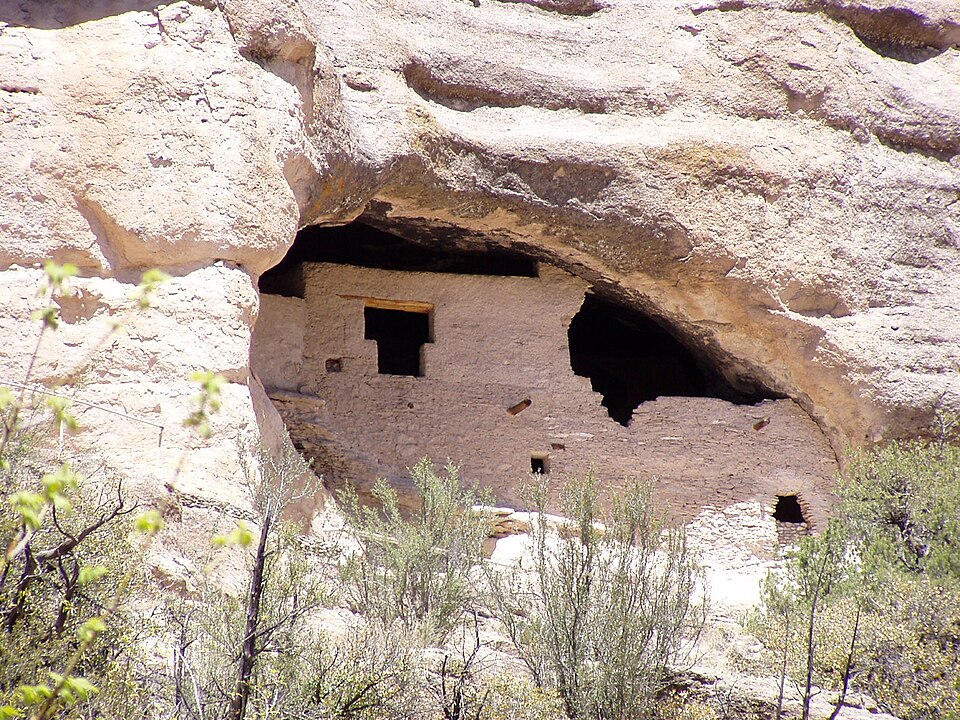
Gila Cliff Dwellings National Monument 12. Photo: Gillfoto / Wikimedia Commons. Gila Cliff Dwellings National Monument. Source
That brief occupation has become contested ground. Mainstream archaeology reads the cliff dwellings as a drought-driven relocation settlement: the Tularosa Phase (1100–1300 CE) builders are believed to have migrated roughly forty miles from the Reserve area — the same Reserve area where LA 11568 sits — to take advantage of a sheltered cave near a year-round spring during the Great Drought of 1276–1299. Tularosa Phase pottery recovered from the caves is “nearly identical” to collections from the Reserve area some fifty miles to the northwest, supporting that migration hypothesis. The storage-to-living-room ratio at the site (~1:1.9) matches other Tularosa pueblos at Reserve, and the architecture shows no signs of defensive modification — no thickened walls, no parapets, no restricted access points. Bioarchaeological analysis of 247 adult burials from 17 Late Pithouse and Pueblo sites in the broader Mimbres region (A.D. 550–1300) found interpersonal trauma in only 10.5% of individuals, leading researchers to conclude that “Mimbres communities do not appear to have had endemic warfare seen in other regions of the Southwest”. [7]
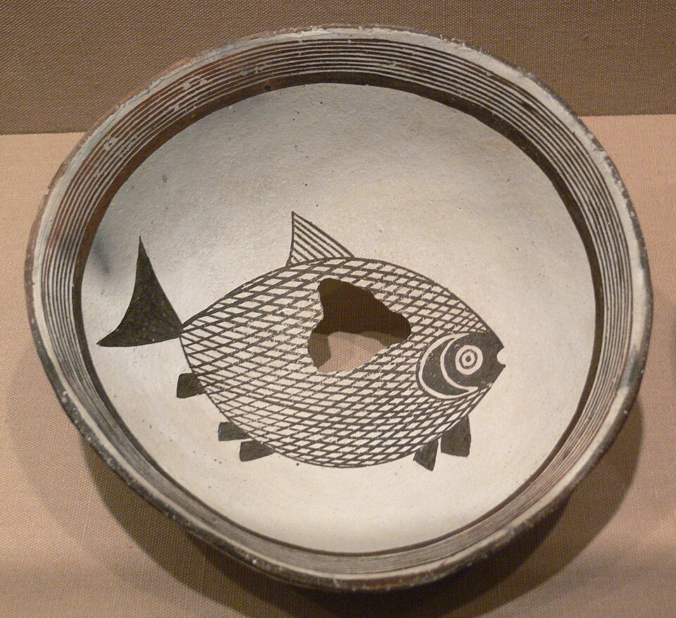
Mimbres Bowl with fish DMA 1998-103-FA. Photo: User:FA2010 / Wikimedia Commons. Source
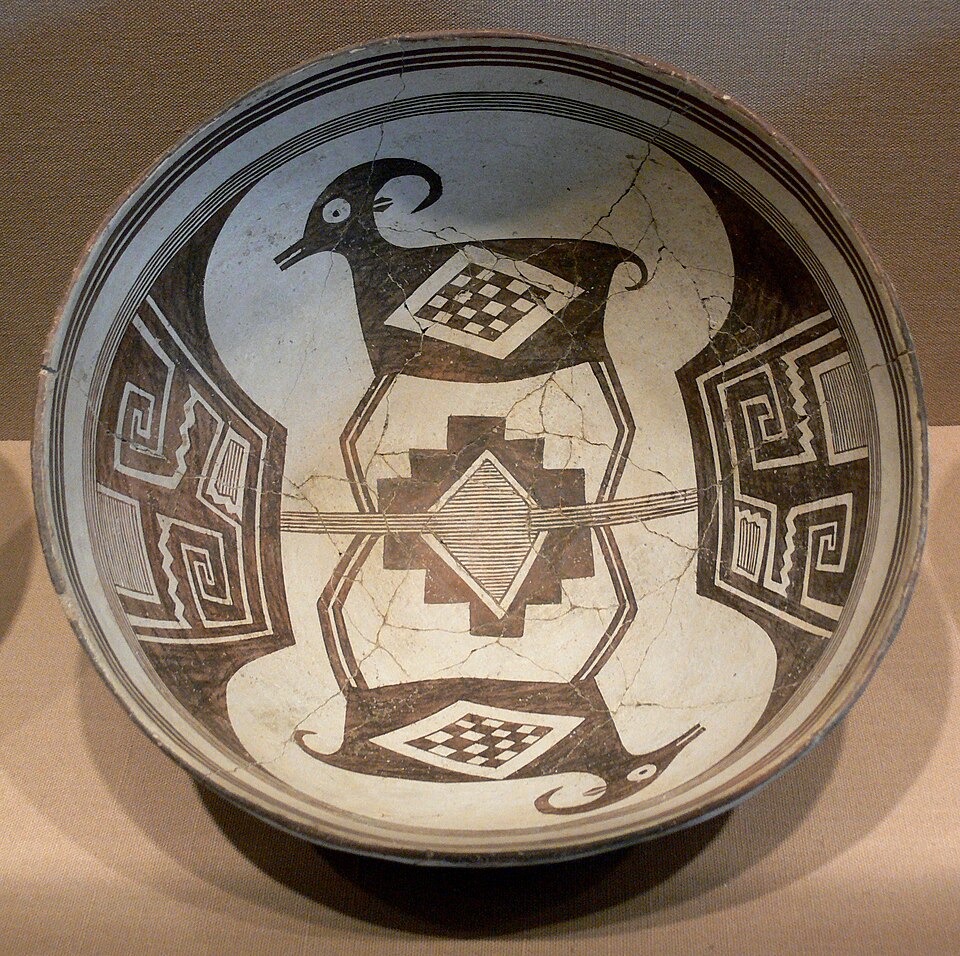
Mimbres Bowl with bighorn sheep and geometrical design 224 DMA 1990-215-FA. Photo: User:FA2010 / Wikimedia Commons. Source
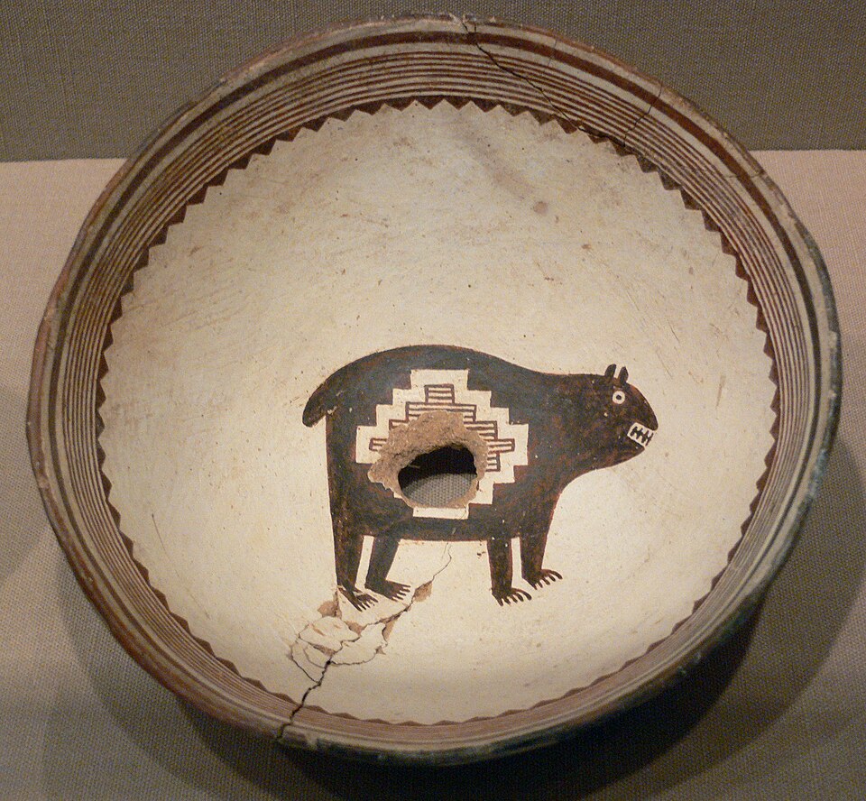
Mimbres Bowl with bear DMA 1990-216-FA. Photo: User:FA2010 / Wikimedia Commons. Source
Fringe interpreters read the same evidence differently. The DeDunking YouTube channel characterizes the cliff dwellings as a “castle” and a “defensive position for warfare,” frames the roughly 30-year occupation as evidence of military use, and alleges an “Archaeology Coverup” involving redacted National Register forms. Luke Caverns, in an 11-day expedition video, claims to have “discovered” an “ancient village” of pit houses in what he calls “one of the most remote corners of the Hila (Gila) wilderness” — sites that in fact fall within a landscape where Don Morris’s 1968 survey alone documented 106 archaeological sites within a one-mile radius of the Gila Visitor Center, including 31 pithouse villages and 25 cliff shelters. The archaeological inventory of the Gila National Forest now exceeds 6,314 recorded sites. The claim of “uncharted” ground does not survive contact with the site records 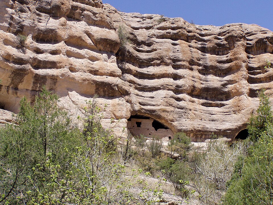 [8]
[8]

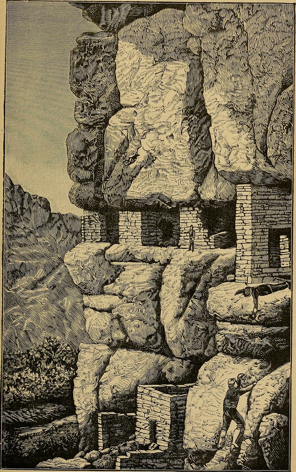
The resources of Arizona; a description of its mineral, farming, grazing and timber lands; its rivers, mountains, valleys and plains; its cities, towns and mining camps; its climate and productions. Photo: Internet Archive Book Images / Wikimedia Commons. Source
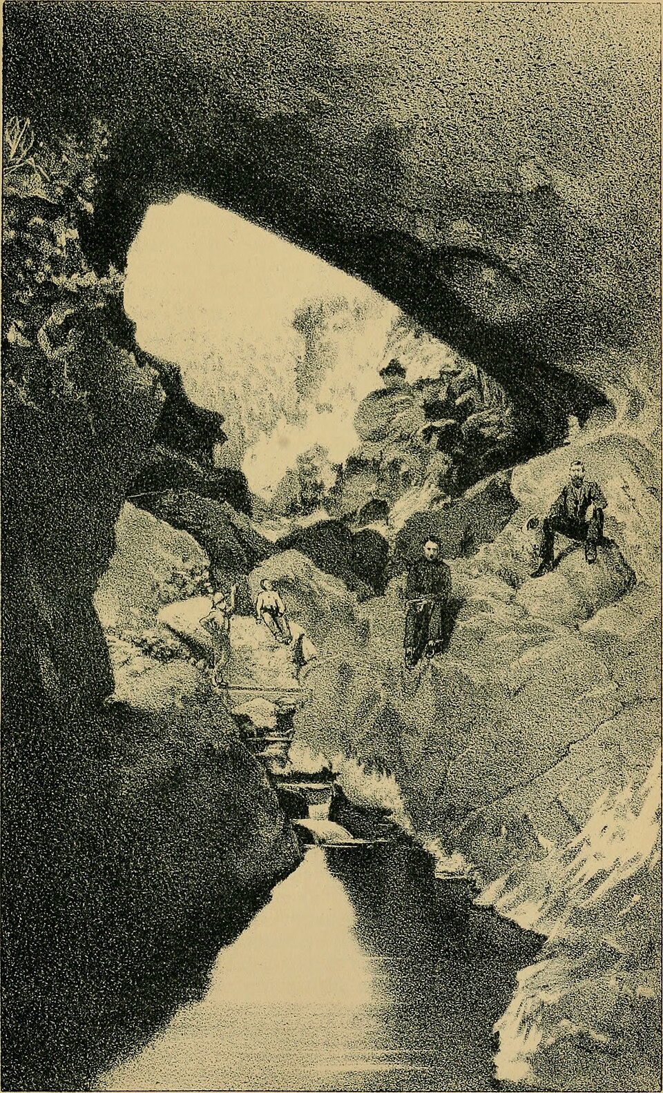
Natural Bridge, Tonto Basin 1883. Photo: Hamilton, Patrick; Arizona (Ter.) Legislative assembly / Wikimedia Commons. Source
Gila Cliff Dwellings National Monument 11. Photo: Gillfoto / Wikimedia Commons. Gila Cliff Dwellings National Monument. Source .
The most consequential recent work at Mogollon Village itself has not been excavation but reanalysis. Lori Barkwill Love’s June 2020 Bayesian chronological modeling of radiocarbon dates from LA 11568 — using ten dated circular pithouses and additional rectangular pithouse samples — concluded that occupation began no later than cal A.D. 5–130 and ended around cal A.D. 895–990, spanning roughly 800 years. The model’s critical implication: only a few pithouses were inhabited at any given time throughout that span, consistent with the broader regional pattern of Mogollon communities oscillating between dispersed small settlements and larger aggregated communities from A.D. 250 to 1450. The site, long treated as the founding “village” of the Mogollon archaeological culture, served as the type site whose excavations led to the formal definition of the Mogollon culture by Haury (1936) and Martin and colleagues, distinguishing it from the Ancestral Pueblo (Anasazi) and Hohokam traditions based on brown ware pottery and pit house architecture. Radiocarbon dates from Mogollon Village partially overlap chronologically with those from the nearby Ho-Bar Site, which range from 900 B.C. to A.D. 750, placing both within the long Early Pithouse horizon of the broader region. [9]
Adjacent to the cliff dwellings themselves, the TJ Ruin sits on a mesa top at the confluence of the Middle Fork and West Fork of the Gila River — an unexcavated, roughly 200-room Mogollon village occupied from approximately A.D. 900 to 1150, predating the cliff dwellings by 125 to 250 years. Pottery analysis from the 1968 survey shows TJ Ruin had a “dominant Mimbres occupation, a hiatus during the Tularosa phase and a limited occupation during the Salado period” — meaning the people who later moved into the cliff caves were not necessarily the direct descendants of those who built TJ Ruin. The Reserve Area Archaeological Project, a collaboration between the Denver Museum of Nature & Science and the U.S. Forest Service, has documented 44 archaeological sites near Reserve since 2015, including the Torriette Lakes Great Kiva at 7,300 feet — the highest-elevation great kiva in the American Southwest — alongside 76 masonry pueblos totaling over 150 rooms within a two-mile radius. That documentation has reframed the Mogollon Highlands as a substantial Pueblo-period population center (1000–1250 CE), not the “transitional zone” or “backwater” earlier scholarship assumed. [10]
Mogollon Archaeology Between Orthodoxy and Revision
In 1936, Emil W. Haury published “The Mogollon Culture of Southwestern New Mexico,” formally defining the Mogollon as an archaeological culture distinct from the Ancestral Pueblo (Anasazi) and Hohokam. The defining material correlates were a long sequence of brown-ware utility pottery produced by coil-and-scrape technique, and pit-house architecture. The name derived from the Mogollon Mountains of New Mexico, themselves named after 18th-century Spanish Governor Don Juan Ignacio Flores Mogollón (1712–1715), who had no direct connection to the prehistoric culture. That publication triggered a major intellectual controversy in Southwestern archaeology: were the Mogollon a genuinely distinct cultural tradition, or a backwoods peripheral variant of Ancestral Pueblo people? The dispute was largely resolved through well-documented fieldwork, including Haury’s contemporaneous excavations at Forestdale Valley. [11]
Three excavation seasons at the SU Site — 1939, 1941, and 1946 — anchored that resolution. Paul S. Martin and John B. Rinaldo of the Field Museum of Natural History, with Emil W. Haury and Russell Hastings participating, worked the site on the east bank of the San Francisco River in western New Mexico, about ten miles north of a reference point. The 1941 second season alone cleaned out eight more houses and recovered approximately 18,000 pottery sherds and 750 stone and bone tools. Over the full program the team documented multiple pit houses — lettered H, I, J, L, M, N, O, P and others — with central post-holes, ramp or stepped entrances, internal pits, secondary pits, metates, and at least one burial (Burial 36). Out of this fieldwork came the tripartite chronological framework that still organizes Mogollon scholarship today: Early Pithouse (ca. AD 200–550), Late Pithouse (550–1000), and Mogollon Pueblo (1000–1400/1450), with the Classic Mimbres era spanning 1000–1130 within the Pueblo period. Mogollon pit houses were typically 2–5 feet deep and 10–16 feet in diameter, with log-and-mud umbrella roofs and ramped entries; the long-lived brownware Alma Polished Plain dominated Early Pithouse assemblages from ca. AD 200 to 1250. The Reserve Area Archaeological Project has since re-located and recorded 26 of 32 sites excavated from 1939–1955, with dendrochronology providing precise solar-calendar dates for the original sequence. [12]
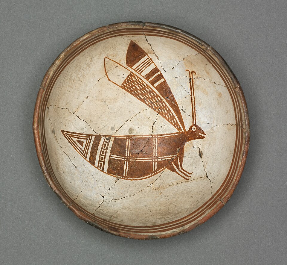
Clevelandart 1930.47. Photo: Wikimedia Commons. Source
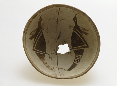
savinen hauta-astia. Photo: Europeana. Source
But the controversy did not stay sealed in the 1940s. Stephen Lekson, writing in Penn Museum’s Expedition Magazine, argued that the Anasazi/Hohokam/Mogollon tripartite division should be understood not as interacting cultures or peoples but as archaeological patterns reflecting different adaptations to different environments — with the original Haury-era definition “stretched to the breaking point”. Mainstream archaeology now deliberately uses the term “Mogollon archaeological culture area” rather than “Mogollon people,” reflecting the vast geographic extent and internal heterogeneity of the region, which encompasses most of southern and western New Mexico, much of western and southwest Arizona, extreme western Texas, and northern Chihuahua. The culture area is internally subdivided into at least eight named branches — Mimbres, Reserve, Forestdale, Point of Pines, Jornada, San Simon, Upper Gila, and Chihuahuan — covering populations that may not have shared language, pottery, identity, or self-conception. The Reserve Area Archaeological Project has documented 44 archaeological sites across more than 3,000 acres in the Gila National Forest near Reserve, including masonry pueblos of 40–100 rooms and the Torriette Lakes Great Kiva at 7,300 feet elevation — the highest great kiva in the American Southwest. By the time of regional depopulation around AD 1400–1450, most mainstream archaeologists treat both Mogollon and Anasazi groups as ancestral to the historic Pueblo peoples first encountered by Coronado in 1540. [13]
The most recent revision is methodological rather than taxonomic. In June 2020, Lori Barkwill Love published “Rethinking ‘Village’ at Mogollon Village (LA 11568): Formal Chronological Modeling of a Persistent Place” in American Antiquity. The site sits on Gila National Forest land within or adjacent to the Gila Wilderness, and had been excavated by three separate archaeological projects before her reassessment. The conventional radiocarbon dates had produced wide or bimodal distributions, complicating straightforward chronological interpretation. Barkwill Love’s Bayesian model — built on two structural components, circular pithouses and rectangular pithouses, with ten radiocarbon-dated circular pithouse contexts — placed occupation between cal AD 5–130 and cal AD 895–990, with the Early Pithouse-period component spanning approximately AD 200–700. The finding reframes the site: not a contemporaneously inhabited village, but a “persistent place” of repeated, transient occupation, with only a few pithouses occupied at any given time across nearly a millennium of use. Conventional dates from the nearby Ho-Bar Site (900 BC to AD 750) partially overlap with Mogollon Village dates, situating LA 11568 within a broader Early Pithouse-period settlement network. The implication is broader: Early Pithouse pithouse clusters across the Mogollon region are likely palimpsests of asynchronous households with continuing mobility and foraging, rather than sedentary villages — challenging the older equation of ceramic introduction plus maize plus pithouses equals sedentary village. Barkwill Love’s findings point to a larger problem: the Haury tripartite scheme may have mis-described not only who the Mogollon were but how they actually lived. [4]
Fringe Narratives Around Gila Mogollon Sites
The Mogollon archaeological culture existed from approximately A.D. 200 until sometime between A.D. 1400 and 1450 in mountainous regions of present-day New Mexico and Arizona, divided into Early Pithouse (ca. A.D. 200–550), Late Pithouse (550–1000), and Mogollon Pueblo (1000–1400/1450) periods. It is named after the Mogollon Mountains, themselves named for Don Juan Ignacio Flores Mogollón, Spanish Governor of New Mexico from 1712 to 1715. Archaeologist Emil Haury first defined the culture as distinct from Hohokam and Ancestral Pueblo groups, based on a long sequence of ‘brown ware’ utility pottery and pit-house architecture that gives the cultural definition its archaeological signature. The Gila Cliff Dwellings themselves were built between roughly A.D. 1270 and 1300 by Tularosa-phase Mogollon people, with tree-ring dates clustering in the 1276–1287 range, an estimated population of 40–60 inhabitants, and a brief occupation of about one generation before the community dispersed into other pueblos across the Southwest. [1] [14] [15]
The DeDunking YouTube channel has lifted this documented brief occupation and recharacterized the cliff dwellings as a “defensive castle” used for warfare and abandoned after roughly 30 years. The framing extracts the defensible positioning of the site from its broader settlement-pattern context and presents the short occupation as evidence of militarized defense rather than the climatic adaptation mainstream archaeology documents. NPS interpretive material at the monument does identify defense as a likely factor in site selection — a position associated with Steven LeBlanc’s broader argument for warfare as a significant factor in late prehistoric Southwest settlement — but situates the cliff dwellings within regional population movements coinciding with the Great Drought of 1270-1300, rather than treating them as anomalous fortifications. The channel’s reframe exemplifies what mainstream critics identify as the “science-cannot-explain-this-mystery-so-X-must-be-responsible” gap-filling argument: documented defensive placement is reframed as exclusive militarization, with no engagement with the dendrochronology, the thin tree rings indicating drought stress, or the post-drought dispersal patterns that anchor the mainstream chronology. [16]
The same channel levels an “Archaeology Coverup” allegation, claiming that pre-Columbian transoceanic contact evidence has been suppressed and that finds have been “stolen and sold” from Gila-area sites, with redactions on National Register of Historic Places forms cited as evidence of suppression. Mainstream sources characterize those redactions as standard practice to protect site locations from looting — administrative confidentiality applied across the National Register system, not a Gila-specific anomaly. The argument cherry-picks procedural documentation while ignoring substantive archaeological evidence: a 1968 NPS survey within a one-mile radius of the Gila Visitor Center recorded 106 archaeological sites, including 31 pithouse villages spanning Georgetown through Three Circle phases, 25 cliff shelters, and 32 masonry units — a public survey record with no concurrent suppression mechanism available. Pre-Columbian transoceanic contact claims relevant to Southwestern archaeology are classified by peer-reviewed consensus as “pseudoscience” or “pseudohistory,” though a small number of claims — Norse L’Anse aux Meadows and possible Polynesian–South American contact around 1200 CE — do have limited scholarly support that the Gila claims conspicuously lack. Graham Hancock’s “Ancient Apocalypse” and the broader Hancock-style literature deploy the same argumentative playbook, attacking mainstream archaeologists as suppressive and positioning the fringe author as a persecuted truth-teller, a rhetorical structure that closes off empirical engagement before it can begin. [17]
The Luke Caverns channel’s “11 Day Expedition Discovering Ruins in Uncharted New Mexico” claims the discovery of an “ancient village” with pit-house features in “one of the most remote corners of the Gila Wilderness,” with a companion reportedly identifying the features as a “pit house” based on visual comparison with Mexican house mounds. The channel also raises the possibility of “Maya-style water source features” in uncharted New Mexico ruins. Both moves exemplify the “looks-like-a-X-to-me” resemblance identification critics describe as one of two recurring logical structures in pseudoarchaeological argument: visual analogy to Central American architecture is treated as identification without stratigraphic evidence, diagnostic artifacts, or controlled excavation. The “undiscovered” framing sits awkwardly beside documented regional survey: Pine Lawn Valley, where the original Mogollon Village type site sits, shows phase-by-phase occupation from the Pine Lawn phase (200 BC–AD 500) through the Tularosa phase (AD 1100–1250), with the upper Gila region mapped at a granularity that makes “uncharted” a description of the channel’s research base rather than the territory. Faunal and material remains from the cliff dwellings themselves — turkey feather cordage, plaited yucca sandals, an infant burial with cloth, and Tularosa pottery nearly identical to assemblages 50 miles northwest at Reserve, New Mexico — situate the site within established regional ceramic and subsistence networks rather than as anomalous contact evidence. [18] [19]
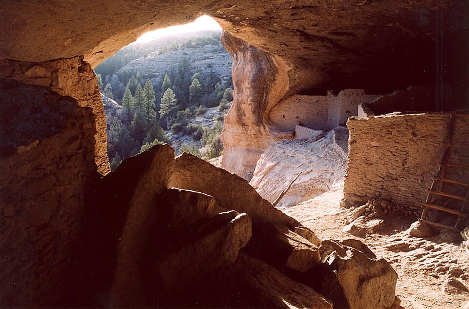
GilaCliffDwellings Interior. Photo: not specified / Wikidata. Interior of one of the dwellings at the w:Gila Cliff Dwellings National Monument, New Mexico, USA. Source
These fringe narratives share the structural fingerprints mainstream critics have catalogued across pseudoarchaeology: resemblance-based identification, gaps-based inference, and a consistent reframing of mainstream rejection as evidence of suppression rather than a substantive objection to the claim. Pseudoarchaeological claims about lost civilizations in the Americas have been formally criticized by both archaeologists and Indigenous communities as carrying racist implications, a critique tied genealogically to 19th-century hyperdiffusionist frameworks rooted in eugenics and colonial-era race science that attributed Indigenous monumental architecture to white-skinned outsiders. The Society for American Archaeology has formally critiqued such claims and requested their reclassification as “science fiction” rather than documentary programming. Flint Dibble, an archaeologist at Cardiff University, has publicly debated Graham Hancock on The Joe Rogan Experience using a “truth sandwich” misinformation-countering strategy that directly confronts the mainstream versus fringe framing. The evidence at Gila itself — a brief Tularosa Mogollon occupation using locally available materials (Gila Conglomerate slabs, Ponderosa Pine, Douglas Fir, juniper, cottonwood, and sandy clay mortar), preserved organic remains made possible only by the dry rockshelter environment, and pottery dominated by Tularosa Phase types with limited Classic Mimbres Phase presence — sits in the public archaeological record without supporting either a military-castle narrative or a transoceanic-contact coverup. The fringe channels endure because they direct audiences to a stripped version of that record and treat the absence of what was never claimed as evidence of what was deliberately hidden. [20]
Connecting the Dots
Mogollon Village (LA 11568), also called the SU Site, is a formally designated archaeological site in the Gila National Forest of western New Mexico excavated across three field seasons by Emil W. Haury, and later by Paul S. Martin and John B. Rinaldo in 1939, 1941, and 1946, with pottery and artifact analysis by Rinaldo and skeletal analysis by Marjorie Kelly. The site fits the classic profile of a Mogollon Early Pithouse period settlement: clusters of small pithouses with central post-holes, entrance ramps, secondary pits, and brownware utility pottery including Alma Polished Plain, a long-lived type spanning ca. AD 200 to 1250. Haury first defined the Mogollon as a culture distinct from Ancestral Pueblo and Hohokam in his 1936 publication, and the SU Site excavations became part of the foundational evidence for the culture-area concept. Radiocarbon dates place occupation from cal AD 5–130 through cal AD 895–990, situating the site within the Early to Late Pithouse periods. [4]
Bayesian chronological modeling of those radiocarbon dates reveals something the original excavators could not detect: only a few pithouses appear to have been inhabited at any given time across nearly a millennium of use, reframing Mogollon Village not as a continuously occupied settlement but as a “persistent place” of “repeated, transient occupation”. The 1941 second-season excavation documented at least eight pithouses (designated H, I, J, L, M, N, O, P) and two surface houses (2, 3) with detailed architectural plans, all initially treated as a single “village” occupation. What was catalogued as one village across the site’s history now reads as episodic returns to a favored location, each generation building anew on ground already weighted with cultural memory. [2] [21]
“Mogollon” itself is an archaeological culture-area label imposed by researchers, not a self-identified ethnic group, and derives from the Mogollon Mountains, which were named after Don Juan Ignacio Flores Mogollón, Spanish governor of Nuevo México from 1712 to 1715. The brownware-and-pithouse definition subsumes highland New Mexico, southern and western Arizona, far western Texas, and northern Chihuahua, Mexico. The Mogollon Highlands/Gila Wilderness is now recognized as a substantial population center during the Pueblo period (1000–1250 CE), not a “transitional zone” or “backwater” as earlier scholarship characterized it. TJ Ruin, with approximately 200 rooms at the confluence of the Middle Fork and West Fork of the Gila River, sits nearby as evidence of that demographic weight. [22]
Placing these threads side by side exposes a pattern invisible from any single angle. Mogollon Village was abandoned around cal AD 895–990, centuries before the Gila Cliff Dwellings were constructed between 1276 and 1287 CE. The Tularosa Mogollon who built those cliff dwellings migrated from approximately 40 miles away, near present-day Reserve, New Mexico, during the Great Drought of 1276–1299. The original excavators treated the eight pithouses and two surface houses at the SU Site as a single village occupation across nearly a millennium; Bayesian modeling now reframes that same record as episodic returns to a persistent place. TJ Ruin’s approximately 200 rooms at the Gila River forks and the Torriette Lakes Great Kiva, the highest-elevation great kiva in the American Southwest at 7,300 feet and possibly occupied as early as the 12th century, together mark the demographic and ceremonial scale that earlier scholarship, dismissing the region as a transitional backwater, failed to recognize. [22]
The Other Side
Mainstream interpretation of the Gila Cliff Dwellings’ function is also more pluralistic than fringe presentations allow. The National Park Service’s own “Hidden and Defensible” feature explicitly cites defense as “a probable major factor” in the occupation of the cliff dwellings, and Archaeology Southwest’s interpretive material describes the location as chosen “for protection from elements and as a defensive strategy” alongside drought response and agricultural access. The defensive reading is therefore not a fringe novelty but a mainstream position that simply does not monopolize the explanation the way the “castle” hypothesis claims. The drought-driven migration narrative that fringe sources treat as their own is similarly well established in tree-ring and paleoclimate reconstructions showing severe regional drought in the late thirteenth century, conditions documented in mainstream dendrochronological work and adopted in NPS and Archaeology Southwest interpretive material. [23]
The technical substance of the radiocarbon critique also survives contact with mainstream methodology. Conventional dating of Mogollon Village has long produced wide and sometimes bimodal distributions, which is precisely why Lori Barkwill Love’s Bayesian reassessment was undertaken in the first place; her “Rethinking ‘Village’” article treats the site as a “persistent place” in which only a subset of pithouses were occupied at any one time, and that interpretive framework now sits squarely in the peer-reviewed literature rather than on its margins. The DeDunking claim that averaged radiocarbon dates “suggest 200 plus years older” can be read, charitably, as a methodological complaint about Bayesian priors and the treatment of legacy dates, and legacy excavation practices at Gila Cliff Dwellings are indeed a legitimate target of mainstream critique: NPS administrative histories and current interpretive staff, including ranger Dana Dick, have characterized the 1950s–1970s fieldwork as artifact-collection-oriented rather than systematic study, a self-criticism that originates inside the agency itself. [24]
What We Actually Know
Mogollon Village (LA 11568, also called the SU Site) is a formally designated archaeological site in the Gila National Forest of western New Mexico, excavated across three field seasons (1939, 1941, 1946) by Paul S. Martin and John B. Rinaldo, with pottery and artifact analysis by Rinaldo and skeletal analysis by Marjorie Kelly. Tree-ring dates from the site’s houses supplied the first absolute dates for the Mogollon tradition — a culture-area label Emil W. Haury first defined in 1936 as distinct from Ancestral Pueblo and Hohokam traditions. The label itself derives from the Mogollon Mountains, named after Spanish Governor Don Juan Ignacio Flores Mogollón (1712–1715); the original inhabitants had oral, not written, languages, and “Mogollon” is an archaeological construct imposed on the past, not a self-identified ethnic group. [25]
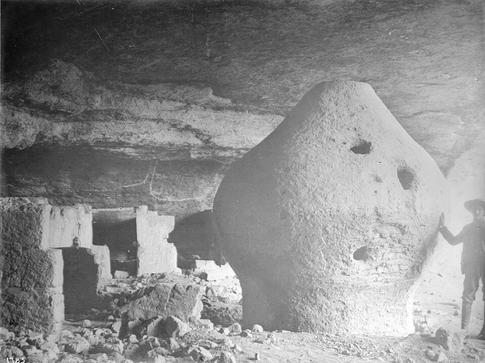
Man standing next to a granary of the Indian cliff dwellings, Sierra Madre, Mexico, ca.1900 (CHS-1783). Photo: Unknown author / Wikimedia Commons. A landscape view of the Mogollon Mountains makes the geographic origin of the archaeological label…. Source
Mainstream scholarship divides the Mogollon sequence into three periods — Early Pithouse (ca. AD 200–550), Late Pithouse (550–1000), and Mogollon Pueblo (1000–1400/1450) — with the Classic Mimbres era within the Pueblo period. Early Mogollon villages consisted of clusters of small pithouses — typically 6–8 houses per village housing about 30 people — with brown-ware pottery, often on elevated terrain before shifting to floodplain agricultural locations. The ceramic tradition centered on Alma Polished Plain brownware (ca. AD 200–1250), produced through coil-and-scrape technique, a diagnostic feature distinguishing the culture area; painted wares (red-on-brown, black-on-white, red-on-white) emerged in parallel rather than following a linear progression. The Gila Cliff Dwellings — 40–42 masonry rooms in 5–7 Gila Conglomerate caves — show tree-ring cutting dates between 1276 and 1287 CE, occupied roughly 20–30 years before abandonment around 1300, with thin tree rings confirming Great Drought conditions (1270–1300) and the Tularosa Mogollon inferred to have migrated from approximately 40 miles away near Reserve, New Mexico. Mainstream scholarship explicitly rejects any “disappearance” narrative — the Tularosa Mogollon dispersed to other pueblos across southwest New Mexico and into Mexico, with Chiricahua and Mimbrenos Apache groups later occupying the area. [23]

Tree rings in Taxodium distichum wood (bald cypress) 2. Photo: James St. John / Wikimedia Commons. Source
Bayesian chronological modeling by Barkwill Love (2021) indicates Mogollon Village occupation began by cal AD 5–130 and ended around cal AD 895–990, substantially predating the Gila Cliff Dwellings occupation by several centuries. This chronology is cross-validated by Mauldin’s 1996 independent recalibrated radiocarbon dates using obsidian hydration analysis, which preceded the Bayesian work by 25 years and provides methodological triangulation. The same modeling suggests only a few of the ten radiocarbon-dated circular pithouses were inhabited at any given time, with the majority not contemporaneous — a finding consistent with a broader revisionist current arguing that “mobility and foraging remained important strategies throughout the Early Pithouse period”. Conventional radiocarbon dates from the nearby Ho-Bar Site (900 BC to AD 750) partially overlap with Mogollon Village dates, suggesting regional Early Pithouse contemporaneity in the Upper Gila area. The site itself contained both circular and rectangular pithouses, with circular forms predating rectangular ones per the standard architectural sequence, though the type site shows overlap rather than clean changeover. Mainstream sources frame Gila Cliff Dwellings function as drought-response settlement compounded by rapid resource depletion, with defensive considerations as one element among several — “protection from elements and as a defensive strategy” — rather than as purely military fortifications. [2]
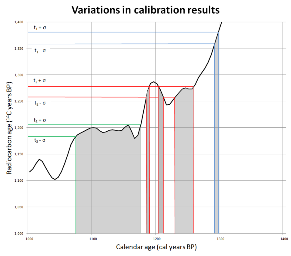
Variations in calibration results. Photo: Mike Christie / Wikimedia Commons. Source
Whether the Gila Cliff Dwellings served primarily as a defensive “castle” for warfare remains an open interpretive question; the architectural evidence — rooms set into natural alcoves with no parapets, palisades, or restricted entries — is inconsistent with purpose-built fortifications, and “defensible location” is not equivalent to “primarily defensive function”. Claims of an “archaeology coverup” involving suppression of pre-Columbian transoceanic contact, looting, and mismanagement are not supported by any peer-reviewed source; fringe sources exhibit documented pseudoarchaeological logical structures, non-standard terminology (“Moyon realm,” “Mogon Clifton Wellings,” “wholewellians”) reflecting systematic failure to reproduce established archaeological nomenclature, and a framework that attributes Indigenous achievement to lost non-Indigenous civilizations. Amateur exploration media (Luke Caverns YouTube) claim personal discovery of “ancient village” pit house features and “uncharted” ruins in the Gila Wilderness using LiDAR without referencing the formal LA 11568 site record or any peer-reviewed publication. Linguistic connections between Mogollon and historic Pueblo groups are necessarily inferential — no indigenous written Mogollon language survives — and must rest on material-culture parallels rather than linguistic data. The 9,500 BCE human presence claim derives from a single Smithsonian Magazine source rather than peer-reviewed evidence and remains chronologically speculative. [18] [19]
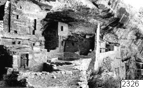
Mesa Verde, Balcony House, fotografi, photograph. Photo: Europeana. Source
References
[1] Who or What Is the Mogollon? — https://www.archaeologysouthwest.org/free-resources/fact-sheets/who-or-what-is-mogollon/ (accessed 2026-08-04)
[2] Rethinking “Village” at Mogollon Village (LA 11568) — https://www.cambridge.org/core/journals/american-antiquity/article/rethinking-village-at-mogollon-village-la-11568-formal-chronological-modeling-of-a-persistent-place/247E01765CBC47DB93BD852DB278286F (accessed 2026-08-04) [Academic]
[3] The SU site excavations at a Mogollon village, Western New Mexico by Paul S. Martin ; with reports on pottery and artifacts by John Rinaldo ; and appendix on skeletal material by Marjorie Kelly — https://siris-libraries.si.edu/ipac20/ipac.jsp?&profile=liball&source=~!silibraries&uri=full=3100001~!1164937~!0#focus (accessed 2026-08-04) [Academic]
[4] Rethinking “Village” at Mogollon Village (LA 11568) — https://par.nsf.gov/servlets/purl/10227042 (accessed 2026-08-04) [Academic]
[5] Prehistory, Personality, and Place — https://dokumen.pub/download/prehistory-personality-and-place-emil-w-haury-and-the-mogollon-controversy-1nbsped-9780816501069-9780816528639.html (accessed 2026-08-04)
[6] Gila Cliff Dwellings of the Mogollon Mountains — https://adventr.co/2020/02/gila-cliff-dwellings-of-the-mogollon-mountains/ (accessed 2026-08-04)
[7] Kathryn M. Baustian (2020). The Bioarchaeology of Social Order: Cooperation and Conflict Among the Mimbres (AD 550-1300). Digital Scholarship - UNLV (University of Nevada Reno). DOI: 10.34917/7645844 (accessed 2026-08-04) [Academic]
[8] Cultural Resources Specialist Report — https://www.fs.usda.gov/media/239447 (accessed 2026-08-04) [Academic]
[9] Culture Name: Ancestral Pueblo: Greater Mogollon — https://ceramics.nmarchaeology.org/typology/culture?p=3 (accessed 2026-08-04)
[10] The Gila Cliff Dwellings National Monument — https://casitasdegila.com/the-gila-cliff-dwellings-national-monument/ (accessed 2026-08-04)
[11] New Mexico National Monuments : The Gila Cliff Dwellings — https://newmexiconomad.com/the-gila-cliff-dwellings/ (accessed 2026-08-04)
[12] The SU site excavations at a Mogollon Village, western New Mexico, … — https://archive.org/download/susiteexcavation322mart/susiteexcavation322mart.pdf (accessed 2026-08-04) [Reputable]
[13] Life of The Gila: Mogollon—It’s Complicated — https://www.archaeologysouthwest.org/2020/03/05/life-of-the-gila-mogollon-its-complicated/ (accessed 2026-08-04)
[14] Mogollon culture — https://en.wikipedia.org/wiki/Mogollon_culture (accessed 2026-08-04) [Reputable]
[15] Mogollon culture | Ancient Southwest, Pottery & Artifacts — https://www.britannica.com/topic/Mogollon-culture (accessed 2026-08-04) [Reputable]
[16] The Gila Cliff Dwellings | Gambler’s House - WordPress.com — https://gamblershouse.wordpress.com/2011/09/06/the-gila-cliff-dwellings/ (accessed 2026-08-04)
[17] Gila Cliff Dwellings NM: An Administrative History (Chapter 5) — https://npshistory.com/publications/gicl/adhi/chap5.htm (accessed 2026-08-04)
[18] 11 Day Expedition Discovering Ruins in Uncharted New Mexico [20:39-23:54] — Luke Caverns (YouTube) — https://youtu.be/L_oQ0-mTa54?t=1239 (accessed 2026-08-04)
[19] 11 Day Expedition Discovering Ruins in Uncharted New Mexico [20:40-23:53] — Luke Caverns (YouTube) — https://youtu.be/raLzGTVpT3U?t=1240 (accessed 2026-08-04)
[20] The archaeologist fighting claims about an advanced lost civilisation — https://www.newscientist.com/article/2451556-the-archaeologist-fighting-claims-about-an-advanced-lost-civilisation/ (accessed 2026-08-04) [Reputable]
[21] (PDF) Revisiting Mogollon Village Chronology: A Bayesian Approach — https://www.academia.edu/37589121/Revisiting_Mogollon_Village_Chronology_A_Bayesian_Approach (accessed 2026-08-04) [Academic]
[22] Reserve Area Archaeological Project — https://www.dmns.org/science/research/reserve-area-archaeological-project/ (accessed 2026-08-04)
[23] The Mogollon - Gila Cliff Dwellings National Monument … — https://www.nps.gov/gicl/learn/historyculture/the-mogollon.htm (accessed 2026-08-04) [Academic]
[24] Revisiting the Chronology of Mogollon Village: A Bayesian Approach — https://www.researchgate.net/publication/328292506_Revisiting_the_Chronology_of_Mogollon_Village_A_Bayesian_Approach (accessed 2026-08-04)
[25] The Mogollon Culture Of Southwestern New Mexico — https://ehrafarchaeology.yale.edu/document?id=nt85-012 (accessed 2026-08-04) [Academic]
[26] Friday, October 7, 2016 Session 1: Mimbres Chronology — https://www.unlv.edu/sites/default/files/page_files/27/Anthro-MogollonConference-Abstracts.pdf (accessed 2026-08-04) [Academic]
[27] Program of the 85th Annual Meeting — https://www.saa.org/common/Uploaded%20files/saadocs/AnnualMeeting/Final%20Program/85th-annual-meeting-(2020).pdf (accessed 2026-08-04)
[28] (PDF) The Reserve Area Archaeological Project — https://www.academia.edu/12370640/The_Reserve_Area_Archaeological_Project (accessed 2026-08-04) [Academic]
Keep exploring
Every site on this page sits on the globe, and the people who research them are on the Discord.
3D Globe · Sites by country · Story Archive · Research Library · Weekly Journal · Search