

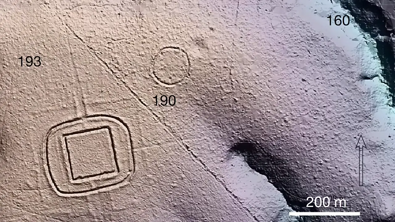
An airborne LiDAR survey in 2024 across the Amazon revealed 432 earthworks in just one region — 396 more than satellite imagery ever detected. In one cleared area, LiDAR found 156 structures where satellites saw only 30! Researchers now estimate 24,000 to 30,000 earthworks across the wider landscape, roughly two-thirds built by the Aquiry civilization between 600 BC and 850 AD. Geometrics, ditches up to 5m deep, roads connecting enclosures — hidden beneath the canopy. 🌿
LiDAR survey reveals 432 earthworks, estimate of 24,000–30,000 in Amazon
Key facts
- Airborne LiDAR survey conducted in 2024 with 10 flights covering 4,497 km identified 432 earthworks
- 396 more earthworks than previously known from satellite images in the same region
- In one deforested section, LiDAR identified 156 earthworks where only 30 were known from satellite images — a factor of five underestimation
- Researchers estimate the wider landscape contains between 24,000 and 30,000 earthworks, with about two-thirds attributed to the Aquiry civilization
- Identified structures were built between 600 BC and 850 AD
- Construction types include deep ditches, raised embankments, enclosed spaces, and roads arranged in circles, squares, and complex geometric forms
- Most structures cover 0.35 to 14 hectares; the largest covers approximately 50 hectares
- Surrounding ditches measure 9 to 13 m across and reach depths of up to 5 m
- Individual enclosures were sometimes connected by roads or grouped into clusters of up to eight monuments
Sources
nature.com
Linked in video description
arkeonews.net
Linked in video description
agencia.fapesp.br
Linked in video description
Was this story useful?
Keep exploring
Every site on this page sits on the globe, and the people who research them are on the Discord.
3D Globe · Sites by country · Story Archive · Research Library · Weekly Journal · Search
AI-generated text · images from the original sources · always verify with the sources.