

Week of October 26: Pompeii Men and a Broken Shield, Shimao DNA Divide, and More
Two male victims recovered outside Pompeii's Porta Stabia gate in deposits of the 79 CE eruption died at separate moments — the older near the end of the pumice fall, the younger overtaken by a pyroclastic current — and excavators interpreted a fractured terracotta mortar as an improvised overhead shield and a ceramic oil lamp as possible illumination. Ancient DNA from Shimao in northern China, a stone-walled city flourishing around 2300–1800 BCE, showed 9 of 10 East Gate victims to be genetically male while women predominated in elite-tomb contexts (6 of 7 and 14 of 19), and three individuals judged female from skeletal morphology were reclassified as male. Alfredo Delgado, head of the Xalapa Museum, flagged a partly worked block at the Llano del Jicaro quarry in Veracruz's Tuxtla Mountains as a possible unfinished eighteenth Olmec colossal head within a landscape of squared blocks, stelae, and figure stones, while Cahokia's Mound 72 yielded 260-plus interments, including two pits holding 77 women reported strangled and a mass grave of 39 individuals described as murdered.
Two male victims recovered outside Pompeii’s Porta Stabia gate in deposits of the 79 CE eruption died at separate moments — the older near the end of the pumice fall, the younger overtaken by a pyroclastic current — and excavators interpreted a fractured terracotta mortar as an improvised overhead shield and a ceramic oil lamp as possible illumination. Ancient DNA from Shimao in northern China, a stone-walled city flourishing around 2300–1800 BCE, showed 9 of 10 East Gate victims to be genetically male while women predominated in elite-tomb contexts (6 of 7 and 14 of 19), and three individuals judged female from skeletal morphology were reclassified as male. Alfredo Delgado, head of the Xalapa Museum, flagged a partly worked block at the Llano del Jicaro quarry in Veracruz’s Tuxtla Mountains as a possible unfinished eighteenth Olmec colossal head within a landscape of squared blocks, stelae, and figure stones, while Cahokia’s Mound 72 yielded 260-plus interments, including two pits holding 77 women reported strangled and a mass grave of 39 individuals described as murdered.
New Excavations & Fieldwork
Two male victims were recovered outside Pompeii’s Porta Stabia gate in deposits associated with the 79 CE eruption. The older man lay curled on his side, his right arm raised beside a broken terracotta mortar; a ceramic oil lamp lay near his left hand; an iron ring was associated with his body; and ten bronze coins lay near his pelvis [1]. Excavators interpreted the fractured mortar, also described as a grinding bowl, as an improvised overhead shield, with its fractures reflecting its failure to protect him. They proposed that the lamp provided visibility in poor conditions, although that function was not independently demonstrated.
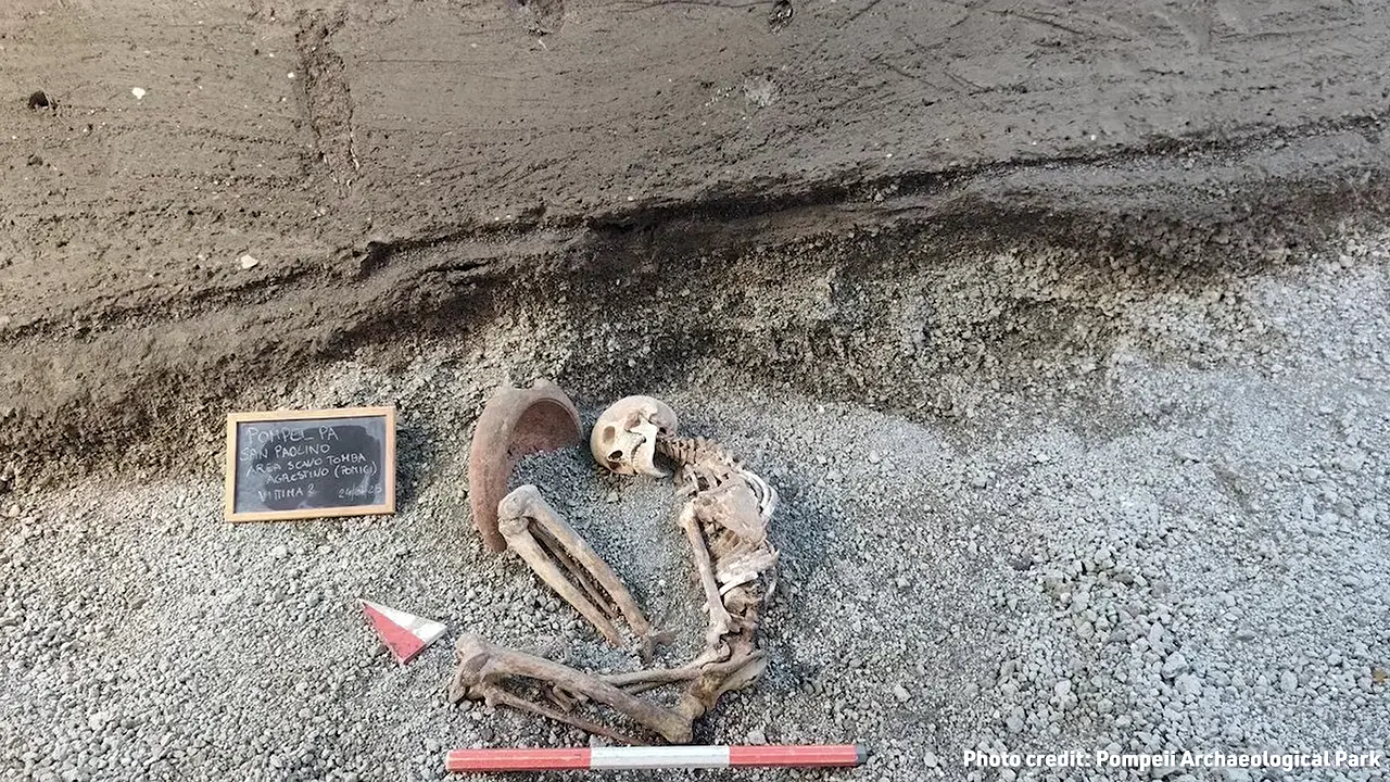
Stratigraphy suggests that their deaths were separated in time. The older man’s position close to the top of the pumice deposit indicates that he died near the end of the hours-long pumice fall, early on the eruption’s second day, while the younger man’s higher position in ash shows that he survived that phase [V1]. Estimated at 18–20 years old, the younger man lay about 1.5 metres away; iron hobnails around his feet were interpreted as remains of studded footwear. A thin pyroclastic-current layer beneath him was understood as marking the current’s first arrival and his death. The report proposed that he first sheltered in a building that resisted collapse under pumice load, then tried to escape during a lull, possibly because of earthquakes or further collapses, before being overtaken by the current. The victims lay within a compact mixed-use neighborhood of modest houses, shops, workshops, food outlets, and hospitality buildings near the entertainment district.

Artifact Discoveries
At Llano del Jicaro, a quarry in Veracruz’s Tuxtla Mountains, Alfredo Delgado—identified in the presentation as head of the Xalapa Museum—recognized a partly worked block as a possible unfinished Olmec colossal head [V2]. It shows an early stage of carving: an emerging face, ears, and a possible headband or hat, while much of the stone remains uncarved and a crack runs through it [V3]. Calling it the eighteenth known Olmec colossal head, after seventeen earlier examples, is provisional; the identification is not securely established, and no independent catalogue or inventory verifies the count.
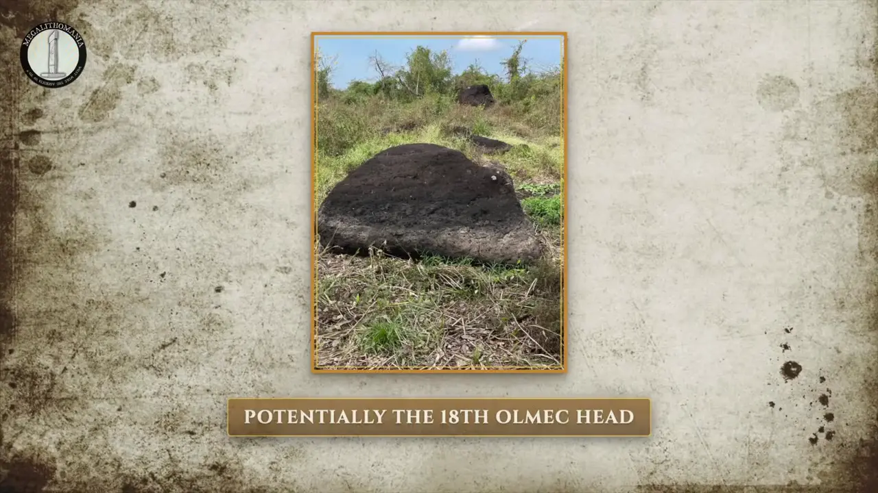
The quarry appears to be a monumental-production landscape rather than an isolated find, with squared blocks, beginnings of human statues, figure stones including a possible feline, stelae, Olmec-type stone pounders, and H-shaped or channel-cut blocks in an overgrown second area [V4] [V5]. The presentation also treats the site as a source of stone for many Olmec colossal heads, but no petrographic, mineralogical, chemical, or comparative provenance evidence independently verifies that link. A 1990 excavation recovered the lower part of a throne; whether the throne fractured during production or was intentionally built in two sections, and whether it relates to the candidate head, remain unresolved. The crack-based explanation for the candidate head’s non-completion is a hypothesis, as is the proposed scenario of finishing at Laguna de los Cerros before transport to San Lorenzo or La Venta. Clearing and condition scanning, rather than controlled excavation, leave its position, orientation, artifacts, and depositional history undocumented.
The strongest conclusion is that Mount Nemrut’s summit cone was not natural bedrock but an artificially constructed mound or tumulus. Early archaeologists reached this determination through campaigns conducted from 1882 to 1954, following Carl Friedrich Texier’s 1881 report of the colossal summit monuments [V7]. The supplied account describes the cone as a mass of loose, granular limestone rubble with a core approximately 5–6 metres deep, composed of crushed-limestone material used to build up the artificial mountain. That internal profile is reported consistently by the specialists, but the supplied evidence includes neither a measured section nor an independent stratigraphic or geotechnical publication. Its depth and internal structure should therefore be treated as reported rather than as independently verified measurements.
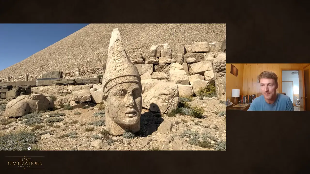
The artificial mound formed the architectural setting for the summit terraces and colossal statuary: colossal seated figures occupied the East and West terraces, while the North Terrace was added later [V8]. The broader summit complex—not specifically the cone fill—is conventionally identified as a first-century-BCE monumental tomb and religious sanctuary associated with Antiochus I and the Kingdom of Commagene, with the summit known as the Hierotheseion, or “house of the gods” [2]. Attribution of the cone itself is more cautious: construction by Commagene “may be postulated,” and no clear ancient quarrying tool marks were reported. That absence does not prove no quarrying occurred [V6].
Dating & Chronology
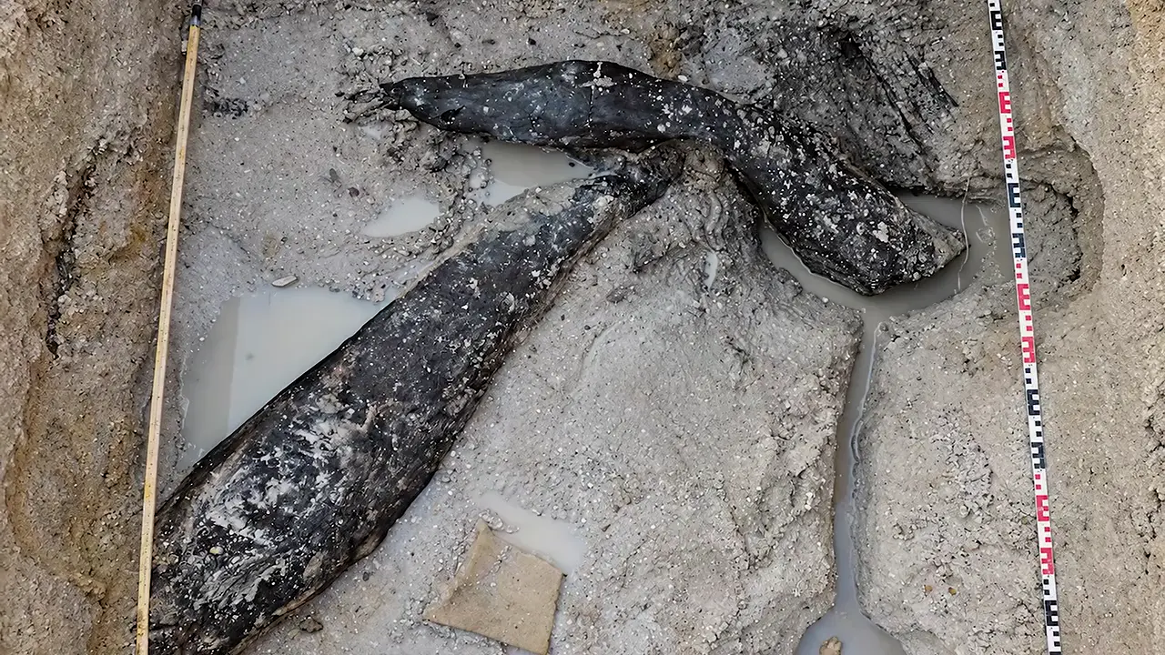
The timber’s age requires caution. Because the timber was beyond the useful range of radiocarbon dating, investigators dated the surrounding sediment, making 476,000 years a contextual minimum rather than a direct date of the wood’s felling. The timber’s makers remain unidentified: the chronology predates the earliest known Homo sapiens by more than 100,000 years, but the dating cannot securely assign the work to sapiens or another hominin [3].
Bioarchaeology & Ancient DNA
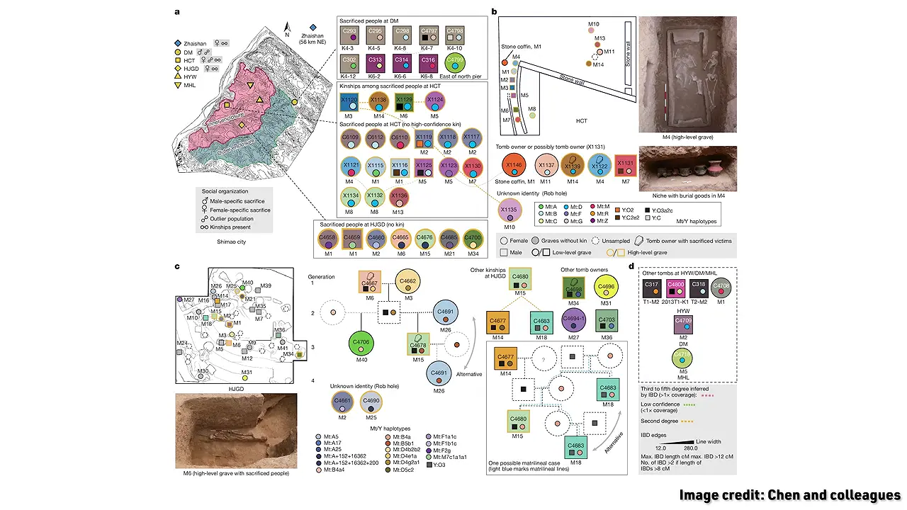
At Shimao, a stone-walled city in northern China that flourished around 2300–1800 BCE, more than 80 human skulls were reported near the eastern gate [V9]. Ancient DNA reveals a pronounced contrast among sampled victims: 9 of 10 East Gate victims were genetically assigned as male, while women predominated in two elite-tomb contexts—6 of 7 in one cemetery and 14 of 19 in another elite area. Three gate individuals previously judged female on the basis of skeletal morphology were reclassified as male. Elite-tomb victims generally had no detectable genetic relationship to the elite occupants they accompanied, although some victims within the second group were related to one another [4].
Architecture & Monuments

A relevant, but not demonstrably related, parallel is H. Frankfort’s reported discovery of a Seti I cartouche in a granite dovetail joint exposed after part of the sandstone wall broke away [6]. The lithology of the later-moved keystone is unspecified, and no lithological, photographic, or other physical connection is supplied, so the reported joint and keystone cannot securely be identified with one another [6]. The Osireion is generally dated to Seti I’s reign and lies beside a temple dated approximately 1280 BCE, but this monument-level attribution cannot date the disputed keystone [5]. Likewise, a proposed sequence—reuse of an earlier, possibly Old Kingdom construction followed by Middle Kingdom reinforcement or repair—was presented as a hypothesis without supporting stratigraphic, petrographic, or other archaeological testing.
William Borlase mapped Boscawen-Ûn in 1754 [V10]. By 1850, a Cornish hedge ran through the stone circle; around 1862, the landowner, Elizabeth Carne, removed it and built a replacement hedge around the stones. The podcast’s presenters characterize this relocation as an early act of ancient-monument preservation, although the supplied evidence does not independently establish Carne’s motive. Henry Jenner inaugurated the Cornish Gorsedd at Boscawen in September 1928, partly justified by the invocation of a Welsh triad naming Boscawen in Dumnonia as one of Britain’s three chief bardic seats [7]. Whether the triad genuinely preserves a sixth-century account or reached modern tradition through the much later Iolo Morgan remains contested.
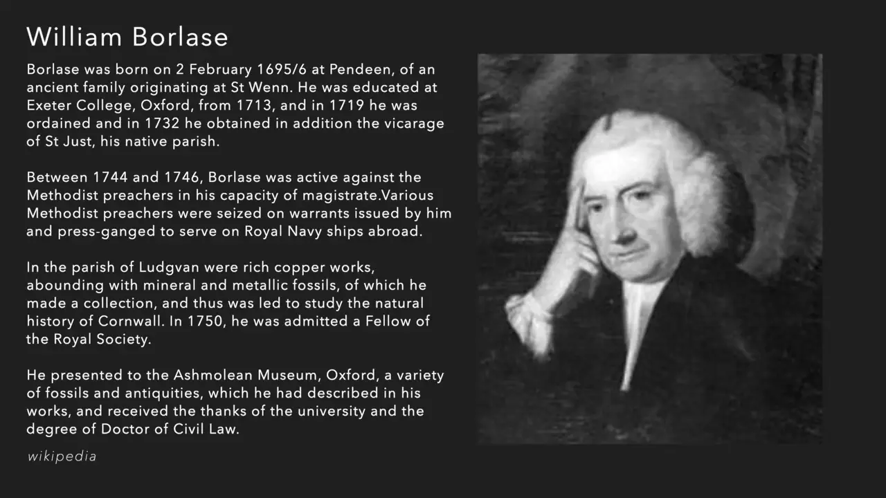
The 1862 hedge move also cannot be linked securely to the monument’s central feature. An 1864 report recorded the central pillar as already leaning strongly northeast, nearly 3 metres long and with its tip about 2 metres above ground; because the report followed the hedge work by only two years, it cannot show whether the relocation caused, accelerated, or merely followed a pre-existing lean. Burl regarded the inclination as deliberate but uncertain, while Stukeley suggested treasure-seekers might have disturbed the stone; Camden’s 1589 description did not note a lean [V11] [V12]. The modern boundary marked by bracken, walls, and vegetation cannot securely be tied to the nineteenth-century hedge.
In Brief
The central revision is that Melton’s alleged 1660 entry was more plausibly into the Red Pyramid, not the Bent Pyramid; he then conflated the two in his account, misleading Vyse and supplying a premise later repeated in notices of Vyse and Perring [V15]. In Perring’s preserved version, Melton called his destination the “Pyramid of Rhodope,” the farthest of fifteen “Pyramids of the Mummies,” three of them large and each with an opening to a chamber. Pococke’s 1743 map and text explicitly equate “Pyramid of Rhodope” with the Red Pyramid, providing documentary support for the reattribution, though not independent proof [V14].
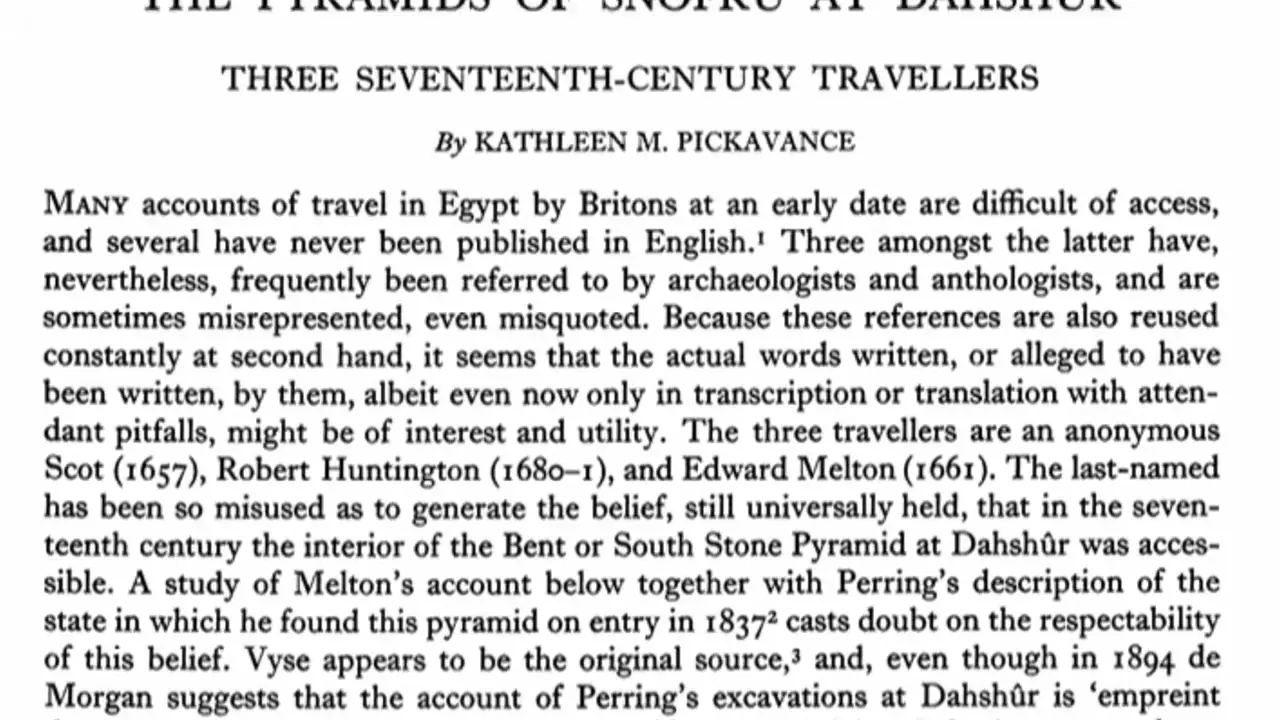
The reattribution does not cancel the separate evidence that the Bent Pyramid was obstructed. In 1837, Perring and Vyse encountered an obstruction about 140 feet inside its northern passage; clearing the antechamber revealed a steep ramp of small squared stones toward the lower chamber and a robber’s tunnel roughly two metres into the south wall [V15] [V14]. The Italian account is spatially persuasive—the presenter calculates about 233.3 feet, close to the surveyed 243-foot passage—but any explanation linking the later blockage to stones thrown down the Red Pyramid or to the earlier burrow remains speculative. Contemporary terminology distinguished the Red and Bent Pyramids as “open” and “closed,” but the flawed 1652 Burattini diagram neither independently ties Melton to either monument nor resolves the question [V13].
The ridge-topped Mound 72, located in what became Cahokia’s civic center, yielded 260-plus interments; estimates range from more than 250 skeletons to at least 270 individuals, so the exact total is uncertain [11] [9] [12]. The evidence does not show that every burial was sacrificial: the shell-artifact study identifies only some interments as probably mass human sacrifices. Five mass graves, each containing about 20 to more than 50 bodies, were accompanied by dozens of burials. It was one of Cahokia’s long, ridge-topped “earthen barns,” as French settlers called them; at least nine, perhaps sixteen, existed, and Mound 72 alone was properly excavated.
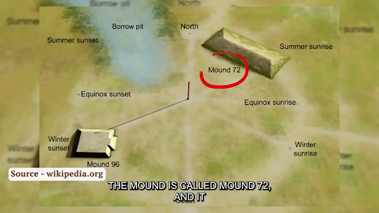
Two adjacent pits held 77 women reported as strangled: one held 24 young women plus four headless, handless young men, while the other held 53 women. A separate pit contained 39 individuals described as murdered, with smashed or severed heads and arrows in their bodies; twelve “honored” burials rested on platforms above it [V16]. At the bottom, a man and woman were covered with about 20,000 shell beads, with the woman slumped over the man; alongside them were two men with hundreds of color-grouped arrowheads and chunky copper discs [8]. The beaded burial was characterized as elite, but its identification as a Cahokia ruler remains tentative [10]. By about 1030 CE, the episode was sealed beneath dark earth, preceding the central plaza’s reorganization around 1050 CE; the violence is interpreted as exceptional rather than continuing, and no evidence establishes that it caused Cahokia’s later decline [V17].
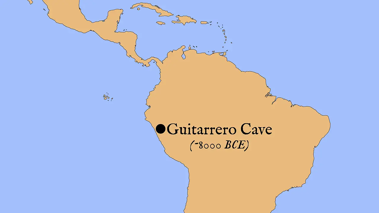
At Huaca Prieta in Peru, preceramic Capsicum seeds are reported to date to 5,500–4,500 BCE. The supplied evidence presents this as a reported, not independently reproduced, result: specimen-level dating, stratigraphic details, and secure species assignment are absent [V20]. The roughly 8,000 BCE Guitarrero Cave attribution is explicitly disputed: its pepper specimens’ provenience, date, and species are unestablished, and beans dated to 2,000–1,000 BCE have been cited as a reason that the peppers could be much younger, although no shared sealed or stratigraphically equivalent context is demonstrated.
Huaca Prieta’s early-plant record—including corncobs from Huaca and Paredones that may date to 4,700 BCE—shows its importance for early plant use, but does not verify the chili date. Its long sequence encompasses late-Pleistocene human presence and later preceramic occupation; the chili interval does not mark the site’s earliest human presence. Within the chronology, Huaca Prieta precedes the Real Alto and Loma Alto starch grains at about 4,000 BCE and the Aguadulce remains at 3,600 BCE, but this establishes order in the record, not worldwide priority. The broad literature places domestication around 7,000–5,000 BCE, yet it does not prove that either specimen group was domesticated: physical remains, domesticated populations, and secure culinary use are separate questions [V18] [V19] [V21]. Tehuacan reinforces the caution: its pepper seeds were not directly dated, and redating maize shifted the apparent context from roughly 6,000 BCE to about 3,600 BCE, yielding a likely pepper age of 4,000–3,600 BCE [V22].
The analysis sharpened the hypothesis Price had advanced in 1959 to calculate celestial motions; “first computer” is retrospective framing rather than his documented wording. His and Charalambos Karakalos’s 1971 work had used X-ray radiography, not CT, and suggested 29 or 30 gears [V25]. About 30 toothed wheels survive, but they do not constitute a complete inventory of the original mechanism [13].

X-ray and CT work made planetary inscriptions legible, including Mercury, Venus, Mars, Jupiter, Saturn, small spheres, a golden Sun, planetary cycles, stationary points, and retrograde motion [V23]. Calendar text supplies twelve Corinthian month names on the 235-month Metonic spiral and the Olympic festivals; Saros glyphs identify possible eclipse months and predict timing, obscuration, direction, and color, while the Exeligmos display tracks three Saros cycles and adds 0, 8, or 16 hours [V24]. Gear geometry strengthens the reading: Price interpreted a linked lunar train as calculating the Moon’s mean position, and eccentric gears were interpreted as reproducing variable lunar speed [14]. Crucially, CT shows only what survives: roughly one-third of the mechanism and its front are missing, so the 2021 nested-ring planetary layout cannot be directly confirmed, and absence from a scan does not prove absence from the complete machine.
The black mat’s coincidence with extinct Pleistocene megafauna and Clovis assemblages beneath it is central to Younger Dryas impact arguments, but not proof of extraterrestrial causation. The layer is proposed to mark an abrupt onset around 12.9 ka: supplied chronologies support a decadal-scale onset within a much longer cold interval and date a synchronous boundary to 12,835–12,735 cal B.P. The onset was not globally instantaneous, beginning in high northern latitudes and spreading southward [18] [16]. At about 50 Clovis-age North American sites, extinct Pleistocene megafauna and Clovis assemblages occur below the thin black layer, but not within or above it. The academic absence applies only to those studied sites: the video’s “never” claim is not supported as a continental or global inventory [19] [V26].
“Black mat” is heterogeneous. In a 97-site survey, about two-thirds of sites had black organic-rich horizons—mollic paleosols, aquolls, diatomites, or algal mats—with reported radiocarbon ages of 10,900–9,800 BP; darkness and organic richness therefore do not establish a common origin [17]. Lake Cuitzeo’s lacustrine deposit differs; supportive studies point beyond darkness to nanodiamonds, carbon and magnetic spherules, soot, and fullerenes with extraterrestrial helium. Yet coincidence does not establish causation: the survey calls the impact evidence “not yet compelling,” while supplied work disputes chronological support and includes a review titled “The Younger Dryas impact hypothesis: A requiem” [15]. These markers target onset, not a second impact layer at termination; rapid termination warming is instead largely attributed to renewed North Atlantic Deep Water formation [20].
The reported damage is localized rather than uniform, with partial melting and discolouration in particular areas; the supplied material does not independently verify those alterations petrographically or mineralogically. The temperature comparison makes intense combustion conceivable in the abstract: Greek fire is said to burn above 1,000°C, while cited melting ranges are approximately 984–1,260°C for basalt and 1,215–1,260°C for granite [V27]. Yet no temperature was measured at Tanis, the affected stone types were not established, and the comparison cannot identify what caused the damage.
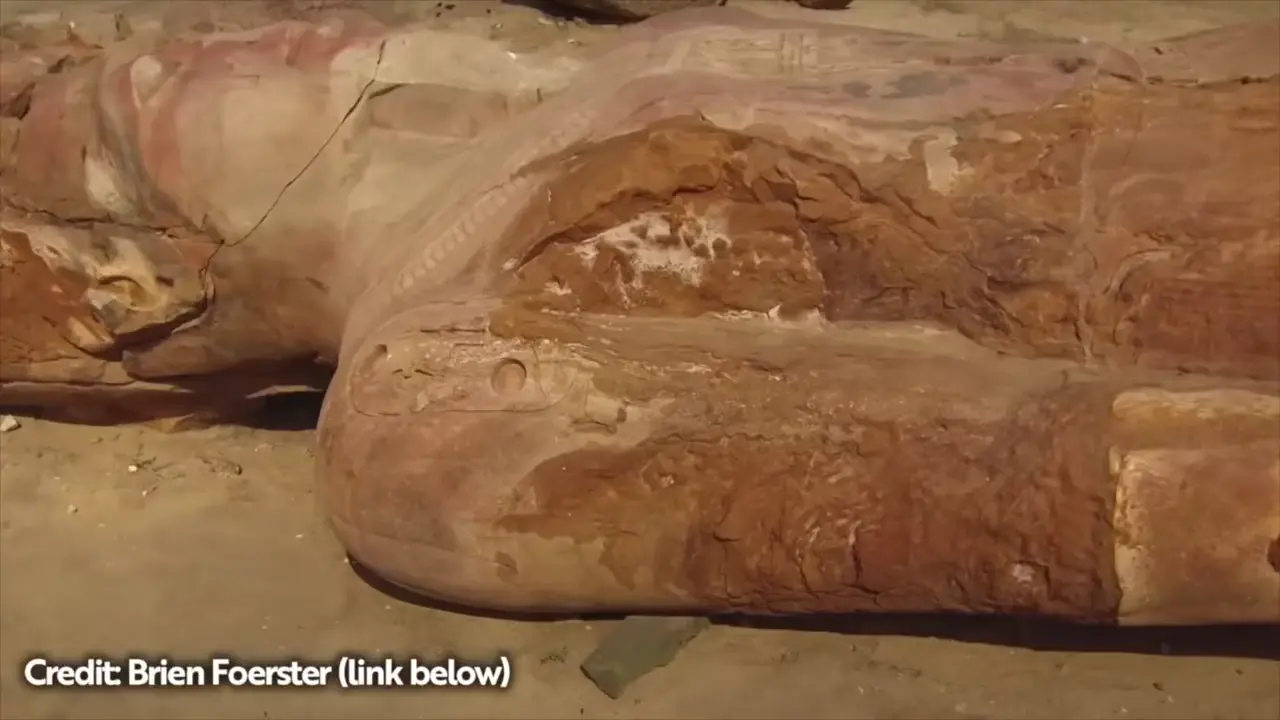
Chronology further complicates attribution. Tanis’s large statues are mainly 21st-Dynasty works, many reused from Pi-Ramesses, so their manufacture and Ramesside origins cannot directly date a burning at Tanis; each statue’s transport, placement, and depositional history must be considered. Pi-Ramesses, identified with Qantir, was a monumental capital built under Ramesses II with enormous royal statues, providing context for later reuse [21] [22]. The video also proposes a violent Byzantine-era earthquake, followed by Tanis’s contraction into a small bishopric, as a non-fire explanation, but the supplied material does not independently establish the earthquake’s date, extent, or relationship to heat damage. The video’s proposed settings—a seventh-century Persian–Byzantine encounter and the Crusader capture in 1168–1169 under Amalric I—are likewise not demonstrated archaeologically. The conjectural transfer of a Greek-fire formula to the Crusaders, and its claimed loss around 1204, remain uncorroborated.
Sources
- Pompeii: remains of two men found in the Porta Stabia …
- Nemrut Dağ
- Archaeologists Uncover Notched Logs That May Be the …
- Ancient DNA from Shimao city records kinship practices in …
- The ‘Osireion’ Temple at Abydos: A unique structure which …
- Who built the Osireion? - Catchpenny Mysteries of Ancient Egypt
- Boscawen-Ûn (Stone Circle)
- Full article: Cahokia’s Mound 72 shell artifacts
- Cahokia: The Bodies at Mound 72 - A Bigger Camera
- Mound 72
- Mound 72
- Ancient bones, teeth, tell story of strife at Cahokia
- The Antikythera Mechanism
- (PDF) The Antikythera Mechanism: From the bottom of …
- The Younger Dryas impact hypothesis: A requiem
- Timing and structure of the Younger Dryas event and its underlying climate dynamics
- Younger Dryas “black mats” and the Rancholabrean termination in North America
- Timing and structure of the Younger Dryas event and its …
- Evidence for an extraterrestrial impact 12,900 years ago that contributed to the megafaunal extinctions and the Younger Dryas cooling
- The Younger Dryas termination and North Atlantic Deep Water formation: insights from climate model simulations and Greenland ice cores
- Pi-Ramesses
- Pi-Ramesses
Videos
V1. World of Antiquity — “Creepiest Finds in Archaeology 2025-2026” V2. MegalithomaniaUK — “The Olmec Head They Never Finished | Megalithomania” V3. MegalithomaniaUK — “The Olmec Head They Never Finished | Megalithomania” V4. MegalithomaniaUK — “The Olmec Head They Never Finished | Megalithomania” V5. MegalithomaniaUK — “The Olmec Head They Never Finished | Megalithomania” V6. Matthew LaCroix — “Do The 5 Statues of Nemrut Contain an Ancient Code that Unlocks Something? | LCP #8” V7. Matthew LaCroix — “Do The 5 Statues of Nemrut Contain an Ancient Code that Unlocks Something? | LCP #8” V8. Matthew LaCroix — “Do The 5 Statues of Nemrut Contain an Ancient Code that Unlocks Something? | LCP #8” V9. World of Antiquity — “Creepiest Finds in Archaeology 2025-2026” V10. The Prehistory Guys — “BOSKAWEN-ÛN - A Cornish Stone Circle Gives up its Secrets” V11. The Prehistory Guys — “BOSKAWEN-ÛN - A Cornish Stone Circle Gives up its Secrets” V12. The Prehistory Guys — “BOSKAWEN-ÛN - A Cornish Stone Circle Gives up its Secrets” V13. IntoTheMap — “I Found a Lost Pyramid Manuscript!” V14. IntoTheMap — “I Found a Lost Pyramid Manuscript!” V15. IntoTheMap — “I Found a Lost Pyramid Manuscript!” V16. Archaeologist Ed Barnhart — “Mississippian Deep Dive” V17. Archaeologist Ed Barnhart — “Mississippian Deep Dive” V18. Ancient Americas — “The Spicy History of the Chili Pepper” V19. Ancient Americas — “The Spicy History of the Chili Pepper” V20. Ancient Americas — “The Spicy History of the Chili Pepper” V21. Ancient Americas — “The Spicy History of the Chili Pepper” V22. Ancient Americas — “The Spicy History of the Chili Pepper” V23. Michael Button — “The Antikythera Mechanism Is Weirder Than You Think” V24. Michael Button — “The Antikythera Mechanism Is Weirder Than You Think” V25. Michael Button — “The Antikythera Mechanism Is Weirder Than You Think” V26. The Cosmic Summit — “What Is the Younger Dryas Impact?” V27. Ancient Architects — “What MELTED the Ancient Egyptian Statues of TANIS?”
Quality Audit — 9/10
Quality Dimensions
✓ spelling✓ week date✗ proper nouns✓ source quality✓ citation format✓ section balance✓ summary accuracy✓ citation coverage✓ academic citations✓ screenshot placementResearch Clusters
Fixes Applied
Proper noun: Boscawen-Un → Boscawen-ÛnProper noun: William Blore → William BorlaseSpelling: Hierotheseion → HierothesionProper noun: Hierothesion → HierotheseionSpelling: Hierotheseion → HierothesionProper noun: Hierothesion → HierotheseionKeep exploring
Every site on this page sits on the globe, and the people who research them are on the Discord.
3D Globe · Sites by country · Story Archive · Research Library · Weekly Journal · Search