

Week of October 19: Khafre Wood Dates to 395–157 BC, Mount Horeb Ring-Ditch, and More
Radiocarbon results reported for the purported Khafre pyramid wood (2215 ± 55 BP, calibrating to 395–157 BC) and an associated thumb bone (1837–1909 AD) show the two samples are not contemporaneous, undercutting any claim of a shared Old Kingdom burial. Mount Horeb Site 1 above Elkhorn Creek in Kentucky is described as an Adena-period circular enclosure with a roughly 105-foot platform, an 8-foot-deep ditch, a 13-foot-wide embankment, and a western causeway, though no Mount Horeb-specific laboratory date supports the 2,000-year attribution. Herculaneum skeletons include a "helmsman" stunted by childhood malnutrition and warped by hard labor alongside a man in his mid-40s with unworked hands but strongly developed arms and shoulders, evidence of upper-body conditioning rather than a proven athletic occupation. At the Osireion, a guide's claim that a dovetail clamp bears Seti I's cartouche remains unauthenticated, with site staff reportedly moving the clamp into storage pending official authentication.
Radiocarbon results reported for the purported Khafre pyramid wood (2215 ± 55 BP, calibrating to 395–157 BC) and an associated thumb bone (1837–1909 AD) show the two samples are not contemporaneous, undercutting any claim of a shared Old Kingdom burial. Mount Horeb Site 1 above Elkhorn Creek in Kentucky is described as an Adena-period circular enclosure with a roughly 105-foot platform, an 8-foot-deep ditch, a 13-foot-wide embankment, and a western causeway, though no Mount Horeb-specific laboratory date supports the 2,000-year attribution. Herculaneum skeletons include a “helmsman” stunted by childhood malnutrition and warped by hard labor alongside a man in his mid-40s with unworked hands but strongly developed arms and shoulders, evidence of upper-body conditioning rather than a proven athletic occupation. At the Osireion, a guide’s claim that a dovetail clamp bears Seti I’s cartouche remains unauthenticated, with site staff reportedly moving the clamp into storage pending official authentication.
Artifact Discoveries
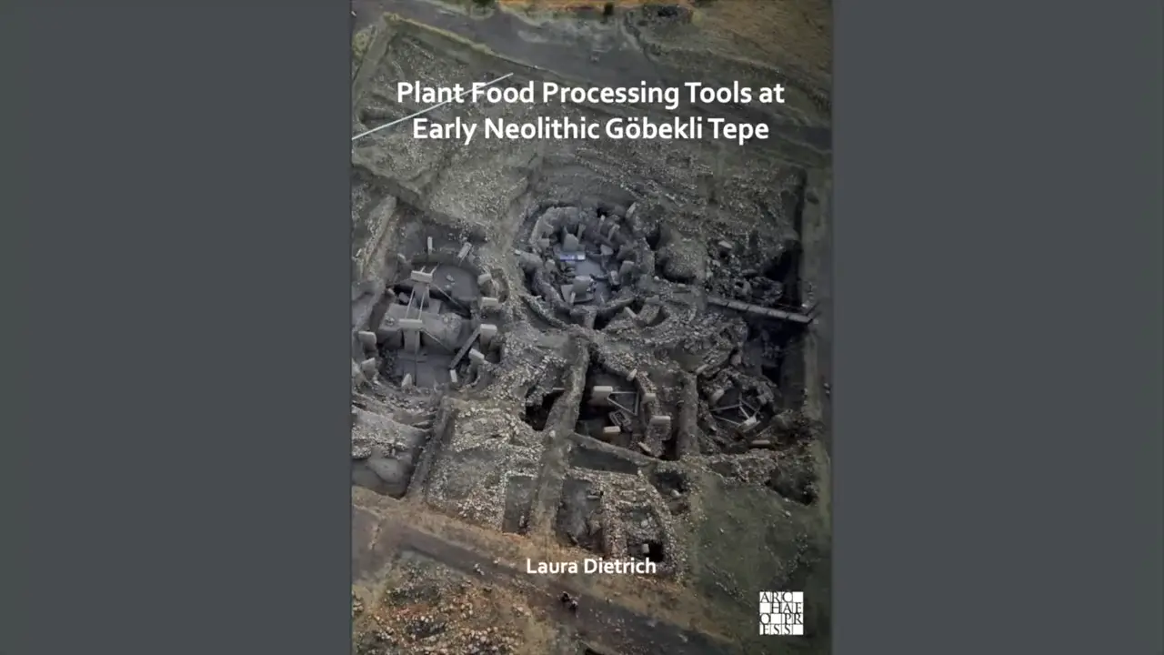
At Tell ‘Abr 3, the stone balls have a reported spatial association with troughs, storage basins, and basalt millstones, making plant- or cereal-processing a plausible interpretation. Laura Dietrich explicitly proposed the balls as heating stones, while Dietrich et al. (2020) describe them as “Burned stone balls.” These publications document a scholarly hypothesis rather than a secure functional identification [V1]. The balls’ dark grey or black appearance cannot presently identify them as burnt basalt: their lithology remains unidentified in the published record supplied here, and burnt limestone is an explicitly raised alternative. Although the 2020 article uses the term “burned” and cites Yartah (2013), the available evidence does not independently confirm that the Tell ‘Abr 3 balls were demonstrably burnt.
Dating & Chronology
The central result is that the reported dates do not place the purported Khafre wood and thumb bone in one contemporaneous context. The wood was reported as 2215 ± 55 radiocarbon years BP, calibrating to a 95% interval of 395–157 BC. That percentage applies to the calibrated interval, not to the probability that the wood was cut, used, or deposited in a particular year. The thumb bone reportedly calibrated to 1837–1909 AD—only 116–188 years old at testing—so, if the sample and its attribution to Khafre are genuine, it belongs to the modern period rather than an Old Kingdom burial.

These measurements date the biological materials; they do not independently establish a construction or entry date, a burial date, or the identity of the person represented by the bone. Old wood can predate its use or deposition, but the supplied excerpt does not establish that this explanation applies to Khafre. A presenter interprets the 395–157 BC interval as evidence for the earliest known post-Old-Kingdom entry into Khafre, drawing on claimed textual silence in Herodotus, Diodorus Siculus, and Pliny; specialists treat this as a low-confidence interpretation rather than an independently demonstrated conclusion. The presenter’s suggestion that the thumb belonged to a worker, a claim linked to the investigations of Howard Vyse and John Perring, likewise lacks an identified individual or documented provenance.

Remote Sensing & Technology
Mount Horeb Site 1 is the Adena-period circular ditch-and-embankment enclosure above Elkhorn Creek near Lexington; it should be distinguished from the broader Mount Horeb complex, which also includes the Peter Village enclosure and several smaller features. A burial mound stood on its circular platform, although available accounts do not independently date the mound or establish that it occupied the platform’s precise geometric center. The often-cited roughly 300-foot measurement describes the smaller inner enclosure as a whole, not the platform; the embankment itself is 13 feet wide. Within it, an approximately 45-foot-wide, 8-foot-deep ditch encircles a circular platform about 105 feet in diameter, and a roughly 33-foot-wide causeway on the western side crosses the ditch zone to provide access [1].

Mount Horeb is conventionally attributed to Adena peoples and broadly described as more than 2,000 years old, although no Mount Horeb-specific laboratory date supports that description; postholes have likewise been interpreted as possible henge evidence without establishing a woodhenge, stone henge, or construction material. Regionally, Biggs Site’s ring-ditch and central-mound layout, Grave Creek’s original ring ditch, the Wolf Plains Group’s burial mounds and ring ditches, and additional LiDAR identifications show a broader Adena landscape [V2]. Regional models estimate that earthen-enclosure construction likely occurred within a span of 170 years or less and report burial mounds as early as 400 BC, but these dates and construction sequences cannot be assigned directly to Mount Horeb because it is not among the excavated sites in that research.
Bioarchaeology & Ancient DNA
Herculaneum’s skeletons preserve sharply contrasting activity histories, but they do not securely identify an athlete. The so-called “helmsman” showed growth stunting from childhood malnutrition, while a lifetime of hard physical work had warped the bones; “helmsman” was only the excavators’ nickname, not documentation of an occupation [V3]. A second man, in his mid-40s, had hands unmarked by manual labor but strongly developed arms and shoulders, with the latter attributed to regular “exercise in the beds.” This supports habitual upper-body conditioning, but no supplied evidence establishes a particular sport, competition, or athletic occupation. The source contrasts the first individual as a laborer with the second as a physically active non-manual worker from the leisure class. That social ranking, however, remains an inference from skeletal markers rather than independently corroborated status evidence.
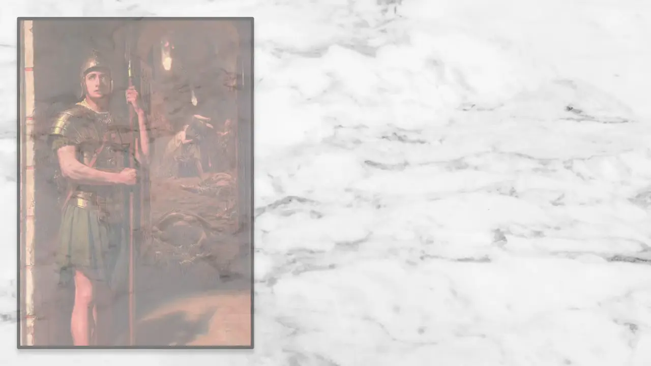
The broader Herculaneum corpus is considerable: scientific investigation began with 1980s discoveries of hundreds of skeletons, including a documented assemblage at the boathouse in 1982. Skeletons also came from varied contexts, such as the House of the Skeleton in Insula III, where one account places a human skeleton in an upper-floor room in 1831 [2]. The physically active man in his mid-40s cannot be securely equated with a separate mid-40s male reported killed near the sea. Although Herculaneum lay beneath more than 20 meters of mud, ash, and other pyroclastic material, that burial context does not mean all bodies shared a deposit, history, or completeness. Skeletons—supplemented by associated objects—are therefore central evidence for health, work, exercise, and social position, not simply death circumstances.
Architecture & Monuments
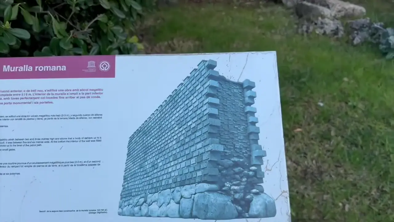
The chronology, however, remains contested. Supplied summaries date the wall complex or its Roman phase broadly to the third century BCE, 217–197 BCE, or the second century BCE, while some local descriptions place the Cyclopean blocks and towers within that Roman phase [3]. A stock-photo caption assigns the Cyclopean walls to the sixth or fifth century BCE, but provides no excavation context, stratigraphy, dating method, or scholarly reference. Thus, Cyclopean construction alone cannot establish a pre-Roman date; the lower core may have an earlier history than the Roman wall, but the supplied record does not independently demonstrate it.
Naville’s 1913 assessment was qualified—it did not prove that the Osireion predated Khafre’s pyramid. He described the Osireion as having a “much more archaic character” than Khafre’s pyramid, adding only that he “would not be surprised” if it were Egypt’s oldest structure. He also acknowledged “as yet no certain indications” of its construction date: its apparent antiquity rested on style, the scale of its materials, and the complete absence of ornament [V4]. More confident about function and location, he said there was “no longer any doubt” that the Osireion was the fountain or building Strabo placed “near the temple,” not part of Seti I’s temple; he stressed corridors whose ceilings were formed from enormous monolithic blocks.

In Brief
The supplied evidence falls short of the video’s headline claim. It argues that cart and rut measurements commonly attributed to the Romans form a continuous lineage predating Rome, implying that Rome inherited a unit of measurement from an earlier civilization; neither that chronology nor that inheritance is independently substantiated by the supplied record [V5]. The video likewise attributes the disputed ruts to sleds rather than wheels and reports a recurring association with wedge-cutting, but no independent experimental, stratigraphic, tool-wear, or sedimentological corroboration is offered.
The video describes a comparative LiDAR workflow: Mike scanned ruts at sites he visited worldwide and sent the scans to Sean Harrison, who assembled them into a large analytical database and a website featuring interactive components and 3D rut models. Yet the site inventory, scan settings, measurement protocol, and validation methodology are not supplied, limiting assessment of that evidence. Modern wheel-cart tracks near Round Rock, Texas, are used as a visual comparison and characterized as much shallower than the Austin-area ruts, but no numerical depths or matched environmental and traffic controls are provided. Independent LiDAR research has identified Roman road alignments [6] [5], but it does not validate the disputed rut chronology, measurement continuity, or sled interpretation. The ancillary references likewise document modern infrastructure applications or a corporate appointment, not archaeological corroboration [8] [7] [4].
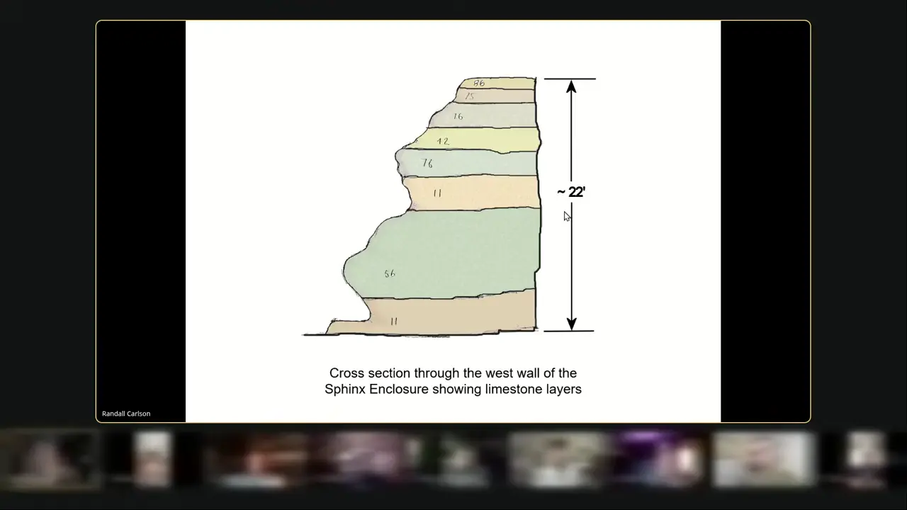
The key point is that the video advances a specific mechanism—preferential dissolution along natural limestone joints and fissures—as an explanation for the west enclosure wall’s vertical fissures, rounded surfaces, and severe erosion; it does not independently demonstrate that joints caused them [V6]. The wall stands about 22 feet above the enclosure floor, and the video presents a published cross-section with a quarry profile superimposed as evidence of extreme erosion. Because the original publication, survey scale, measurements, and quarry-profile basis are unavailable, that figure cannot be independently verified from the supplied material.
Limestone beds of differing hardness make uneven weathering plausible, but no bed-scale hardness, mineralogical, petrographic, or quantitative weathering data show whether differential weathering outweighed joint-controlled dissolution. The proposed runoff pathway assumes that local ground rises toward the west, so water crossing the wall would drain eastward toward the Nile. Schoch’s research page is consistent with the broader context of elevated western terrain and rainfall erosion, but neither source measures flow across the west wall [10]. Ancillary references do not corroborate the mechanism: Britannica’s “finer joints” concern masonry joints in internal walls and outer casing stones, not natural geological joints [11]; the protective walls are under three feet high and distinct from the approximately 22-foot enclosure wall [13]. Deliberate cutting and alignment of the southern enclosure wall show that some enclosure geometry was constructed, although they do not establish the west wall’s original geometry [9]. Finally, one secondary overview characterizes the broader water-erosion hypothesis as fringe, but this is not a mechanism-specific adjudication of joint-guided dissolution [12].
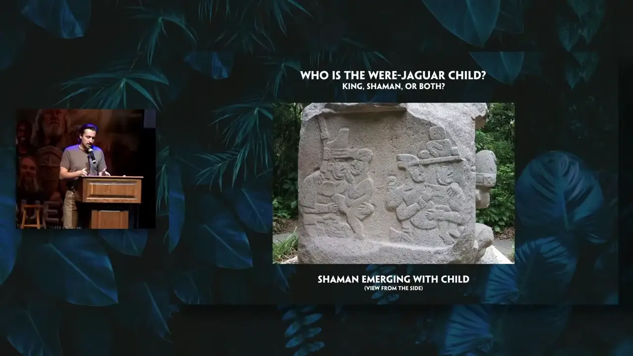
La Venta’s altars do not establish the video’s cave-emergence and literal-event claims: Altar 5 shows a human holding a limp, possibly dead were-jaguar baby, with the frontal figure wearing a jaguar-skull headdress; death or sacrifice remains disputed [V7] [16] [14]. Were-jaguars are a widespread, variable Olmec motif: nearly feline forms coexist with figures bearing almond eyes, downturned mouths, and cleft or V-shaped heads, so not every image represents one biological hybrid or infant scene [15]. The Altar 4 description places a human below two meeting serpent heads, but identifies neither were-jaguar nor childbirth.
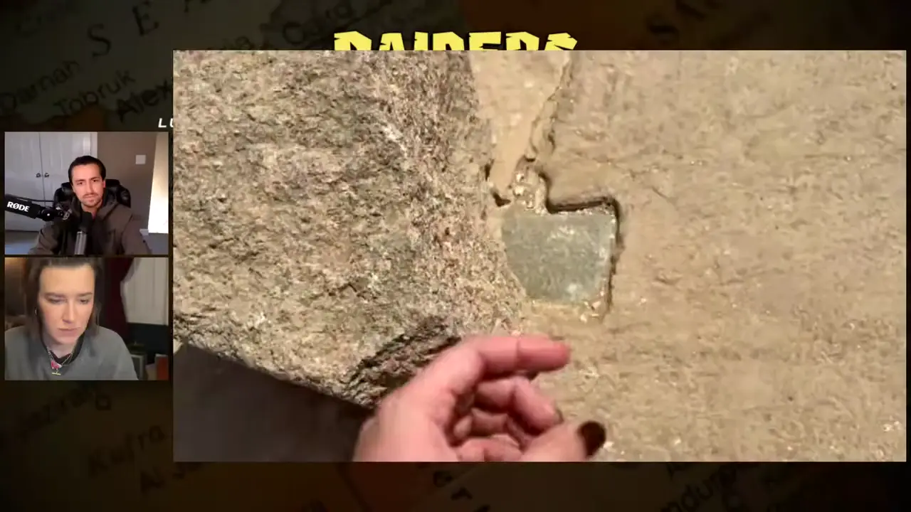
At the Osireion, the guide’s claim that a dovetail clamp bears Seti I’s cartouche remains an unauthenticated field report, not an established inscription. Site staff reportedly moved one allegedly inscribed clamp into storage pending official authentication; the presenters said the publication record was unclear [V8]. Photographs from roughly 60–70 years ago were said to show an upside-down clamp with the cartouche, but the images, their provenance, and a legible view were not supplied, so the corroboration remains testimony rather than independently inspectable evidence.
Dovetail and tenon features are independently attested: the Frankfort re-excavation account describes a chip in the northwest wall exposing part of an internal dovetail clamp, without stating that it was inscribed [17]. A secondary webpage offers a historical lead, reporting that Henri Frankfort found Seti I’s cartouche in a granite dovetail joint and mentioning another cartouche-bearing tenon in a sandstone-wall context. Yet without a primary excavation citation, artifact number, photograph, inventory entry, or current location, it cannot authenticate the guide’s claim.
Seti I’s name is separately reported in connection with the entrance approach, although one overview says the main interior blocks are uninscribed [19]. The Osireion’s conventional identification as a cenotaph or symbolic tomb of Seti I is an independent interpretation [18]. Even if the clamp inscription were authenticated, it would not distinguish original construction from a later royal repair: the presenters acknowledged both possibilities and treated the half-finished smoothing of the rear walls for hieroglyphs as evidence of at least one refurbishment phase.
After excavating Ballowall Barrow, Borlase built up the stonework to display the excavated remains and created the circular passage that visitors now walk through between the central mound and the apron [22] [V9]. The masonry visible today is therefore not a single prehistoric monument: its principal dry-stone walling is nineteenth-century work associated with Borlase, while the walls behind it are reported to be roughly 4,000 years old. The surviving structure is an incomplete composite, with part of the original central cairn now lost and unspecified discrepancies in Borlase’s account.
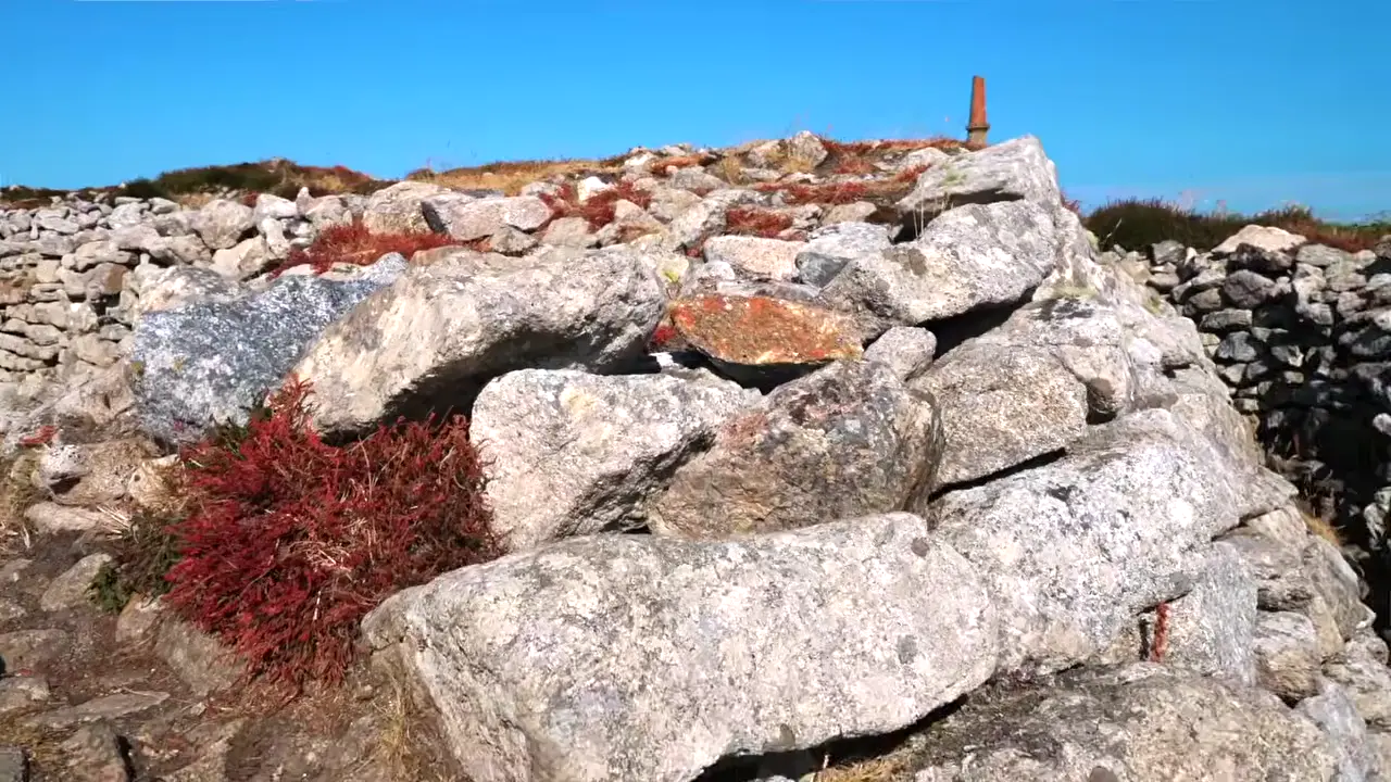
The prehistoric baseline was itself not a single, untouched construction. The prehistoric remains record Neolithic and Middle Bronze Age funerary practices, including repeated rebuilding or extension, so “original fabric” already embodies several phases [23] [20]. Borlase’s excavation belongs to the late Victorian period: one account dates his discovery of the site to 1878, while another places his work in the late nineteenth century; however, the supplied evidence does not explicitly date the masonry intervention itself [21] [24]. Because Borlase inserted an artificial corridor and some prehistoric material was lost or displaced, the modern visitor route cannot serve as a direct proxy for the original sealed cairn. The resulting experience has consequently been described as far less dramatic than the monument Borlase encountered was likely to have been.
The video’s claim—that a Siberian “cosmic hunt” featuring a mammoth may date to roughly 40,000 years—is a low-confidence astronomical hypothesis about the wider motif, not an established date for that variant. It rests on a reconstruction placing Ursa Major near the horizon on 2 November 40,000 years ago, and the supplied scholarship does not independently establish or date the mammoth substitution [V10]. The video counts 128 Cosmic Hunt versions divided into mythemes—hunter, animal, attempted killing, and transformation into constellations—but the count cannot be reproduced without its query, criteria, and coding protocol. Another presentation calls the motif 30,000 years old, and the evidence cannot adjudicate between that figure and the video’s proposed range of more than 25,000 to about 40,000 years.
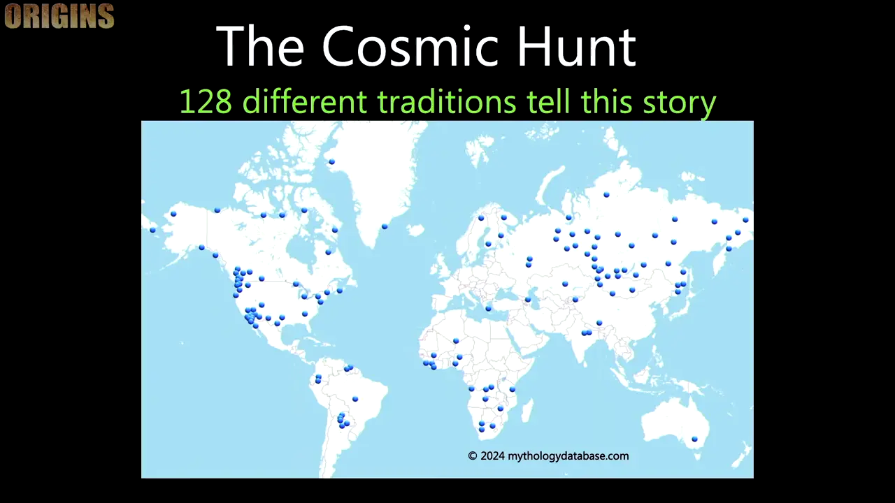
Scholarship places the motif in northern and central Eurasia and the Americas, while its apparent absence elsewhere depends on the corpus’s multilingual coverage and collection practices [30] [26] [28] [27]. Most versions identify the four-star bowl of Ursa Major as the animal and the three-star Dipper handle, including Mizar–Alcor, as the hunter; variants also describe three hunters with a dog or identify Orion as the hunter, and the rarity of explicit stellar identifications prevents any single mapping from dating the whole tradition. D’Huy’s phylogenetic project supports relative comparisons among narrative variants, while a secondary summary groups Siberian and Native American versions together; neither supplies an absolute 40,000-year chronology, site-level archaeological dating, nor support for the proposed Beringia route [25] [29]. A separate migration-era reading likewise does not connect two variants to the mammoth form.
According to the supplied secondary account, Reisner recorded three levels at G3a, four at G3b, and a smooth-sided, completed pyramid at G3c; he found no evidence of a tomb or original burial in any of the three and classified G3c as a functional pyramid rather than a tomb [V11]. The account does not define the criteria or function behind that classification. It describes G3c’s entrance as featuring a composite three-level step pyramid with a broad top and says Reisner recorded T-shaped forms in its layout. These are reported observations, not independent corroboration: biographical and institutional sources document Reisner’s prominence at Giza but do not verify the specific architectural, burial, functional, or reuse claims.
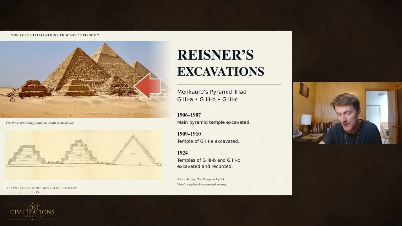
Even so, the negative finding must be stated narrowly: heavy erosion and pillaging at G3c, plus exposed bedrock at its base, mean an original tomb or burial might no longer be detectable. This rules out an unqualified claim that the structures were never buried, but does not contradict the narrower claim that no original burial was found. The video reportedly links this reuse to Reisner’s interpretation that a structure predated the dynastic period, without identifying which structure or providing dating or stratigraphic evidence. The idea that G3a and G3b’s stepped forms progressed to smooth-sided G3c as a deliberate design sequence is the presenter’s interpretation, not explicitly Reisner’s. The Taurus “G3c” references are lexical false matches involving a firearm and provide no archaeological evidence [34] [32] [35] [33] [31].
Sources
- Mount Horeb Earthwork
- Herculaneum III.3. Casa dello Scheletro or House …
- The Walls (Archaeological Promenade) (MHT)
- Sean Miles HARRISON personal appointments
- Roman Roads Discovered by LiDAR in the UK
- Examples of segments of Roman roads identified from the …
- Infrastructure Technology Podcast: How LiDAR is changing …
- How LiDAR Is Changing Infrastructure Project Monitoring
- The Great Sphinx of Egypt: Nature’s Shabby-Chic Trick?
- Robert M. Schoch: Research Highlights The Great Sphinx
- Great Sphinx of Giza | Photos, Nose, Facts, Age …
- Sphinx water erosion hypothesis
- Scientists unearth protective walls around Sphinx
- La Venta
- Olmec Figure of a Werejaguar , c. 900 to 500 BCE
- La Venta Park, Tabasco, Mexico
- The Osireion Investigation: Egypt’s Most Misunderstood …
- Osireion
- The unexplained Osireion: Ancient Egypt’s most mysterious …
- Ballowall Barrow - Heritage Gateway - Results
- Ballowall Barrow - AllDaysOut!
- History of Ballowall Barrow
- Ballowall Barrow, St Just, Cornwall | English Heritage
- Places to see in Cornwall - Ballowall Barrow
- The Cosmic Hunt Myth: One Story Tracked Across the Bering …
- Cosmic Hunt: Variants of Siberian-North American Myth
- the cosmic hunt: variants of a siberian – north-american myth
- Area distribution of the third variant of the Cosmic Hunt tale. …
- a phylogenetic reconstruction of a Palaeolithic mythology.
- THE COSMIC HUNT: VARIANTS OF A SIBERIAN
- Taurus G3C: Full Review
- Taurus G3 vs G3c: Does Size Matter More than Price?
- Taurus G3C Review: Ditch Your G2C? [Hands-On + Video]
- Taurus G3c Pistol Review - Handguns
- Taurus G3c vs G2c
Videos
V1. Ancient Architects — “Mysterious 11,000-Year-Old Coloured Stone Balls Discovered” V2. Archaeologist Ed Barnhart — “Adena Pyramids in Ohio” V3. toldinstone — “Diseases of the Roman Emperors” V4. Luke Caverns — “Egypt’s Strangest Archaeological Site: The Osireion (with Jahannah James)” V5. DeDunking — “Side Quest for Ancient Civilizations Recap” V6. The Randall Carlson — “How Old Is the Sphinx?” V7. Luke Caverns — “The Olmec Civilization: A Deep Dive (4 Hour Compilation)” V8. Luke Caverns — “We’re going BACK to Egypt! (2027 Tour)” V9. The Prehistory Guys — “THE BALLOWALL BARROW. A 5,000 Year Old Burial Mound in Cornwall.” V10. MegalithomaniaUK — “Finding Our Oldest Stories | Tracing Mythology to the Roots of Humanity | Jon F. White | Origins” V11. Matthew LaCroix — “Are These Giza Pyramids the Missing Key to the Egypt Code? LCP#7 - Matthew LaCroix”
Quality Audit — 9/10
Quality Dimensions
✓ spelling✓ week date✓ proper nouns✓ source quality✓ citation format✗ section balance✓ summary accuracy✓ citation coverage✓ academic citations✓ screenshot placementResearch Clusters
Fixes Applied
Citation: correctedBalance: correctedScreenshot: correctedBalance: correctedBalance: correctedBalance: correctedBalance: correctedKeep exploring
Every site on this page sits on the globe, and the people who research them are on the Discord.
3D Globe · Sites by country · Story Archive · Research Library · Weekly Journal · Search