

Week of November 9: Great Pyramid SAR Scan Matches Chambers, Ötzi Axe Purity, and More
A live SAR tomography evaluation inside the Great Pyramid produced anomalies aligning with the plotted positions of the King's and Queen's Chambers, though the result remains provisional, the raw scan data and processing specification are missing, and the negative-control area was unverified. 2022 helicopter LiDAR over the Casarabe culture in Bolivia's Llanos de Mojos mapped 26 sites — 11 of them previously unknown — including the large settlements of Cotoca (~315 hectares) and Landívar (~147 hectares), plus kilometre-long raised causeways, canals and reservoirs. Two Nature ancient DNA studies, adding 712 new genomes to a 4,587-person time transect, identify an unrecognized migration into Scandinavia around 4,000 years ago and Urnfield-related ancestry expanding west into France, Britain and northeastern Spain around 3,200–2,800 years ago, while Ötzi's 99.3% copper axe purity, the Shigir Idol's creation-myth reading, Dispilio's proposed proto-writing, Malta's Classical-period cart ruts and Banteay Kdei's Garuda bridge all drew closer scrutiny.
A live SAR tomography evaluation inside the Great Pyramid produced anomalies aligning with the plotted positions of the King’s and Queen’s Chambers, though the result remains provisional, the raw scan data and processing specification are missing, and the negative-control area was unverified. 2022 helicopter LiDAR over the Casarabe culture in Bolivia’s Llanos de Mojos mapped 26 sites — 11 of them previously unknown — including the large settlements of Cotoca (~315 hectares) and Landívar (~147 hectares), plus kilometre-long raised causeways, canals and reservoirs. Two Nature ancient DNA studies, adding 712 new genomes to a 4,587-person time transect, identify an unrecognized migration into Scandinavia around 4,000 years ago and Urnfield-related ancestry expanding west into France, Britain and northeastern Spain around 3,200–2,800 years ago, while Ötzi’s 99.3% copper axe purity, the Shigir Idol’s creation-myth reading, Dispilio’s proposed proto-writing, Malta’s Classical-period cart ruts and Banteay Kdei’s Garuda bridge all drew closer scrutiny.
Artifact Discoveries
Ötzi’s reported 99.3% copper purity does not demonstrate metalworking beyond that achieved through known smelting. The axe is securely associated with an early Copper Age burial context radiocarbon-dated to about 5,300 years ago [4]; its 99.3% purity lies at the extreme upper end of the reported 98.5–99.3% range for early smelted copper and below the cited approximately 99.5% theoretical maximum [1]. The accounts do not yield a harmonized assay value: one reports 99.3% from a 1999 assay, while a secondary account gives 99.7% for a Swiss blade said to match Ötzi’s, without reconciling sample, method, corrosion correction, rounding, or the basis of that match [2].

The arsenic-smelting explanation is also unsettled. Arsenic commonly occurs in early smelted copper with silver and nickel, so its presence does not by itself prove a special refining process. Rick Osmon argues in his recorded presentation that no published arsenic process reaches the reported purity, that Michigan copper contains little arsenic, and that the axe’s assay excludes a Tuscan origin; these are video positions rather than independently corroborated findings, while the anomaly and ceiling remain premises of his challenge [V1]. The proposal that Ötzi smelted the axe inferred occupational involvement from substantial arsenic in both the axe and his hair; later reporting says he probably did not work metal himself, while tooth strontium and Central Italian links likewise provide context rather than direct proof of the axe’s ore source [3].

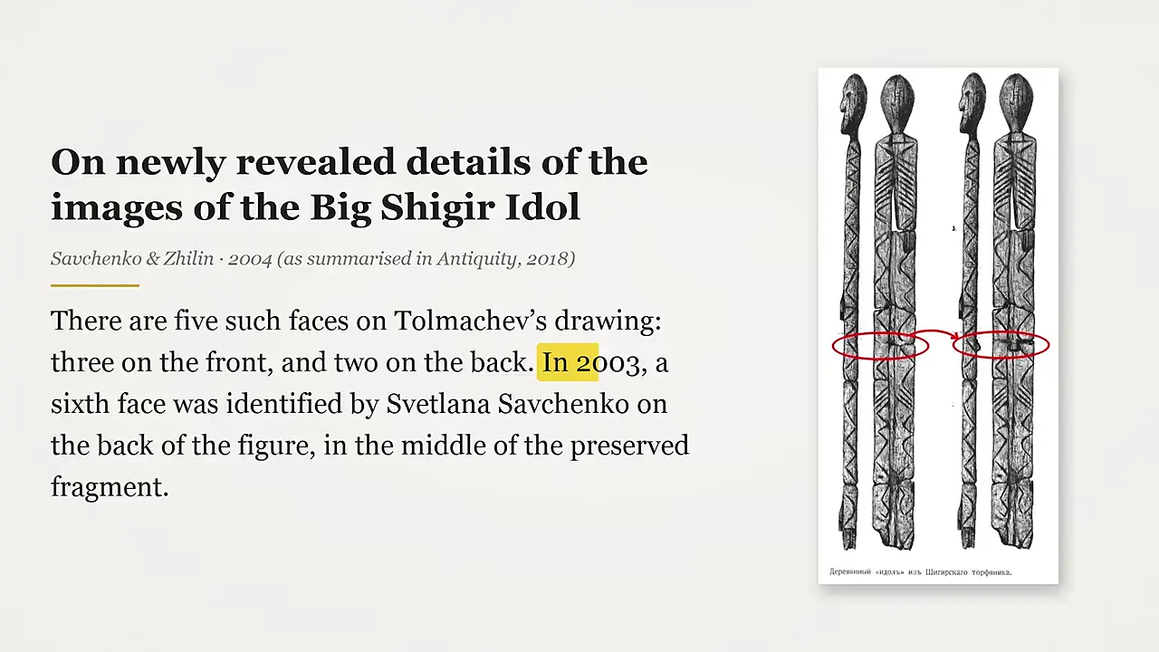
The central interpretive divide is between Svetlana Savchenko’s claim that the Shigir Idol’s decoration encodes the creation myth of the people who carved it and Natalia Chekirina’s view of the carving as a representation of the universe as a whole [V2]. Savchenko’s 2022 scheme assigns the main head to a universal creator, the double zigzags to water, plant forms to vegetation, and the branching lower section to an owl symbolizing the sky; a snout-face on the back stands for the animal world, making the composition a depiction of people and their surroundings. Chekirina also proposes a cosmological interpretation, but it is presented without a component-by-component mapping, making the specific contrast difficult to test.
Dating & Chronology
Ancient DNA does not overturn Yamna’s role in early Indo-European dispersal; the paired Nature studies instead focus on later migrations associated with the formation of Germanic and Celtic populations and languages. The Copenhagen and Leiden teams combined 712 new genomes with published data, creating a 4,587-person time transect across roughly 5,000 years of Bronze and Iron Age Europe [7]. Crucially, they identify an unrecognized migration into Scandinavia around 4,000 years ago, probably involving an Eastern Scandinavian group that crossed the Baltic and spread widely around 3,500 years ago; the crossing remains probable, not established [V3].

The proposed sequence includes movement south from Scandinavia into Poland, Germany, and the Netherlands about 2,000 years ago, then back from northern Germany and Jutland into Denmark and southern Sweden about 1,500 years ago during Old Norse formation; those populations were close relatives of Anglo-Saxon ancestors. Willerslev and McColl suggest that the Scandinavian movement may have carried a Germanic-language precursor roughly 800 years later than traditional Yamna chronology, but this is inferred rather than direct genetic evidence of speech. Celtic dispersal is most strongly supported by eastern, Urnfield-related ancestry expanding west into France, Britain, and northeastern Spain around 3,200–2,800 years ago, though this does not establish language; a western or Atlantic component remains possible. Norway’s continuity alongside Old Norse formation suggests language spread through contact, not only wholesale replacement. Viking-Age Scandinavians were genetically heterogeneous, with gene flow into Scandinavia from southern and eastern Europe around AD 750–1050 [6] [5].
The archaeological match intensity index (AMII) comparison of a French peat core’s lead-isotope sequence points to a geographically mixed, temporally shifting metal network rather than an exclusively Iberian one [V4]. The two-metre archive came from the Digonnière peatland in the Massif du Pilat, about 1,055 m above sea level and roughly 12 km south of Saint-Étienne—not from Digonnière bog. It preserves roughly 6,000 years of atmospheric fallout, including microscopic lead particles whose isotope ratios can be compared with ore-source signatures. In a Science Advances paper published in October, the team matched the sequence against an ore-field database. The first major signal, around 3,700–2,200 BCE, centres on Laurion and the Cyclades; the Iron Age pattern shifts toward the Massif Central, Rhineland, German uplands, and Britain.
Remote Sensing & Technology
A reported hilltop complex in Peru’s Cusco region, broadly near Cusco and Machu Picchu, was spotted while browsing Google Earth and Google Maps. Its location remains independently unverified because no coordinates, map, or reproducible geolocation were provided [V5]. The complex is described from satellite imagery as occupying a hill that descends into a valley, with a buried square feature roughly 20 m (60 ft) across and a larger circular anomaly about 33 m across. That is closer to 108 ft than exactly 100 ft; both dimensions are provisional visual estimates, and “arena” is an informal label, not evidence of function.
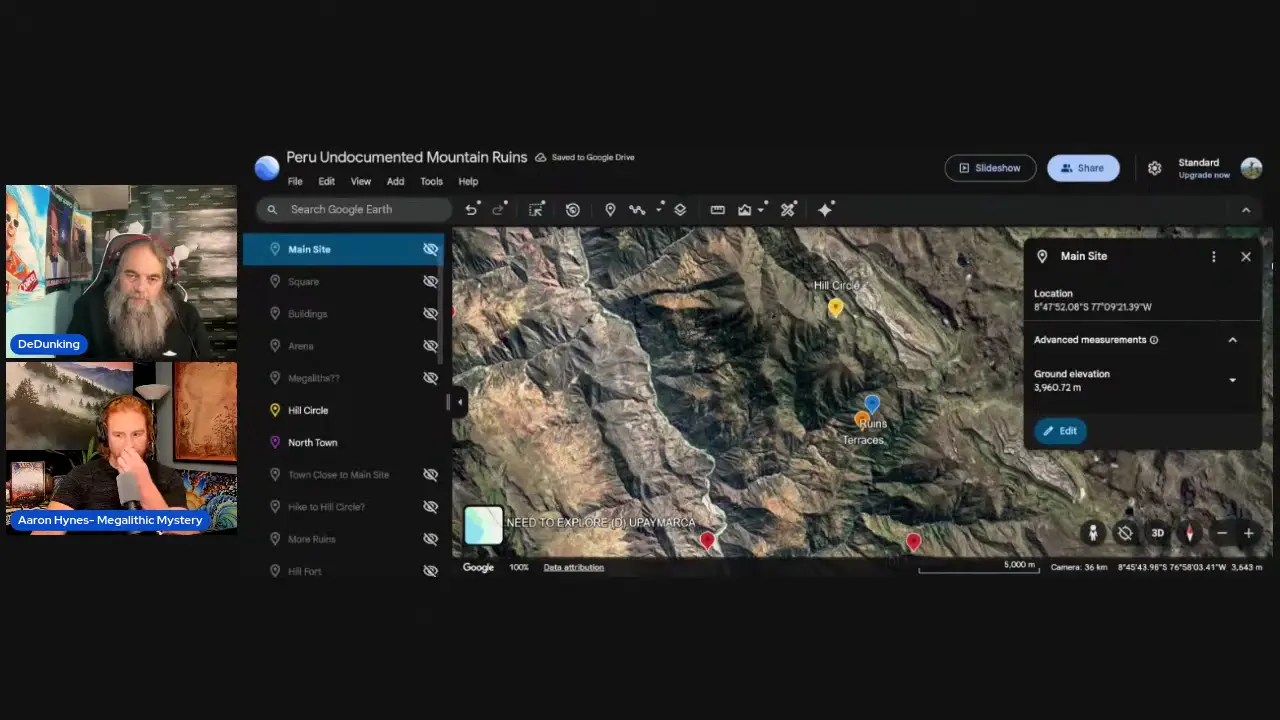
The presenter reports finding neither a registration nor government photographs in Peru’s Ministry of Culture records, but this remains an undocumented search: no database name, date, terms, extract, or official confirmation is supplied. Reported visits by residents of a nearby village suggest possible prior familiarity, though the community is unnamed and no interviews or records substantiate this. The supplied general Cusco-area guides do not separately list the complex; omission from those excerpts cannot prove legal non-registration or absence from national and scholarly catalogues. National Geographic’s T’aqrachullo reference concerns a different excavated settlement, so it cannot corroborate this complex’s antiquity or affiliation [8]. A separate remote Andean candidate with concentric rings about 37 m across has no supplied location or survey record, and claims that it remains uninvestigated are speculative; the wider assertion that remote sensing is exposing overlooked Cusco sites likewise remains presenter testimony.
The 2022 helicopter-borne LiDAR survey revealed a connected, hierarchically ranked Casarabe settlement pattern that the Nature study characterised as a previously undescribed form of tropical low-density urbanism—an analytical classification that does not itself establish that these settlements were cities comparable to later state capitals [15] [13] [11]. By modelling ground returns separately from vegetation, the survey produced terrain models that exposed settlement geography beneath the forest canopy [V6]. The known Casarabe settlement horizon extends roughly from AD 500 to AD 1400 across the savanna–forest mosaic of the Llanos de Mojos [9]. Six surveyed portions yielded 26 sites, including 11 previously unknown; because coverage was partial, this is not a complete regional inventory [12].

Cotoca and Landívar were the two particularly large mapped settlements, covering approximately 315 and 147 hectares, respectively, although these extents do not imply that every mapped hectare was densely built or continuously occupied. LiDAR also exposed raised causeways extending for kilometres, along with canals and reservoirs interpreted as water-management infrastructure, although their hydraulic functions were not independently validated. Major settlements contained monumental platforms and pyramid-like mounds, some reaching about 22 metres in height; the evidence does not establish that all were masonry-built, single-phase, or specifically funerary. The area then known to contain Casarabe culture was reported to cover approximately 4,500 square kilometres [10]. A separate 2025 demographic model estimated that Casarabe society eventually supported 10,000–100,000 people within roughly 5,020 square kilometres, but this was not a direct population count from the LiDAR survey [14].
Inscriptions & Texts
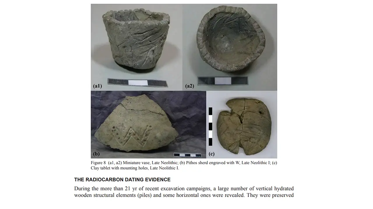
A presenter proposes that the Dispilio signs could constitute a proto-writing system, combining tally-like marks with signs for a person or ownership and a trade-related symbol, but this remains an argued interpretation rather than a decipherment [V7]. Waterlogging and restricted oxygen are proposed to explain the wooden tablet’s survival, implying—untested—that comparable marked wooden objects elsewhere may have decayed beyond detection. The video also invokes Magdalenian bones with 21 distinct signs and a reported symbolic system dating to approximately 40,000 years ago; without sign-by-sign concordance or underlying primary documentation, however, these remain broad analogies rather than demonstrated connections.
Ancient Art
Banteay Kdei’s bridge in Cambodia is described as a Garuda bridge rather than a naga bridge because Garuda dominates the composition; this is a descriptive identification, not a demonstrated formal category of ancient Khmer monument. In the presenter’s reading, the sandstone carving gives Garuda at least three layers of feathers. The bird grips naga serpents with its feet and carries further nagas in its arms, while three naga heads appear along the bottom and four along the top. Its handrails take the form of elongated, large naga bodies resembling anacondas. These detailed observations have not been independently checked against measured drawings, rubbings, or a specialist sculptural catalogue [V8].
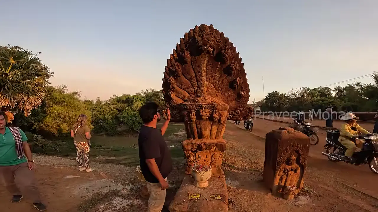
A separate textual account of an enormous Garuda riding a three-headed serpent broadly corroborates the site’s Garuda-and-serpent theme, but it does not confirm the proposed arrangement of feet, arms, seven heads, feather layers, or handrails; “riding” also differs from “grasping or carrying.” The presenter’s uniqueness claim is similarly bounded: he says this is the only Garuda bridge he has encountered among the dozens of Cambodian and other Southeast Asian temples covered by his channel, not proof of absolute regional uniqueness. Banteay Kdei as a complex is generally placed in the twelfth to early thirteenth century and linked with Jayavarman VII’s reign and Buddhist religious programme; this does not independently date the bridge [18] [17] [16]. Finally, the proposed mythic opposition and kundalini interpretation is a modern presenter-led explanation, not an established original Khmer meaning.
In Brief
The Newark Octagon opened for full public access on January 1, 2025—an access milestone, not a new UNESCO proclamation. It is part of the Hopewell Ceremonial Earthworks property inscribed by UNESCO in December 2023; the evidence does not establish that the same opening date or access regime applied to the Great Circle, High Bank, or every parcel of the Newark property [V9]. The three earthworks are attributed to Hopewell builders and broadly dated to about 100 BCE–400 CE, a range that cannot date every surviving bank.
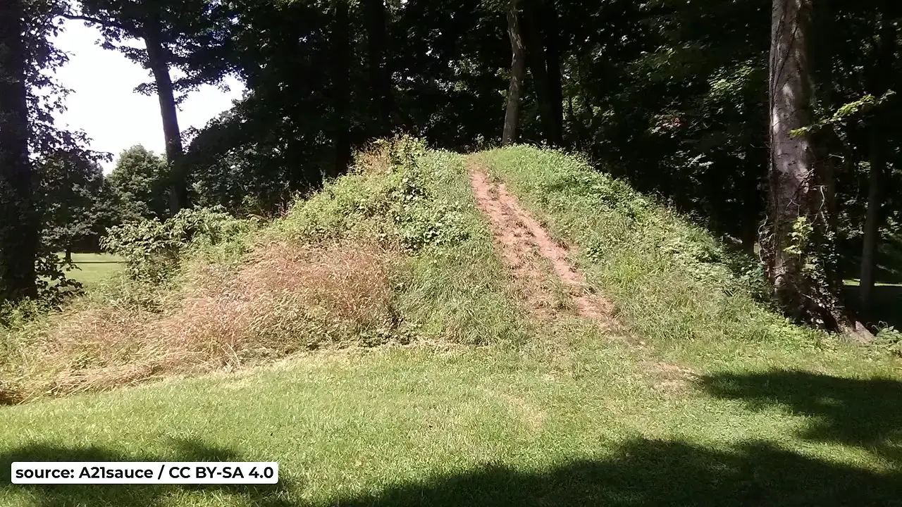
LiDAR and colour-coded elevation imagery made the Octagon and Great or Observatory Circle mappable despite poor visibility in conventional aerial photographs, but they do not independently establish age, buried depth, ceremonial function, or an exact ground plan [19]. The former Mound Builders Country Club enclosed the Octagon and superimposed an 18-hole golf course over the earthworks; the course reportedly helped protect the remains, but its grading and later alteration complicate interpretation. Common figures are about 50 acres for the Octagon and 20 for the Great Circle, linked by a passageway; High Bank covers about 30 acres. One source gives the Octagon nearly 70 acres, so measurements remain source-dependent [20]. Original berms are described as roughly 6–8 feet high, but erosion and disturbance have reduced them; Barnhart’s estimate that 90 percent of the complex was lost is not independently verified here. Astronomical alignments remain published interpretations, not LiDAR-proven findings.
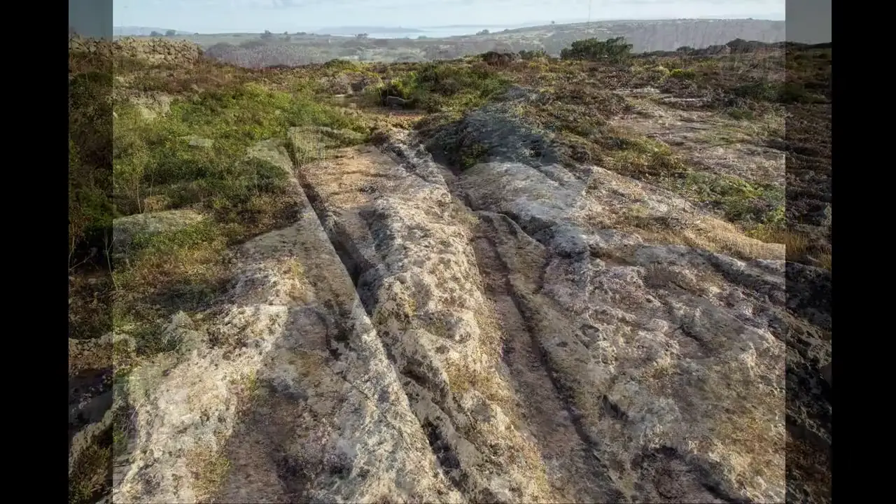
The 2026 survey led by Joel Grima concludes that Malta’s cart-rut system, viewed across Malta and Gozo, is predominantly a Classical-period transport network rather than a chiefly prehistoric one [V10] [21] [24]. This is an aggregate conclusion, not a declaration that every rut is Roman: some tracks are securely Roman and many more can be assigned to the broader Classical period from their context, but most individual pairs remain insecurely dated. The survey found no solid evidence confirming a prehistoric date for any pair, although a prehistoric origin remains possible for some tracks. In the study’s chronology, “Classical” spans roughly 700 BC to AD 870–880 and includes Phoenician, Punic, Roman, and Byzantine phases.
The team reached this result by combining drone photography, digital mapping, satellite imagery, excavation records, and digitized models of ruts compared with nearby structures and rock formations [22]. Relative relationships provided the chronology: researchers asked whether ruts lead toward temples or Roman villas, whether quarries cut across them or are themselves cut by them, and whether roads were laid over them. The project documented 2,628 distinct tracks extending about 31 miles across more than 200 sites—the largest survey of Malta’s cart ruts conducted to date [23]. Because the grooves are cut into bedrock and contain no organic material, they cannot be radiocarbon dated directly; their dates must instead be inherited from associated archaeological and stratigraphic contexts.
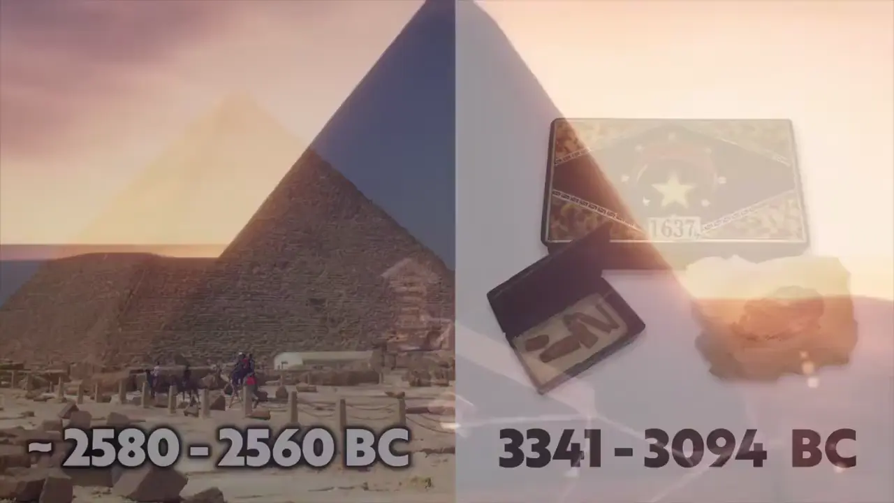
The most significant result is a preliminary positional match: in a live control test of the SAR method, two tomograms—one centred on the pyramid’s east face and another approximately 11 metres farther south—were intended to cut through the King’s and Queen’s Chambers. When the processed images were superimposed on an east–west cross-section, anomalies appeared at the chambers’ plotted positions [V11]. The presenters also reported no anomalous features in a purported chamber-free negative-control area, arguing that the method did not generate random false positives.
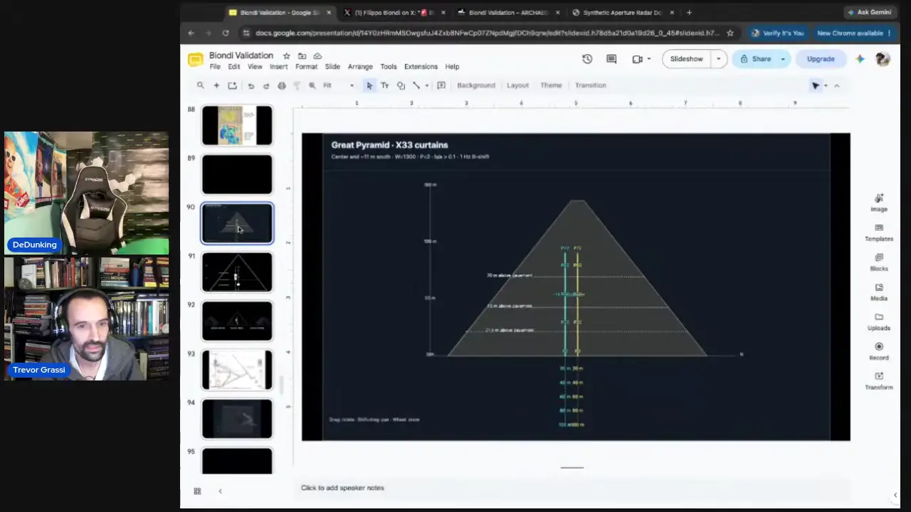
That alignment remains provisional rather than an independently verified three-dimensional detection or localisation. The tomograms’ positional accuracy was not documented to survey-grade standards, while the negative-control area’s location and chamber-free status were also unverified. A separately published SAR scan was interpreted as showing the Grand Gallery rising through the pyramid and was described by the presenters as the clearest example of the method’s output; however, the supplied material lacks raw scan data, a complete processing specification, and independent replication. During the live evaluation, no completed professional assessment was available, the technical paper remained in preparation, and the demonstrated processing might not exactly reproduce the patented protocol chain. Cosmic-ray and muon tomography studies of a large internal void concern a different technique and therefore do not independently corroborate the reported SAR anomalies [25]. The other cited references address business strategy and comparative political economy, not archaeological or radiometric evidence [26].
Lawson’s page-33 episode records a frightening nocturnal disturbance, not an attack. His party was awakened by “the dismalst and most hideous noise that had ever pierced my ears,” while an unnamed Indian pilot explained that such noises were customary in the swamp. The passage associates panthers, tigers, wolves, and other beasts with the swamp by day and says they came “in whole droves” to hunt deer at night, but it reports no assault, injury, pursuit, attempted entry into camp, or attack on provisions; “endless numbers” is qualitative, not a population estimate [V12].
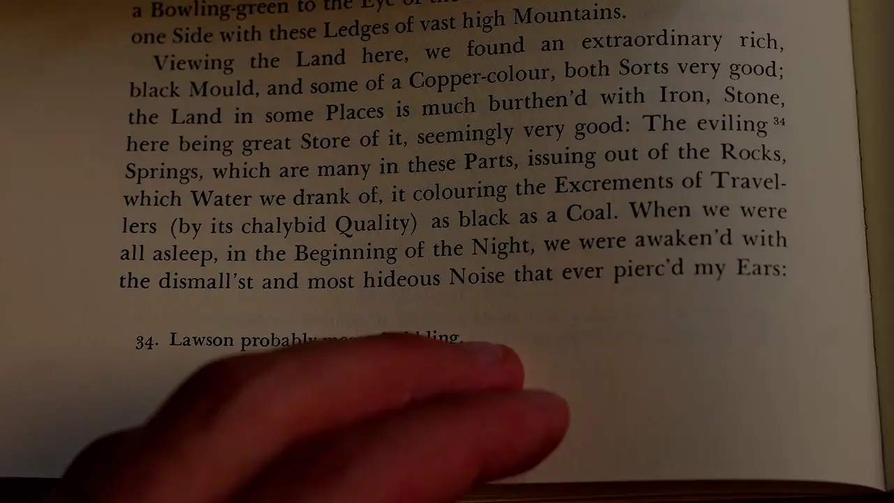
The account therefore cannot establish that these animals attacked anyone at Lawson’s camp. The presenter’s suggestion that Indian guides supplied the panther–tiger distinction remains unverified: the pilot is unnamed, his terminology is not quoted, and the passage does not establish how that distinction entered the text. Likewise, identifying the “dismal” sound as a cougar or catamount scream is the presenter’s claim, unsupported by independent acoustic or faunal evidence in the supplied material. The video’s assertions that no inland wolves remain in the Carolinas and that fewer than 30 Carolina red wolves survive on the North Carolina coast are also uncorroborated here. An available excerpt from Lawson contains “hideous scrietch and noise,” but its context cannot securely be linked to the swamp disturbance [28]. Lawson’s roughly 550-mile backcountry journey began on December 28, 1700, and included encounters with Native peoples, providing the broader setting for his reliance on a local guide [27].
Sources
- Ötzi’s Copper Axe Reconsidered: Purity, Provenance, and …
- Copper axe blade found in Switzerland matches Iceman’s
- Ice Man, Ötzi: A treacherous murder with links to Central Italy
- New evidence from the Alpine Iceman’s copper axe | PLOS One
- Population genomics of the Viking world Scandinavian …
- The Vikings had a mishmash of genes from all over Europe
- Tracing the spread of Celtic languages using ancient …
- Finding the Inca’s lost citadel
- DAI - LIDAR reveals pre-Hispanic low-density urbanism in …
- (PDF) Lidar reveals pre-Hispanic low-density urbanism in …
- Lidar reveals pre-Hispanic low-density urbanism in the …
- Lasers reveal ancient urban sprawl hidden in the Amazon
- Early urbanism found in the Amazon — University of Bonn
- Constraining the population size estimates of the pre … - PMC
- Lidar reveals pre-Hispanic low-density urbanism in the …
- Banteay Kdei - ANGKOR TEMPLES IN CAMBODIA
- Banteay Kdei Temple Guide - The Citadel of Chambers
- Banteay Kdei
- lidar assessment of the newark earthworks
- Celestial Masterpieces: Hopewell Ceremonial Earthworks …
- UM study challenges theories of cart ruts’ prehistoric origins
- News - Wheel Ruts in Malta Analyzed
- The chronology of the Maltese cart ruts: a critical evaluation …
- Most Maltese cart ruts date to the Classical era, not …
- Cosmic rays passing through Great Pyramid help reveal …
- What To Do (and Not to Do) with Time-Series Cross-Section Data
- John Lawson and the Native Peoples of Carolina
- Deodat Lawson
Videos
V1. Institute for Natural Philosophy — “Rick Osmon” V2. Michael Button — “12,100 Years Ago, Someone Left Us a Message” V3. The Prehistory Guys — “LIVE ~ PREHISTORIC ARCHAEOLOGY NEWS From Around the World | 14/11/2026 14:00 GMT” V4. The Prehistory Guys — “LIVE ~ PREHISTORIC ARCHAEOLOGY NEWS From Around the World | 14/11/2026 14:00 GMT” V5. DeDunking — “Newly Discovered Ruins & Jujitsu: Live with Aaron Hynes” V6. Michael Button — “We May Have Missed an Entire Type of Civilisation” V7. Timeless with Fred Snyder — “So much more than just the tablet | 5k BC Dispilio Writing” V8. PraveenMohan — “𝐒𝐧𝐚𝐤𝐞 + 𝐒𝐜𝐢𝐞𝐧𝐜𝐞 = 𝐒𝐩𝐢𝐫𝐢𝐭𝐮𝐚𝐥𝐢𝐭𝐲?” V9. Archaeologist Ed Barnhart — “LiDAR Shows Hidden Pyramids in the USA – Part 2” V10. Curious Being — “Malta’s Cart Ruts: Do they rewrite history?” V11. DeDunking — “Evaluating the Biondi SAR Method with Trevor Grassi LIVE” V12. Luke Caverns — “This book from 1709 says Appalachian Jaguars Existed”
Quality Audit — 10/10 ✓
Quality Dimensions
✓ spelling✓ week date✓ proper nouns✓ source quality✓ citation format✓ section balance✓ summary accuracy✓ citation coverage✓ academic citations✓ screenshot placementResearch Clusters
Fixes Applied
Citation: correctedScreenshot: correctedScreenshot: correctedProper noun: Donier → DigonnièreSpelling: environmental match intensity index → archaeological match intensity indexKeep exploring
Every site on this page sits on the globe, and the people who research them are on the Discord.
3D Globe · Sites by country · Story Archive · Research Library · Weekly Journal · Search