

Week of November 2: Oldest Shipwreck Claim at Kekova, Shamuka's Hittite Tablets, and More
A wreck off Kekova Island in Antalya, Turkey, lying about 30 m below the surface, yielded more than 30 amphorae and three large stone anchors with no surviving wooden hull, and its 4,400–4,700-year typological range makes it a strong contender for the world's oldest shipwreck, edging the long-standing benchmark at Dokos. Excavations at Shamuka in central Anatolia produced 131 cuneiform tablets and fragments in 2026, raising the reported total to 184 with 53 comparable finds from earlier years, and the corpus is presented as the most extensive Hittite royal archive of the twenty-first century, attributed to the reign of Tudhaliya II roughly 3,400 years ago. At Los Azules I in northern Spain, an adult man lay on his back with hands over his pelvis in a stone-filled grave stained with red ochre, accompanied by painted pebbles, antler harpoons, and marine shells, dated to around 9000 BC and supporting a funerary role for Azilian painted pebbles. Also reported: a University of Malta assessment led by Joel Grima placed most of Malta's 2,628 cart ruts over nearly 50 km in the Classical period, while LiDAR America imagery was said to reveal a roughly 50-foot earthen form at Emerald Mound in Illinois near Cahokia.
A wreck off Kekova Island in Antalya, Turkey, lying about 30 m below the surface, yielded more than 30 amphorae and three large stone anchors with no surviving wooden hull, and its 4,400–4,700-year typological range makes it a strong contender for the world’s oldest shipwreck, edging the long-standing benchmark at Dokos. Excavations at Shamuka in central Anatolia produced 131 cuneiform tablets and fragments in 2026, raising the reported total to 184 with 53 comparable finds from earlier years, and the corpus is presented as the most extensive Hittite royal archive of the twenty-first century, attributed to the reign of Tudhaliya II roughly 3,400 years ago. At Los Azules I in northern Spain, an adult man lay on his back with hands over his pelvis in a stone-filled grave stained with red ochre, accompanied by painted pebbles, antler harpoons, and marine shells, dated to around 9000 BC and supporting a funerary role for Azilian painted pebbles. Also reported: a University of Malta assessment led by Joel Grima placed most of Malta’s 2,628 cart ruts over nearly 50 km in the Classical period, while LiDAR America imagery was said to reveal a roughly 50-foot earthen form at Emerald Mound in Illinois near Cahokia.
New Excavations & Fieldwork
The strongest evidence comes from the reported Los Azules I burial in northern Spain: an adult man lay on his back with his hands over his pelvis, accompanied by painted pebbles, antler harpoons, and marine shells. This direct association supports treating the pebbles as grave goods or funerary objects, although their exact placement and symbolic function remain unknown [V1]. The stone-filled grave measured about 2 m by 0.80 m; its bottom was stained with red ochre, larger slabs covered the legs, and it was cut into cave sediments sloping toward the rear [1]. The reported date of around 9000 BC fits the broad c. 10,000–7,000 BC chronology assigned to the Azilian painted-pebble tradition, but no direct dating evidence is supplied for the grave or its pebbles [V2].
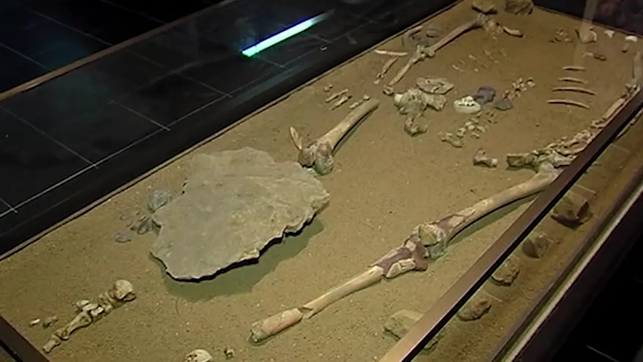
More generally, Azilian painted pebbles are small, flat stones, often 4–10 cm across, painted with red iron-oxide geometric motifs, but these class-wide traits cannot be assigned confidently to the Los Azules specimens without an item-level description. The tradition extended across dozens of sites in France, Spain, Italy, and Switzerland, while Los Azules fits a broader Cantabrian Mesolithic pattern of individual inhumations in pits. The wider corpus is imperfectly documented: more than 2,000 examples are catalogued, many without secure context; Couraud classed 264 of 1,392 stones as indeterminate and 260, about 19 percent, as fakes [V4]. Although sign combinations in that corpus appear non-random and have inspired a possible lunar-month interpretation, the evidence does not establish a calendar, and the proposed prehistoric alphabet is not generally accepted [V3].
Artifact Discoveries
At Abri Blanchard in France’s Dordogne, a bone fragment or plaque bears pits, incisions, and repeated geometric marks, yet the supplied excerpts lack a complete sign inventory or full technical examination. Its age remains unsettled: some accounts give about 28,000 years, while others retain approximately 35,000–40,000-year attributions, and no supplied primary dating report reconciles the discrepancy [V6] [V5]. Alexander Marshack interpreted the sequence as lunar notation, and that attribution remained prominent in later literature; this establishes the history of the interpretation, not the correctness of an astronomical decoding. The two Cave Script pages go further, claiming that the lunar phases match the bone and that it depicts both lunar and solar cycles; because both pages belong to the same project, the supplied material offers no independent corroboration [2] [3]. Assertions that the marks tracked phases across successive months or embodied notation transmitted through generations remain interpretations rather than independently demonstrated findings.

Portugal’s reported 40–45 artifacts, described as “100% pure copper,” along with several at about 99.8% purity, have been relayed rather than independently reproduced [V8]. Perdigões is the leading candidate for “Purig” in southwestern Iberia, though sources never equate the names. A peer-reviewed study examined 26 artifacts and found almost pure copper using nondestructive ED-XRF with Monte Carlo correction. This fits third-millennium metallurgy, not a direct date for “Purig.” The archaeologist has led excavations for about 25 years; fieldwork continues, so counts may change. Ricardo’s 99.7% native-metal cutoff is not established: the program cites smelted oxhide ingots at 99.9%, so purity alone cannot distinguish native, smelted, refined, remelted, or recycled copper [V7]. The evidence cannot establish that Iberian mines could not achieve such purity; the rock-chip study concerns historic mines, not ancient ore or prehistoric production limits [4].
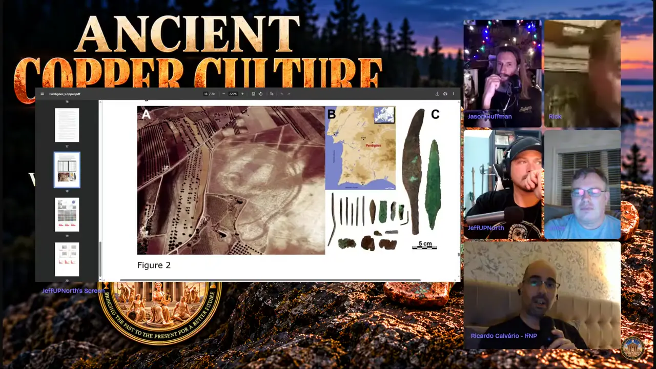
Poverty Point is the largest and most complex Archaic-period earthwork site in eastern North America and the type site of its culture, but this establishes no Portuguese connection [5]. The parallels in palisades, mound-cap-like timbers, driven logs, and a henge-like plan remain part of a panel interpretation, with no measured plans, sections, or excavation publication supplied. Portuguese blades resemble Old Copper Culture knives and spear points, yet no Portuguese provenience, compositional match, or transmission route has been demonstrated. LA-ICP-MS, instrumental neutron activation analysis, and trace-element comparisons could test the proposal, but no cross-site fingerprint links the assemblage to Poverty Point or Old Copper Culture copper.
Dating & Chronology
A University of Malta assessment led by Joel Grima places most of Malta’s cart ruts in the broad Classical period, defined here to include Phoenician, Punic, Roman, and Byzantine phases; it is therefore not a claim that every groove is Roman. The finding applies to the network as a whole: the study found no evidence for a prehistoric origin, while leaving open the possibility that some ruts began earlier. A classical context can also date a phase of use or preservation rather than the initial cutting of a groove [V10].
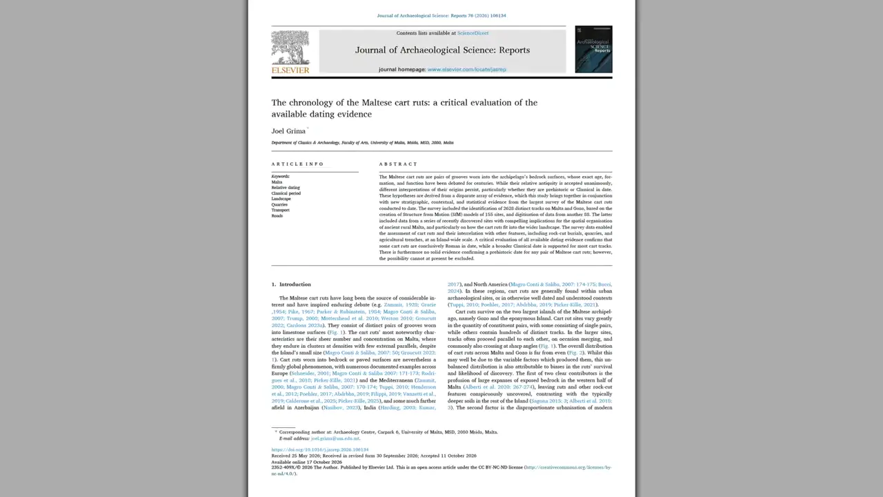
Grima’s chronology combines digital surveying, excavation, statistical analysis, historical records, structural comparisons, and 3-D models derived from drone and ground photography. The surveyed assemblage comprises 2,628 tracks over nearly 50 kilometres across Malta and Gozo: 228 sites were examined, 155 modelled, and 82 historically recorded locations have since been destroyed or have become inaccessible. At Domus Romana, ruts predate successive Roman road surfaces; at Talaroka, a route is bracketed between classical quarrying phases; and at Il Corton, ruts cross a warehouse threshold and align with a Roman harbour complex. These are relative contextual associations, not direct dates for every incision [V9]. The study favours long-term traffic abrasion beneath shallow soil, potentially from repeated metal-rimmed wheels, over deliberately carved guide grooves, although form alone cannot prove cart use or date an incision. A paper arguing against a predominantly Roman origin provides a counterposition, but its limited documentation makes it unclear whether it contradicts Grima’s broader, non-Roman-specific conclusion.
Remote Sensing & Technology
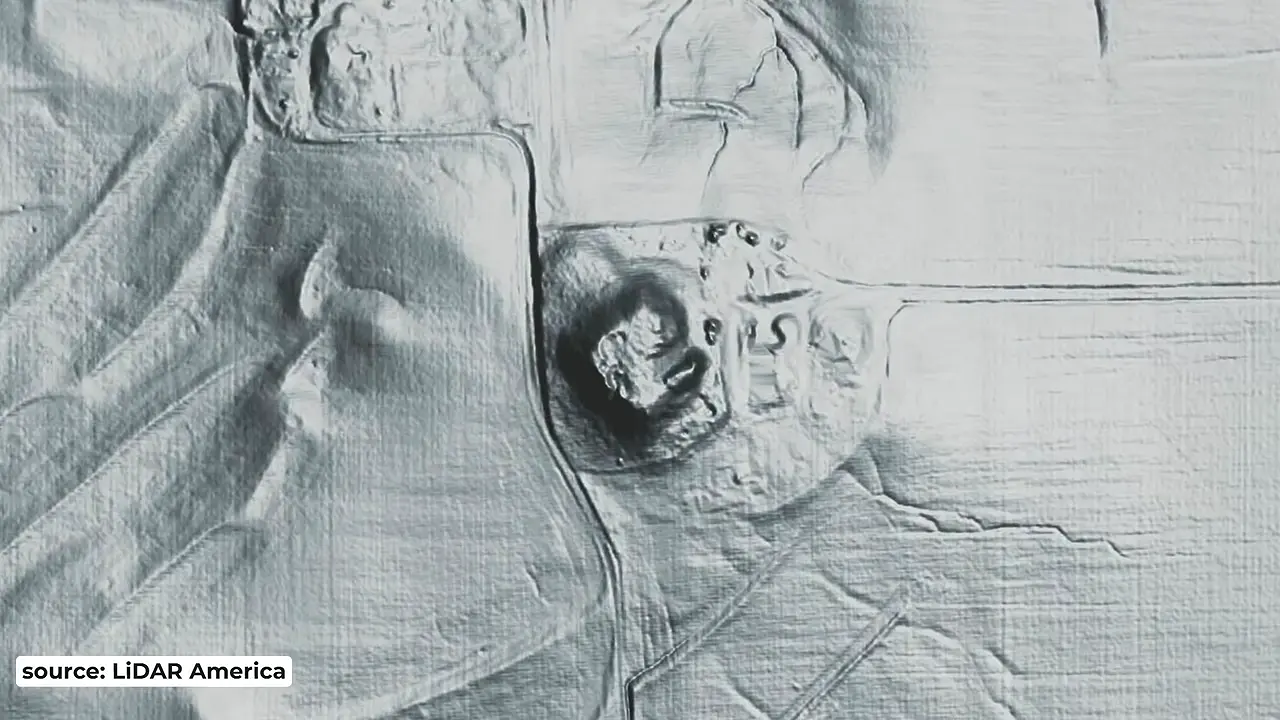
Barnhart’s presentation attributes a roughly 50-foot-high earthen form—approximately 300 by 300 feet, or about two football fields—at Emerald Mound to LiDAR America imagery [V11]. A published figure, credited to the Illinois State Archaeological Survey, presents the wider “Emerald Acropolis,” labeling a borrow area and a now-defunct spring. The dimensions are presentation-level, not corroborated by excavation: the figure gives none, while area estimates require spatial reconciliation. A second reported pyramid, about 30 feet high outside the main view, also lacks independent documentation.
Underwater Archaeology
The wreck off Kekova Island in Antalya, Turkey, is a strong contender for the world’s oldest shipwreck, but “4,700-year-old” is not a precise or securely proven date. Archaeologists place it within a typological range of about 4,400–4,700 years based on its amphorae; without reported radiocarbon dating, the claim remains provisional, and if the proposed chronology is accepted, the wreck would predate the long-standing benchmark wreck at Dokos by a few centuries [V12] [8] [7] [11]. At approximately 30 metres below the sea surface, the site yielded more than 30 amphorae and three large stone anchors, although no wooden hull survived; underwater archaeologists from Akdeniz University participated in recovering the ceramics [9].
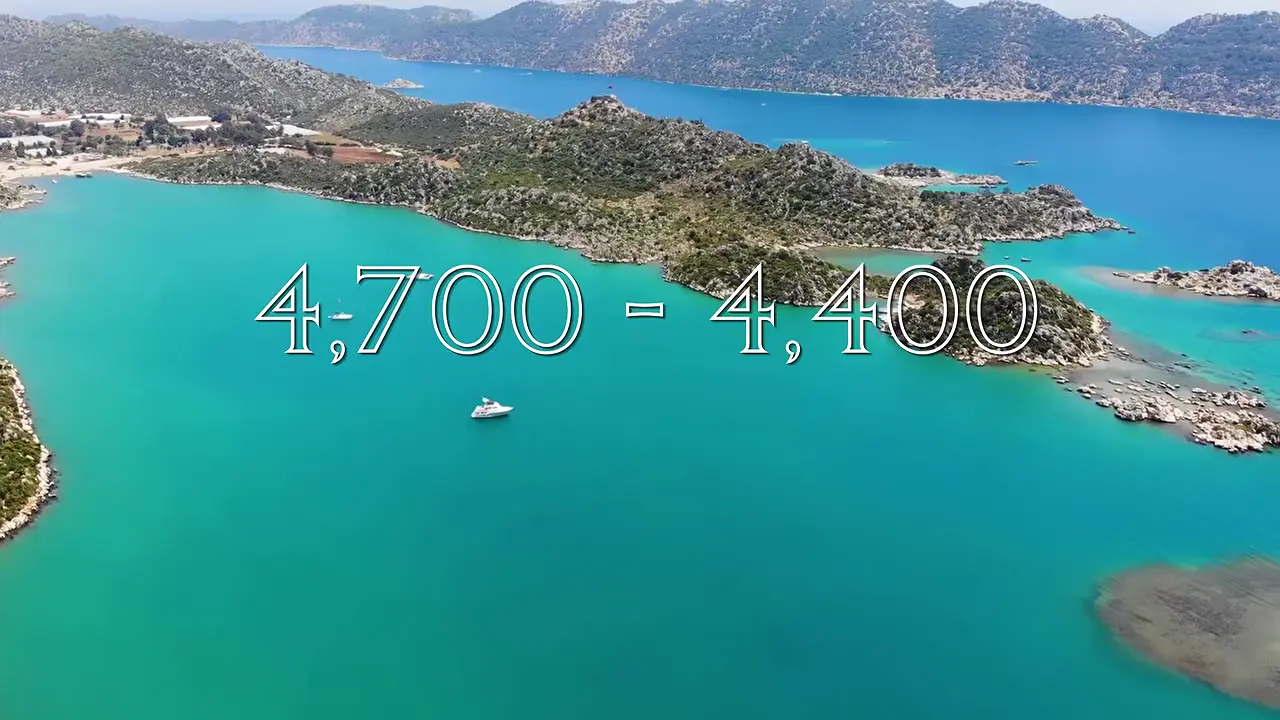
From the surviving remains, archaeologists estimate the vessel at about 10 metres long and interpret it as a trade ship, while its actual cargo remains uncertain: glossy residues in some intact amphorae could indicate olive oil, wine, or tree resin, but analysis was still under way. A voyage from the eastern Mediterranean toward Troy or Minoan Crete has been proposed, but this remains speculative, and the available evidence does not establish a direct connection with Troy [6]. One recovered amphora is also unusual in bearing nine distinct markings and two holes in its body, although the significance of these features remains unknown [10].
Architecture & Monuments
The video’s striking visual case for Puma Punku’s precision is qualitative rather than a measured engineering demonstration. It concentrates on precision-cut H-blocks and describes cut stone scattered across a plateau nearly 13,000 feet above sea level, but the supplied material gives no dimensions, tolerances, joint-fit measurements, surface-finish data, quarry marks, or tool-trace analyses, and the two excerpts come from one upload rather than independent corroboration [V13] [V14]. The dating debate is likewise reported more clearly than demonstrated: the video says mainstream archaeology attributes Puma Punku’s construction to Tiwanaku, while unidentified voices push its history substantially farther back; none of the specialists treats those excerpts as establishing the older chronology, and no date, stratigraphy, construction sequence, artifact assemblage, named proponent, proposed date, or analytical method is supplied. Other descriptions nevertheless place the H-blocks within a formal T-shaped complex of plazas, ramps, and gateways near Tiwanaku’s ceremonial core, not simply an isolated field of stone.
Inscriptions & Texts
In 2026, excavations at Shamuka in central Anatolia yielded 131 cuneiform tablets and fragments. With 53 comparable finds from earlier years, the cumulative total reaches 184, but this is not a count of intact or independently legible documents. Presented as a Hittite royal archive, the corpus is described as the most extensive Hittite archive of the twenty-first century; without a comparative inventory or inclusion criteria, however, that ranking remains an attributed report rather than an independently verified conclusion [V15]. The tablets are attributed as a whole to the reign of Tudhaliya II, roughly 3,400 years ago, although the basis for the attribution and approximate date is not supplied.
Ancient Art
The repeated downward-reaching hand position in the shrine reliefs is iconographically consistent with bhumisparsha, the earth-touching mudra: standard descriptions explain the gesture as the Buddha calling on Earth to witness his attainment of enlightenment, while the video interprets the episode as his overcoming of Mara [V16]. The identification remains provisional, resting on the video’s visual reading rather than independent architectural, archaeological, or photographic examination. The ensemble includes seated Buddhas, several figures making the gesture, and one figure who appears to bow or surrender before a Buddha. That figure has not been securely identified as Mara, an earth witness, a donor, an attendant, or another participant. Even laterality is inconclusive, since references disagree over whether the mudra uses the right or left hand.
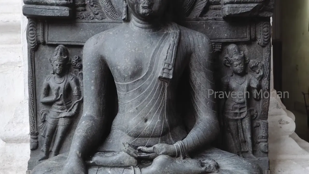
The exterior yoni-like object is likewise unresolved: lacking both a lingum and an obvious projecting spout, it could be a yoni with a missing lingum or a pedestal intended for a Buddha image. A smaller nearby shrine provides only a possible comparison, with a large headless standing figure described as a Buddha beneath an umbrella and another empty base resembling a yoni; no physical join, dimensional match, or original installation relationship is documented. Because the figure is headless, elongated earlobes, ushnisha, and urna cannot be assessed, so its identification as a Buddha cannot be independently checked [12]. All monument-specific observations derive from the same narrated video, not an excavation report, artifact catalogue, measured record, or independent photographic survey, leaving the object’s function and the bowing figure’s identity unresolved.
In Brief
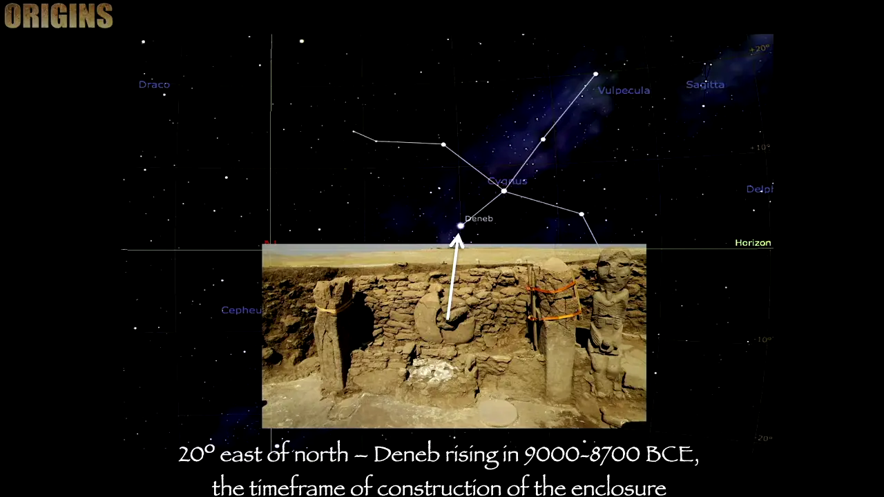
Collins’s central claim is that Karahan Tepe’s new upper enclosure alignment matches Deneb’s rising around 9000 BCE, but this is presented as an archaeoastronomical interpretation, not an established measurement. In the video, Collins traces a Deneb-setting line from the Great Ellipse/Structure AD through the portal stone toward Keceli Tepe and extends the proposal to Göbekli Tepe’s portal stones, but Pillar 43’s approximately 9600 BCE Cygnus–Scorpius sky-map overlay supplies comparative context, not confirmation [V18] [V17]. The video also reports a small vulture found in situ near the altar and later housed in the Şanlıurfa Archaeological Museum, although the bird’s provenance is not independently documented.
A modern experiment establishes that an abrasive-assisted copper-pipe drill can cut a circular groove in granite, although progress was slow and shallow. A section of copper plumbing pipe was worked in a back-and-forth seesaw motion while quartz sand and about a gallon of corundum were fed between the pipe and the stone; roughly one pound supplied downward pressure. The first session produced a full circular groove. Penetration reached only about 1/16 inch after 15 minutes and 3/8 inch by day four, after more than seven cumulative hours; no completed deep cylindrical hole or extracted core resulted. Approximate toothpick-marker readings came from a non-independent video account [V19] [V20] [V21].
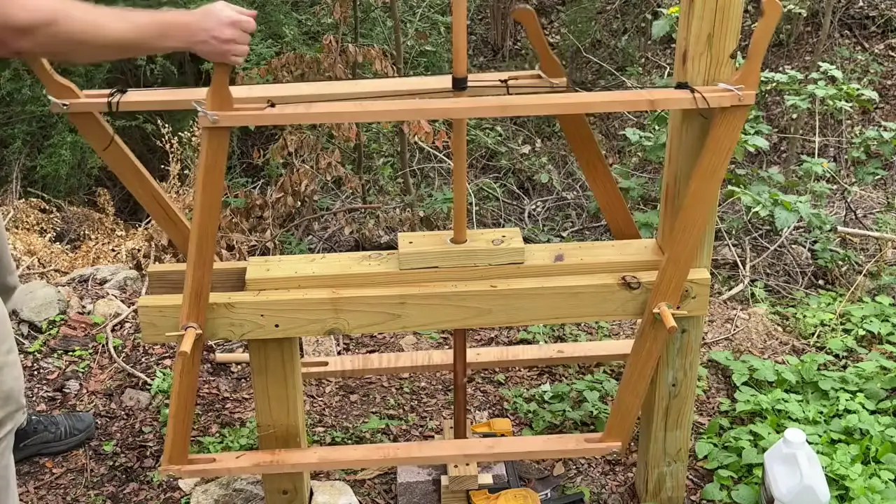
Cutting depended on concentrated, replenished grit. A small clay collar roughly doubled the rate compared with a wide moat; a constant grit column reduced wear, and the grit batch was rinsed and replaced every five minutes. Too little grit increased wear, while excess water and dilution from rain reduced consistency. Changes in vibration through the rope and handle qualitatively signaled when grit or water needed attention, but no thresholds were reported. Alignment was critical; the rig did not work effectively on its side [V22]. Most importantly, this establishes mechanical feasibility rather than an artifact-identical reconstruction. No direct archaeological evidence supports the experimental collar, and cited overviews report no recovered tubular copper barrels or wooden drill shafts used for rock coring in ancient Egypt or Mesopotamia. Non-recovery does not prove such components never existed; the Penn Museum source leaves ancient tool geometry and abrasive systems unidentified.
Within the supplied record, the video advances a 2024 genetics-and-pollen argument for Rapa Nui–Peru contact, but neither its source audit nor the reception literature documents that result as accepted, proven, replicated, or disciplinary consensus; it remains an unverified hypothesis, although the corpus’s silence cannot prove that no publication exists [V23]. The ancient-DNA evidence described is older and narrower: a news account identifies DNA from 12 Rapa Nui skeletons as Polynesian, while a 2016 synthesis places the first settlers’ arrival from the west around AD 1200–1253. Given the sparse data, this is not a comprehensive 2024 genomic survey; the pattern neither excludes every small, later, or otherwise unrepresented contact episode nor demonstrates direct, intentional travel from Peru. The truncated Popular Archaeology excerpt cannot identify the population, attribute contact to Peru, or reveal the peer-reviewed methods.

Any pollen-based contact interpretation would require secure archaeological context and chronology, controls, and assessment of taxonomic ambiguity, local or introduced pollen, natural or animal-mediated transport, stratigraphic mixing, and contamination. The 2019 Rull review predates the 2024 result [13]. Reception shifted from cautious interest in the late 1930s–1940s to sharp rejection after the expedition. Kon-Tiki demonstrated the feasibility of long-distance seafaring from the Americas, not a prehistoric Peru-to-Rapa Nui journey.
Menkaure’s GIII-a subsidiary pyramid is a plausible but not independently proven candidate for Norden’s “fourth pyramid” [V26]. If accepted, it would reclassify one of the nine pyramids already counted at Giza—three main and six subsidiary—rather than establish an additional lost main pyramid. GIII-a is the only one of Menkaure’s three subsidiary pyramids built as a true pyramid, and its large squared summit block on a pedestal offers the strongest physical correspondence. Yet the Vyse attribution comes through the video, not his original reasoning, while the comparison lacks dimensions, masonry analysis, and engineering testing.
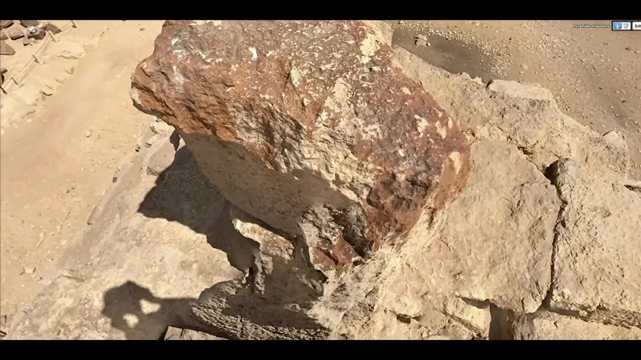
Norden’s fourth structure, slightly west of the main alignment, was about 100 feet lower than Menkaure’s; it was unfinished or externally incomplete, lacked casing or a temple, and ended in a stone or pedestal. The “black pyramid” label may reflect dark granite casing rubble rather than a basalt core; sand may also have buried a lower granite belt on Menkaure. Historical counts of Giza’s pyramids varied with viewpoints and inclusion practices [V27] [V25]. Three of Norden’s diagrams show four pyramids, and he reportedly mentioned a fourth again while discussing John Graves in England; this establishes what he represented, not the existence of four Great Pyramids [14] [V24]. The broader claim that a fourth Great Pyramid existed is disputed, although the supplied source neither identifies the authorities behind that dispute nor addresses the narrower GIII-a reinterpretation. His image and account were assembled posthumously by editors and engravers, and the overhead Giza view may be a simplified rendering rather than an untouched field sketch; his 1737–1738 travel and preparation of plans nevertheless give the account a firsthand basis [15].
Kapova Cave’s bowl-shaped ceramic, reported at about 14,500 BC, is the oldest pottery known from European Russia, a regional “oldest” designation rather than evidence for the invention of pottery or a global first [V29]. Its function remains unresolved because no reported use-wear, soot, thermal, residue, or comparable evidence distinguishes a lamp from a mixing bowl. Kapova’s Late Palaeolithic rock art is independently dated, but those dates neither corroborate the bowl’s date nor demonstrate that it was contemporary with any painted phase [16].

The Gromatukha culture, dated to approximately 14,000 BC, therefore does not push Russian pottery earlier than Kapova; it broadens the reported range eastward into the middle Amur region roughly five centuries later. Gromatukha vessels are conical, with flat or round bottoms, thick walls tempered with plant fibre, and, on some examples, cord-marked surfaces. Round-bottomed vessels may have been suspended or placed on stands, but neither practice is archaeologically documented in the supplied evidence, and no direct connection between Kapova and Gromatukha has been demonstrated. The regional picture is also complicated by Govan-style pottery dated to about 14,500–14,200 BC and by the co-occurrence of Osipovka and Gromatukha labels; the relationship between those labels remains unclear. A separate claim for southern Russian cord-impressed pottery at approximately 23,000 BC rests on scant, unresolved evidence and cannot presently displace Kapova’s reported date [V28].
Sources
- Azilian Burial from Los Azules I, Asturias, Spain
- Abri Blanchard Calendar: The Moon - Cave Script Translation Project
- Astronomy at Abri Blanchard - Cave Script Translation Project
- Rock Chip Assays Highlight Sedimentary-Hosted Copper- …
- Assessing the provenance of Poverty Point copper through …
- A 4700-Year-Old Shipwreck Hailed as the World’s Oldest …
- What may be world’s oldest shipwreck found off Turkish coast
- World’s oldest shipwreck off Turkey
- World’s oldest shipwreck found off Kekova Island in Turkey
- 4,700-Year-Old Shipwreck Investigated off Turkey
- A New Contender for the World’s Oldest Shipwreck Has …
- How to recognize the Buddha (video)
- Human Discovery and Settlement of the Remote Easter …
- Diskerfery and the Alignment of the Four Main Giza Pyramids
- Putting Egypt on the map: Frederik Ludvig Norden’s …
- Rock Paintings of Shulgan-Tash Cave
Videos
V1. Timeless with Fred Snyder — “The Forgotten Mystery of the “Azilian Painted Pebbles”“ V2. Timeless with Fred Snyder — “The Forgotten Mystery of the “Azilian Painted Pebbles”“ V3. Timeless with Fred Snyder — “The Forgotten Mystery of the “Azilian Painted Pebbles”“ V4. Timeless with Fred Snyder — “The Forgotten Mystery of the “Azilian Painted Pebbles”“ V5. DeDunking — “Archaeology is Not a Science” V6. DeDunking — “Take 2! Canary Islands & Coast of Spain: Live w Michael Donnellan” V7. Institute for Natural Philosophy — “Ancient Copper Culture Special” V8. Institute for Natural Philosophy — “Ancient Copper Culture Special” V9. Ancient Architects — “Ancient CART RUTS of Malta: Mystery SOLVED?!” V10. Ancient Architects — “Ancient CART RUTS of Malta: Mystery SOLVED?!” V11. Archaeologist Ed Barnhart — “LiDAR Shows Hidden Pyramids in the USA” V12. Inside Archaeology — “What Did #Archaeology #Discover in October 2026?” V13. Wandering Wolf — “Puma Punku to Death Road - Bolivia is INSANE” V14. Wandering Wolf — “Puma Punku to Death Road - Bolivia is INSANE” V15. Inside Archaeology — “What Did #Archaeology #Discover in October 2026?” V16. PraveenMohan — “I Thought This Temple Was Abandoned. Then I Saw the Flame 🔥” V17. MegalithomaniaUK — “From Karahan Tepe to Stonehenge | The Greatest Revelations | Andrew Collins | Origins Conference” V18. MegalithomaniaUK — “From Karahan Tepe to Stonehenge | The Greatest Revelations | Andrew Collins | Origins Conference” V19. IntoTheMap — “My Ancient Egyptian Drill Does the Impossible” V20. IntoTheMap — “My Ancient Egyptian Drill Does the Impossible” V21. IntoTheMap — “My Ancient Egyptian Drill Does the Impossible” V22. IntoTheMap — “My Ancient Egyptian Drill Does the Impossible” V23. DeDunking — “Archaeology is Not a Science” V24. IntoTheMap — “Why Ancient Travelers Saw the Pyramids Differently” V25. IntoTheMap — “Why Ancient Travelers Saw the Pyramids Differently” V26. IntoTheMap — “Why Ancient Travelers Saw the Pyramids Differently” V27. IntoTheMap — “Why Ancient Travelers Saw the Pyramids Differently” V28. The Prehistory Guys — “POTTERY: Does it Really Tell us Anything About People in the Past?” V29. The Prehistory Guys — “POTTERY: Does it Really Tell us Anything About People in the Past?”
Quality Audit — 10/10 ✓
Quality Dimensions
✓ spelling✓ week date✓ proper nouns✓ source quality✓ citation format✓ section balance✓ summary accuracy✓ citation coverage✓ academic citations✓ screenshot placementResearch Clusters
Fixes Applied
Citation: correctedKeep exploring
Every site on this page sits on the globe, and the people who research them are on the Discord.
3D Globe · Sites by country · Story Archive · Research Library · Weekly Journal · Search